
Pimenta, Minas Gerais
Encyclopedia
Minas Gerais
Minas Gerais is one of the 26 states of Brazil, of which it is the second most populous, the third richest, and the fourth largest in area. Minas Gerais is the Brazilian state with the largest number of Presidents of Brazil, the current one, Dilma Rousseff, being one of them. The capital is the...
. Its population as of 2007 was 8,164 people living in a total area of 415 km². The city belongs to the meso-region of Oeste de Minas and to the micro-region of Formiga. It became a municipality in 1948.
Location
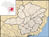
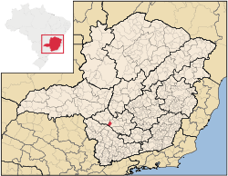
The city center of Pimenta is located at an elevation of 776 meters on a northern arm of the great reservoir of Furnas. Neighboring municipalities are: PainsPains, Minas Gerais
Pains is a Brazilian municipality located in the center of the state of Minas Gerais. Its population as of 2007 was 8,122 people living in a total area of 418 km². The city belongs to the meso-region of Oeste de Minas and to the micro-region of Formiga...
(N), Formiga
Formiga
Formiga is a and municipality in central-west Minas Gerais state, Brazil. The population of the municipality in 2007 is 64,585. The area of the municipality is 1,504 km². It is located in the statistical meso-region of Centro-Oeste de Minas and the statistical micro-region of Formiga...
(E), Guapé
Guapé
Guapé is a town and municipality in the state of Minas Gerais in the Southeast region of Brazil.-References:...
, and Piumhi
Piumhi
Piumhi is a Brazilian municipality located in the west of the state of Minas Gerais. Its population as of 2007 was 30,984 people living in a total area of 902 km². The city belongs to the meso-region of Oeste de Minas and Alto Paranaíba and to the micro-region of Piumhi...
(W).
The distance to Belo Horizonte
Belo Horizonte
Belo Horizonte is the capital of and largest city in the state of Minas Gerais, located in the southeastern region of Brazil. It is the third largest metropolitan area in the country...
is 241 km. The distance to regional center Formiga
Formiga
Formiga is a and municipality in central-west Minas Gerais state, Brazil. The population of the municipality in 2007 is 64,585. The area of the municipality is 1,504 km². It is located in the statistical meso-region of Centro-Oeste de Minas and the statistical micro-region of Formiga...
is 44 km. Connections are made by state highway BR-050.
Economic activities
Services and agriculture are the most important economic activities. In 2005 there were 22 small transformation industries employing 69 workers. Public administration was the biggest employer with 221 workers. The GDP in 2005 was approximately R$65 million, with 28 million reais from services, 3 million reais from industry, and 30 million reais from agriculture. There were 560 rural producers on 28,000 hectares of land. 113 farms had tractors (2006). Approximately 1,500 persons were employed in agriculture. The main crops are coffee, rice, beans, and corn. There were 14,000 head of cattle (2006).There was one bank (2007). In the vehicle fleet there were 1,057 automobiles, 174 trucks, 185 pickup trucks, and 1,012 motorcycles (2007).
Health and education
In the health sector there were 4 public health clinics and 1 hospital with 22 beds. (2005). Patients with more serious health conditions are transported to DivinópolisDivinópolis
Divinópolis is a city and municipality located in the centre-west of Minas Gerais state, Brazil. The estimated population in 2007 was 201,921 inhabitants. The total area of the municipality is 709 km² and the elevation is 712 metres. It is located at 120 km from state capital Belo Horizonte...
, Piumhi
Piumhi
Piumhi is a Brazilian municipality located in the west of the state of Minas Gerais. Its population as of 2007 was 30,984 people living in a total area of 902 km². The city belongs to the meso-region of Oeste de Minas and Alto Paranaíba and to the micro-region of Piumhi...
or Formiga
Formiga
Formiga is a and municipality in central-west Minas Gerais state, Brazil. The population of the municipality in 2007 is 64,585. The area of the municipality is 1,504 km². It is located in the statistical meso-region of Centro-Oeste de Minas and the statistical micro-region of Formiga...
. Educational needs of 1,550 students were met by 3 primary schools, 1 middle school, and 3 pre-primary schools.
- Municipal Human Development IndexHuman Development IndexThe Human Development Index is a composite statistic used to rank countries by level of "human development" and separate "very high human development", "high human development", "medium human development", and "low human development" countries...
: 0.768 (2000) - State ranking: 179 out of 853 municipalities as of 2000
- National ranking: 1377 out of 5,138 municipalities as of 2000
- Literacy rate: 88%
- Life expectancy: 73 (average of males and females)
In 2000 the per capita monthly income of R$239.00 below the state and national average of R$276.00 and R$297.00 respectively. Poços de Caldas
Poços de Caldas
Poços de Caldas is a city and municipality in south-western Minas Gerais state, Brazil, in the microregion of the same name. Its estimated population in 2009 was 151,449 inhabitants...
had the highest per capita monthly income in 2000 with R$435.00. The lowest was Setubinha
Setubinha
Setubinha is a municipality in the northeast of the Brazilian state of Minas Gerais. As of 2007 the population was 10,834 in a total area of 536 km². The elevation is 729 metres. It is part of the IBGE statistical microregion of Teófilo Otoni...
with R$73.00.
The highest ranking municipality in Minas Gerais in 2000 was Poços de Caldas
Poços de Caldas
Poços de Caldas is a city and municipality in south-western Minas Gerais state, Brazil, in the microregion of the same name. Its estimated population in 2009 was 151,449 inhabitants...
with 0.841, while the lowest was Setubinha
Setubinha
Setubinha is a municipality in the northeast of the Brazilian state of Minas Gerais. As of 2007 the population was 10,834 in a total area of 536 km². The elevation is 729 metres. It is part of the IBGE statistical microregion of Teófilo Otoni...
with 0.568. Nationally the highest was São Caetano do Sul
São Caetano do Sul
São Caetano do Sul is a city in São Paulo state in Brazil, located in the Greater São Paulo Metropolitan Area. It is the city with the highest per capita income in Brazil and it also has the highest Human Development Index .-Geography:São Caetano do Sul is located on a plateau that is part of the...
in São Paulo with 0.919, while the lowest was Setubinha. In more recent statistics (considering 5,507 municipalities) Manari in the state of Pernambuco
Pernambuco
Pernambuco is a state of Brazil, located in the Northeast region of the country. To the north are the states of Paraíba and Ceará, to the west is Piauí, to the south are Alagoas and Bahia, and to the east is the Atlantic Ocean. There are about of beaches, some of the most beautiful in the...
has the lowest rating in the country—0,467—putting it in last place.
See also
- List of municipalities in Minas Gerais