

Pieria quadrangle
Encyclopedia
Quadrangle (geography)
In geology or geography, the word "quadrangle" usually refers to a United States Geological Survey 7.5-minute quadrangle map, which are usually named after a local physiographic feature. The shorthand "quad" is also used, especially with the name of the map; for example, "the Ranger Creek, Texas...
on Mercury
Mercury (planet)
Mercury is the innermost and smallest planet in the Solar System, orbiting the Sun once every 87.969 Earth days. The orbit of Mercury has the highest eccentricity of all the Solar System planets, and it has the smallest axial tilt. It completes three rotations about its axis for every two orbits...
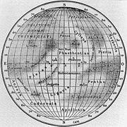
runs from 288 to 360° longitude and from -25 to 25° latitude. It was named after the Pieria albedo feature.
Since the Pieria quadrangle wasn't illuminated when Mariner 10
Mariner 10
Mariner 10 was an American robotic space probe launched by NASA on November 3, 1973, to fly by the planets Mercury and Venus. It was launched approximately two years after Mariner 9 and was the last spacecraft in the Mariner program...
made its flybys, this region hasn't been mapped in detail.
The massive Skinakas Basin
Skinakas Basin
The Skinakas Basin is the informal name given to a structure on Mercury that appeared to be an extremely large impact basin. The traditional name for this region of Mercury is Solitudo Aphrodites...
overlaps the border of this quadrangle and neighboring Solitudo Criophori quadrangle
Solitudo Criophori quadrangle
The Solitudo Criophori quadrangle on Mercury was named after the Solitudo Criophori albedo feature. It runs from 216 to 288° longitude and from -25 to 25° latitude....
.