
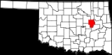
Okmulgee County, Oklahoma
Encyclopedia
Okmulgee County is a county located in the U.S. state
of Oklahoma
. As of 2000, the population was 39,685. Its county seat
is Okmulgee
.
, the county has a total area of 1,819 km² (702 mi²). 1,805 km² (697 mi²) of it is land and 14 km² (5 mi²) of it (0.76%) is water.
of 2000, there were 39,685 people, 15,300 households, and 10,694 families residing in the county. The population density
was 22/km² (57/mi²). There were 17,316 housing units at an average density of 10/km² (25/mi²). The racial makeup of the county was 69.73% White
, 10.20% Black
or African American
, 12.85% Native American
, 0.19% Asian
, 0.02% Pacific Islander
, 0.61% from other races
, and 6.40% from two or more races. 1.95% of the population were Hispanic
or Latino
of any race.
There were 15,300 households out of which 32.00% had children under the age of 18 living with them, 52.80% were married couples
living together, 13.10% had a female householder with no husband present, and 30.10% were non-families. 27.10% of all households were made up of individuals and 12.60% had someone living alone who was 65 years of age or older. The average household size was 2.53 and the average family size was 3.06.
In the county, the population was spread out with 26.90% under the age of 18, 9.50% from 18 to 24, 25.30% from 25 to 44, 23.30% from 45 to 64, and 15.10% who were 65 years of age or older. The median age was 37 years. For every 100 females there were 95.20 males. For every 100 females age 18 and over, there were 90.80 males.
The median income for a household in the county was $27,652, and the median income for a family was $33,987. Males had a median income of $29,935 versus $20,861 for females. The per capita income
for the county was $14,065. About 14.90% of families and 18.90% of the population were below the poverty line, including 24.90% of those under age 18 and 15.50% of those age 65 or over.
:
U.S. state
A U.S. state is any one of the 50 federated states of the United States of America that share sovereignty with the federal government. Because of this shared sovereignty, an American is a citizen both of the federal entity and of his or her state of domicile. Four states use the official title of...
of Oklahoma
Oklahoma
Oklahoma is a state located in the South Central region of the United States of America. With an estimated 3,751,351 residents as of the 2010 census and a land area of 68,667 square miles , Oklahoma is the 28th most populous and 20th-largest state...
. As of 2000, the population was 39,685. Its county seat
County seat
A county seat is an administrative center, or seat of government, for a county or civil parish. The term is primarily used in the United States....
is Okmulgee
Okmulgee, Oklahoma
Okmulgee is a city in Okmulgee County, Oklahoma, United States. The population at the 2010 census was 12,321 a loss of 5.4 percent since the 2000 census figure of 13,022. It has been the capital of the Muscogee Nation since the United States Civil War. Okmulgee means "boiling waters" in the Creek...
.
Geography
According to the U.S. Census BureauUnited States Census Bureau
The United States Census Bureau is the government agency that is responsible for the United States Census. It also gathers other national demographic and economic data...
, the county has a total area of 1,819 km² (702 mi²). 1,805 km² (697 mi²) of it is land and 14 km² (5 mi²) of it (0.76%) is water.
Adjacent counties
- Tulsa CountyTulsa County, OklahomaTulsa County is a county located in the U.S. state of Oklahoma. According to the 2010 U.S. Census, the population is 603,403. Its county seat is Tulsa.-History of Tulsa County:The history of Tulsa County greatly overlaps the history of the city of Tulsa...
(north) - Wagoner CountyWagoner County, OklahomaWagoner County is a county located in the U.S. state of Oklahoma. As of 2010, the population was 73,085. Its county seat is Wagoner.-Early History:The area of Wagoner County was settled by the Creek after their forced removal in Alabama in the 1820's...
(northeast) - Muskogee CountyMuskogee County, OklahomaMuskogee County is a county located in the U.S. state of Oklahoma. As of 2010, the population was 70,990. Its county seat is Muskogee.-Government:...
(east) - McIntosh CountyMcIntosh County, OklahomaMcIntosh County is a county located in the U.S. state of Oklahoma. As of 2000, the population was 19,456. Its county seat is Eufaula.-Geography:...
(southeast) - Okfuskee CountyOkfuskee County, OklahomaOkfuskee County is a county located in the U.S. state of Oklahoma. As of 2000, the population was 11,814. Its county seat is Okemah.-Geography:...
(southwest) - Creek CountyCreek County, OklahomaCreek County is a county located in the U.S. state of Oklahoma. As of 2010, the population was 69,967. Its county seat is Sapulpa.-Geography:According to the U.S. Census Bureau, the county has a total area of , of which is land and is water....
(northwest)
Demographics
As of the censusCensus
A census is the procedure of systematically acquiring and recording information about the members of a given population. It is a regularly occurring and official count of a particular population. The term is used mostly in connection with national population and housing censuses; other common...
of 2000, there were 39,685 people, 15,300 households, and 10,694 families residing in the county. The population density
Population density
Population density is a measurement of population per unit area or unit volume. It is frequently applied to living organisms, and particularly to humans...
was 22/km² (57/mi²). There were 17,316 housing units at an average density of 10/km² (25/mi²). The racial makeup of the county was 69.73% White
Race (United States Census)
Race and ethnicity in the United States Census, as defined by the Federal Office of Management and Budget and the United States Census Bureau, are self-identification data items in which residents choose the race or races with which they most closely identify, and indicate whether or not they are...
, 10.20% Black
Race (United States Census)
Race and ethnicity in the United States Census, as defined by the Federal Office of Management and Budget and the United States Census Bureau, are self-identification data items in which residents choose the race or races with which they most closely identify, and indicate whether or not they are...
or African American
Race (United States Census)
Race and ethnicity in the United States Census, as defined by the Federal Office of Management and Budget and the United States Census Bureau, are self-identification data items in which residents choose the race or races with which they most closely identify, and indicate whether or not they are...
, 12.85% Native American
Race (United States Census)
Race and ethnicity in the United States Census, as defined by the Federal Office of Management and Budget and the United States Census Bureau, are self-identification data items in which residents choose the race or races with which they most closely identify, and indicate whether or not they are...
, 0.19% Asian
Race (United States Census)
Race and ethnicity in the United States Census, as defined by the Federal Office of Management and Budget and the United States Census Bureau, are self-identification data items in which residents choose the race or races with which they most closely identify, and indicate whether or not they are...
, 0.02% Pacific Islander
Race (United States Census)
Race and ethnicity in the United States Census, as defined by the Federal Office of Management and Budget and the United States Census Bureau, are self-identification data items in which residents choose the race or races with which they most closely identify, and indicate whether or not they are...
, 0.61% from other races
Race (United States Census)
Race and ethnicity in the United States Census, as defined by the Federal Office of Management and Budget and the United States Census Bureau, are self-identification data items in which residents choose the race or races with which they most closely identify, and indicate whether or not they are...
, and 6.40% from two or more races. 1.95% of the population were Hispanic
Race (United States Census)
Race and ethnicity in the United States Census, as defined by the Federal Office of Management and Budget and the United States Census Bureau, are self-identification data items in which residents choose the race or races with which they most closely identify, and indicate whether or not they are...
or Latino
Race (United States Census)
Race and ethnicity in the United States Census, as defined by the Federal Office of Management and Budget and the United States Census Bureau, are self-identification data items in which residents choose the race or races with which they most closely identify, and indicate whether or not they are...
of any race.
There were 15,300 households out of which 32.00% had children under the age of 18 living with them, 52.80% were married couples
Marriage
Marriage is a social union or legal contract between people that creates kinship. It is an institution in which interpersonal relationships, usually intimate and sexual, are acknowledged in a variety of ways, depending on the culture or subculture in which it is found...
living together, 13.10% had a female householder with no husband present, and 30.10% were non-families. 27.10% of all households were made up of individuals and 12.60% had someone living alone who was 65 years of age or older. The average household size was 2.53 and the average family size was 3.06.
In the county, the population was spread out with 26.90% under the age of 18, 9.50% from 18 to 24, 25.30% from 25 to 44, 23.30% from 45 to 64, and 15.10% who were 65 years of age or older. The median age was 37 years. For every 100 females there were 95.20 males. For every 100 females age 18 and over, there were 90.80 males.
The median income for a household in the county was $27,652, and the median income for a family was $33,987. Males had a median income of $29,935 versus $20,861 for females. The per capita income
Per capita income
Per capita income or income per person is a measure of mean income within an economic aggregate, such as a country or city. It is calculated by taking a measure of all sources of income in the aggregate and dividing it by the total population...
for the county was $14,065. About 14.90% of families and 18.90% of the population were below the poverty line, including 24.90% of those under age 18 and 15.50% of those age 65 or over.
Cities and towns
|
Henryetta, Oklahoma Henryetta is a city in Okmulgee County, Oklahoma, United States. The population was 6,096 at the 2000 census.Henryetta is notable as the high school hometown of NFL Hall of Fame quarterback Troy Aikman... Hoffman, Oklahoma Hoffman is a town in Okmulgee County, Oklahoma, United States. The population was 148 at the 2000 census.-Geography:Hoffman is located at .According to the United States Census Bureau, the town has a total area of , all of it land.... Liberty, Oklahoma Liberty is a town in Okmulgee and Tulsa counties in the U.S. state of Oklahoma. The population was 210 in the 2010 United States Census, compared to 184 at the 2000 census.-Geography:Liberty is located at .... |
Morris, Oklahoma Morris is a city in Okmulgee County, Oklahoma, United States. The townsite was platted in 1904 by L. R. Kershaw, who was an attorney and was also an Immigration Agent for the Frisco Railroad. He named the town after H. E. Morris, a Frisco Railroad executive... Okmulgee, Oklahoma Okmulgee is a city in Okmulgee County, Oklahoma, United States. The population at the 2010 census was 12,321 a loss of 5.4 percent since the 2000 census figure of 13,022. It has been the capital of the Muscogee Nation since the United States Civil War. Okmulgee means "boiling waters" in the Creek... |
Preston, Oklahoma Preston is a small community located in Okmulgee County, Oklahoma. The post office was established December 13, 1909. It was named for an Okmulgee oilman, Harry Preston.... Schulter, Oklahoma Schulter is a town in Okmulgee County, Oklahoma, United States. The population was 600 at the 2000 census.-Geography:Schulter is located at .... Winchester, Oklahoma Winchester is a town in Okmulgee County, Oklahoma, United States. The population was 424 at the 2000 census.-Geography:Winchester is located at . This puts Winchester about south of downtown Tulsa. The town's fenceline runs approximately from U.S... |
NRHP Sites
The following sites in Okmulgee County are listed on the National Register of Historic PlacesNational Register of Historic Places
The National Register of Historic Places is the United States government's official list of districts, sites, buildings, structures, and objects deemed worthy of preservation...
:
|
|