

Ohio State Route 231
Encyclopedia
State highway
State highway, state road or state route can refer to one of three related concepts, two of them related to a state or provincial government in a country that is divided into states or provinces :#A...
in the northwestern quadrant of the U.S. state
U.S. state
A U.S. state is any one of the 50 federated states of the United States of America that share sovereignty with the federal government. Because of this shared sovereignty, an American is a citizen both of the federal entity and of his or her state of domicile. Four states use the official title of...
of Ohio
Ohio
Ohio is a Midwestern state in the United States. The 34th largest state by area in the U.S.,it is the 7th‑most populous with over 11.5 million residents, containing several major American cities and seven metropolitan areas with populations of 500,000 or more.The state's capital is Columbus...
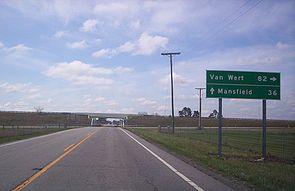
. SR 231 has its southern terminus at its intersection with East Street in the village
Village
A village is a clustered human settlement or community, larger than a hamlet with the population ranging from a few hundred to a few thousand , Though often located in rural areas, the term urban village is also applied to certain urban neighbourhoods, such as the West Village in Manhattan, New...
of Morral
Morral, Ohio
Morral is a village in Marion County, Ohio, United States. The population was 388 at the 2000 census.-History:When the promoters of the Columbus and Toledo Railroad Company, present day CSX, announced its route would include Salt Rock Township, Samuel Morral I and Jacob Neff, each of whom owned the...
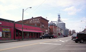
. Its northern terminus is in downtown Tiffin
Tiffin, Ohio
Tiffin is a city in and the county seat of Seneca County, Ohio, United States. The population was 18,135 at the 2000 census. The National Arbor Day Foundation has designated Tiffin as a Tree City USA....
at a signalized intersection with the duplex of SR 18 and SR 101, following a 0.35 mile (0.563269 km) long concurrency with SR 100, which continues north as a solo route north of this point.
Route description
The path of SR 231 takes it through northern Marion CountyMarion County, Ohio
Marion County is a county located in the state of Ohio, United States. As of the 2010 census, the population was 66,501. Its county seat is the city of Marion and is named for General Francis "The Swamp Fox" Marion, an officer in the Revolutionary War....
, eastern Wyandot County
Wyandot County, Ohio
As of the census of 2000, there were 22,908 people, 8,882 households, and 6,270 families residing in the county. The population density was 56 people per square mile . There were 9,324 housing units at an average density of 23 per square mile...
and southern Seneca County
Seneca County, Ohio
Seneca County is a county located in the state of Ohio, United States. As of the 2010 census, the population was 56,745. Its county seat is Tiffin and it is named for the Seneca Indians.The Tiffin Micropolitan Statistical Area includes all of Seneca County....
. There are no segments of SR 231 that are included within the National Highway System
National Highway System (United States)
The National Highway System is a network of strategic highways within the United States, including the Interstate Highway System and other roads serving major airports, ports, rail or truck terminals, railway stations, pipeline terminals and other strategic transport facilities.Individual states...
(NHS). The NHS is a network of highways identified as being most important for the economy, mobility and defense of the nation.
History
SR 231 was applied in 1923. The highway was originally a short connector route in the NevadaNevada, Ohio
Nevada is a village in Wyandot County, Ohio, United States. The population was 814 at the 2000 census.-Geography:Nevada is located at .According to the United States Census Bureau, the village has a total area of , all of it land....
vicinity, running between the former SR 182, now County Road 182, CR 182, in Nevada and the old two-lane alignment of U.S. Route 30 (US 30), now designated as CR 330, north of the village.
In 1932, SR 231 was extended south along the routing that it presently utilizes south of Nevada to its current southern terminus in Morral. Five years after being extended on the south ended, SR 231 was lengthened on the north end, following its present alignment along a previously county-maintained roadway to a new northern terminus at its present eastern junction with SR 103 east of Sycamore
Sycamore, Ohio
Sycamore is a village in Wyandot County, Ohio, United States. The population was 914 at the 2000 census.-Geography:Sycamore is located at ....
. Then, in 1939, SR 231 was extended to the north one more time, via a concurrency with SR 103 and SR 67 and then along a previously un-numbered roadway to its present northern terminus in Tiffin.