

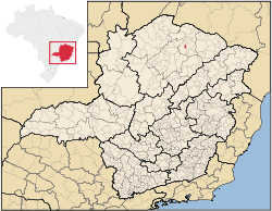
Nova Porteirinha
Encyclopedia
Minas Gerais
Minas Gerais is one of the 26 states of Brazil, of which it is the second most populous, the third richest, and the fourth largest in area. Minas Gerais is the Brazilian state with the largest number of Presidents of Brazil, the current one, Dilma Rousseff, being one of them. The capital is the...
in Brazil
Brazil
Brazil , officially the Federative Republic of Brazil , is the largest country in South America. It is the world's fifth largest country, both by geographical area and by population with over 192 million people...
. The population in 2007 was 7,358 in an area of 121 km² (46.7 sq mi). The elevation is 533 metres (1,748.7 ft). It became a municipality in 1997. The postal code (CEP) is 39525-000.
Nova Porteirinha is part of the statistical microregion of Janaúba
Janaúba
Janaúba is a municipality in the north of the Brazilian state of Minas Gerais. In 2007 the population was 65,387 in a total area of 2,189 km2. The elevation is 692 meters above sea level.-Location:...
. It is surrounded by the municipalities of Janaúba
Janaúba
Janaúba is a municipality in the north of the Brazilian state of Minas Gerais. In 2007 the population was 65,387 in a total area of 2,189 km2. The elevation is 692 meters above sea level.-Location:...
and Porteirinha
Porteirinha
Porteirinha is a municipality in the northern region of Minas Gerais, Brazil. The population in 2007 was 36,864 in an area of 1,806 km². The elevation is 566 meters. It became a municipality in 1938. The postal code is 39520-000....
.
It is across the Rio Gorutuba from the city of Janaúba.
The main economic activities are cattle raising (4,700 head in 2006) and farming with a large production of bananas (1650 ha (4,077.2 acre)) and modest production of tropical fruits, sugarcane, corn, and coconuts. In 2006 there were 644 rural producers with a total area of 9700 ha (23,969.2 acre). Cropland made up 4000 ha (9,884.2 acre) and natural pasture 3000 ha (7,413.2 acre) hectares. There were only 59 tractors, a ratio of one for every 10 farms. In the urban area there were no financial institutions as of 2006. There were 171 automobiles, giving a ratio of about one automobile for every 42 inhabitants. The Gross Domestic Product was R$ 40,300,000 (2005), which was mainly generated by services. Health care was provided by 6 public health clinics. There were no hospitals as of 2005.
Municipal Human Development IndexHuman Development IndexThe Human Development Index is a composite statistic used to rank countries by level of "human development" and separate "very high human development", "high human development", "medium human development", and "low human development" countries...
- MHDI: .685 (2000)
- State ranking: 613 out of 853 municipalities as of 2000
- National ranking: 3,664 out of 5,138 municipalities as of 2000
- Life expectancy: 67.8
- Literacy rate: 77.0
- Combined primary, secondary and tertiary gross enrollment ratio: .773
- Per capita income (monthly): R$114.51 (For the complete list see Frigoletto)