
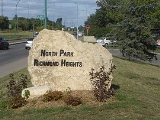
North Park, Saskatoon
Encyclopedia
North Park is a community which is just to the north of the Meewasin Riverworks observation area and the CPR Bridge. It has access along its eastern perimeter to the scenic walking trails along the South Saskatchewan River
developed by the Meewasin Valley Authority. The average home selling price in 2006 was $
101,176- $
139,704. Each family was approximately 2.1 residents, and 63.9% of the residents owned their own home.Statistics c2006 -
on the east and Warman Road which lay parallel to each other. 33rd Street East to the south and Hazen Street demarks the northernmost limit.
. Most of the construction of this area, however came to be in the decade after.
The Municipal Railway opened January 1, 1913 and contributed considerably to the growth of North Park and other outlying districts. The South Saskatchewan River
provided prime real estate with a view of the scenic Meewasin Valley.
North Park with a rich and varied lifestyle and history is documented in this book: E.T. Pete Russell. 'The History of North Park'.
and are mainly a grid fashion. The north and south avenues which are central to the community, and corrections have been made to adapt and Empress Avenue and Spadina Crescent which run along the South Saskatchewan River
.
33rd Street is a major roadway accessing western Saskatoon. Spadina Crescent provides scenic transportation between the Central Business District and communities to the north which are part of the Lawson SDA. Warman Road is a main access road between Central Business District and the North West Industrial SDA which bypasses North Park with limited arterial access into the neighborhood.
South Saskatchewan River
The South Saskatchewan River is a major river in Canada that flows through the provinces of Alberta and Saskatchewan....
developed by the Meewasin Valley Authority. The average home selling price in 2006 was $
Canadian dollar
The Canadian dollar is the currency of Canada. As of 2007, the Canadian dollar is the 7th most traded currency in the world. It is abbreviated with the dollar sign $, or C$ to distinguish it from other dollar-denominated currencies...
101,176- $
Canadian dollar
The Canadian dollar is the currency of Canada. As of 2007, the Canadian dollar is the 7th most traded currency in the world. It is abbreviated with the dollar sign $, or C$ to distinguish it from other dollar-denominated currencies...
139,704. Each family was approximately 2.1 residents, and 63.9% of the residents owned their own home.Statistics c2006 -
Location
Within the Lawson Suburban Development Area (West Side), the neighbourhood of North Park is bordered by the south Saskatchewan RiverSouth Saskatchewan River
The South Saskatchewan River is a major river in Canada that flows through the provinces of Alberta and Saskatchewan....
on the east and Warman Road which lay parallel to each other. 33rd Street East to the south and Hazen Street demarks the northernmost limit.
History
There are some historic dwellings in North Park, as there was some development before World War IIWorld War II
World War II, or the Second World War , was a global conflict lasting from 1939 to 1945, involving most of the world's nations—including all of the great powers—eventually forming two opposing military alliances: the Allies and the Axis...
. Most of the construction of this area, however came to be in the decade after.
The Municipal Railway opened January 1, 1913 and contributed considerably to the growth of North Park and other outlying districts. The South Saskatchewan River
South Saskatchewan River
The South Saskatchewan River is a major river in Canada that flows through the provinces of Alberta and Saskatchewan....
provided prime real estate with a view of the scenic Meewasin Valley.
North Park with a rich and varied lifestyle and history is documented in this book: E.T. Pete Russell. 'The History of North Park'.
Layout
Streets are laid out bordering the west bank of the South Saskatchewan RiverSouth Saskatchewan River
The South Saskatchewan River is a major river in Canada that flows through the provinces of Alberta and Saskatchewan....
and are mainly a grid fashion. The north and south avenues which are central to the community, and corrections have been made to adapt and Empress Avenue and Spadina Crescent which run along the South Saskatchewan River
South Saskatchewan River
The South Saskatchewan River is a major river in Canada that flows through the provinces of Alberta and Saskatchewan....
Education
- North Park Wilson - Public Elementary School North Park operated as a classroom of Wilson School between 1939 and 1954, opening in its own 8 room school.
- E'cole St. Paul (St. Paul School) is a Catholic elementary school.
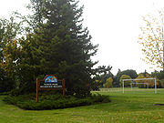
Shopping
Shopper's Drug Mart is located on 7th Avenue and 33rd Street. North Park also has close access to a small light industrial area of City Park to the south of 33rd Street East.Area Parks
- Marriot Park - 0.77 acres (3,116.1 m²)
- Horn Park - 0.44 acres (1,780.6 m²)
- North Park Rec. Unit - 0.92 acres (3,723.1 m²)
City Transit
North Park is serviced by City Transit Bus Routes Saskatoon TransitSaskatoon Transit
Saskatoon Transit is the public transport arm of the City of Saskatoon, Saskatchewan, Canada. It operates a fleet of diesel buses. A total of 23 bus routes serve every area of the city, carrying approximately 11 million passengers in 2008...
.
33rd Street is a major roadway accessing western Saskatoon. Spadina Crescent provides scenic transportation between the Central Business District and communities to the north which are part of the Lawson SDA. Warman Road is a main access road between Central Business District and the North West Industrial SDA which bypasses North Park with limited arterial access into the neighborhood.
Life
The North Park / Richmond Heights Community Association has amalgamated to provide community services for the Saskatoon area between 33rd Street East and Circle Drive utilizing facilities available at North Park-Wilson, River Heights, and St. Paul Schools.Location
Coordinates: 52°8'52"N 106°39'1"W| North: Richmond Heights | ||
| West: Kelsey/Woodlawn Kelsey-Woodlawn, Saskatoon Kelsey-Woodlawn is a combination of industrial park nestled between the North West Industrial SDA and the Central Industrial of down town Saskatoon. It is still serviced by the CNR rail lines to both the north and east... | North Park North Park North Park may refer to:Places in the United States*North Park, San Diego, California, a neighborhood*North Park , a valley in the Rocky Mountains in north central Colorado*North Park, Chicago, Illinois, a neighborhood... | East: South Saskatchewan River South Saskatchewan River The South Saskatchewan River is a major river in Canada that flows through the provinces of Alberta and Saskatchewan.... | U of S Management Area University of Saskatchewan The University of Saskatchewan is a Canadian public research university, founded in 1907, and located on the east side of the South Saskatchewan River in Saskatoon, Saskatchewan, Canada. An "Act to establish and incorporate a University for the Province of Saskatchewan" was passed by the... |
| South: City Park |