
North Dakota Highway 200
Encyclopedia
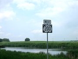
North Dakota Highway 200 is a major east–west highway
in North Dakota
. It runs from Minnesota State Highway 200
at the Minnesota border near Halstad, Minnesota
to Montana Highway 200
near Fairview, Montana
.
This state highway is part of a nationwide chain of similarly-numbered state highways that stretch from Minnesota to Washington state.
}
|
|-
|
|
|
| West end of US 85 overlap
|-
| Watford City
|
|
|
|-
|
|
|
| East end of US 85 overlap
|-
|rowspan=3|Dunn
|
|
|
|
|-
|
|
| 4th Street Southwest - Dunn Center
|
|-
|
|
|
|
|-
|rowspan=7|Mercer
|
|
|
|
|-
|
|
|
|
|-
|
|
|
|
|-
| Hazen
|
|
|
|-
|
|
|
|
|-
|
|
|
|
|-
|
|
|
|
|-
|rowspan=7|Mclean
|
|
|
|
|-
|
|
|
| West end of US 83 overlap
|-
|
|
|
| East end of US 83 overlap
|-
|
|
|
|
|-
|
|
|
| West end of ND 41 overlap
|-
| rowspan=2|Mercer
|
|
| East end of ND 41 overlap
|-
| Mercer
|
|
|-
|rowspan=2|Sheridan
| McClusky
|
| 4th Street east, 5th Aveune Northeast
|
|-
| Denhoff
|
|
|
|-
|rowspan=7|Wells
|
|
|
| West end of ND 3 overlap
|-
| Hurdsfield
|
|
| East end of ND 3 overlap
|-
|
|
|
|
|-
|
| 268
|
| West end of US 52 overlap
|-
|
|
|
|
|-
|
| 207
|
|
|-
|
| 209
|
| Misprinted as ND 30 on some maps.
|-
|rowspan=7|Foster
|rowspan=2|Carrington
| 221
|
|
|-
| 222
|
| East end of US 52 overlap
|-
|
|
|
|
|-
|
|
|
|
|-
|
|
|
|
|-
|
|
| 87th Avenue Northeast - Juanita
|
|-
| Glenfield
|
|
|
|-
|rowspan=5|Griggs
|
|
| 99th Avenue Northeast - Sutton
|
|-
|
|
|
|
|-
|
|
|
|
|-
|rowspan=2| Cooperstown
|
|
|
|-
|
|
|
|-
|rowspan=4|Steele
|
|
|
|
|-
|
|
|
| West end of ND 32 overlap
|-
|
|
|
| East end of ND 32 overlap. 4 Way Stop.
|-
|
|
|
|
|-
|rowspan=8|Traill
|
|
|
| West end of ND 32 overlap
|-
|
|
|
|
|-
| Portland
|
|
|
|-
|rowspan=2| Mayville
|
|
| East end of ND 32 overlap
|-
|
|
|
|-
|
|
|
|
|-
|
|
|
|
|-
| Hillsboro
|
|
|
|-
|
|
|
|
|-
|}
Highway
A highway is any public road. In American English, the term is common and almost always designates major roads. In British English, the term designates any road open to the public. Any interconnected set of highways can be variously referred to as a "highway system", a "highway network", or a...
in North Dakota
North Dakota
North Dakota is a state located in the Midwestern region of the United States of America, along the Canadian border. The state is bordered by Canada to the north, Minnesota to the east, South Dakota to the south and Montana to the west. North Dakota is the 19th-largest state by area in the U.S....
. It runs from Minnesota State Highway 200
Minnesota State Highway 200
Minnesota State Highway 200 is a highway in northwest and northeast Minnesota,which runs from North Dakota Highway 200 at the North Dakota state line near Halstad, and continues east to its eastern terminus at its intersection with U.S...
at the Minnesota border near Halstad, Minnesota
Halstad, Minnesota
Halstad is a city in Norman County, Minnesota, United States. The population was 597 at the 2010 census.-Geography and cultural history:According to the United States Census Bureau, the city has a total area of , all of it land.U.S...
to Montana Highway 200
Montana Highway 200
Highway 200 in the U.S. State of Montana is a route running westerly covering the entire state of Montana, from the starting point of ND 200 near Fairview, Montana to ID 200, near Heron, Montana...
near Fairview, Montana
Fairview, Montana
As of the census of 2000, there were 709 people, 310 households, and 184 families residing in the town. The population density was 736.4 people per square mile . There were 390 housing units at an average density of 405.1 per square mile . The racial makeup of the town was 96.47% White, 0.85%...
.
This state highway is part of a nationwide chain of similarly-numbered state highways that stretch from Minnesota to Washington state.
Major intersections
| County | Location | Mile | Destinations | Notes |
|---|---|---|---|---|
| McKenzie McKenzie County, North Dakota -Major highways:* U.S. Highway 85* North Dakota Highway 22* North Dakota Highway 23* North Dakota Highway 58* North Dakota Highway 68* North Dakota Highway 73* North Dakota Highway 200* North Dakota Highway 1806-National protected areas:... |
||||
|
|-
|
|
|
| West end of US 85 overlap
|-
| Watford City
|
|
|
|-
|
|
|
| East end of US 85 overlap
|-
|rowspan=3|Dunn
Dunn County, North Dakota
-Major highways:*North Dakota Highway 8*North Dakota Highway 22*North Dakota Highway 200-Demographics:As of the census of 2000, there were 3,600 people, 1,378 households, and 986 families residing in the county. The population density was 2 people per square mile . There were 1,965 housing units...
|
|
|
|
|-
|
|
| 4th Street Southwest - Dunn Center
|
|-
|
|
|
|
|-
|rowspan=7|Mercer
Mercer County, North Dakota
-Major highways:* North Dakota Highway 31* North Dakota Highway 48* North Dakota Highway 49* North Dakota Highway 200* North Dakota Highway 1806-Demographics:...
|
|
|
|
|-
|
|
|
|
|-
|
|
|
|
|-
| Hazen
|
|
|
|-
|
|
|
|
|-
|
|
|
|
|-
|
|
|
|
|-
|rowspan=7|Mclean
McLean County, North Dakota
-Major highways:* U.S. Highway 83* North Dakota Highway 28* North Dakota Highway 37* North Dakota Highway 53* North Dakota Highway 41* North Dakota Highway 200* North Dakota Highway 1804-National protected areas:*Audubon National Wildlife Refuge...
|
|
|
|
|-
|
|
|
| West end of US 83 overlap
|-
|
|
|
| East end of US 83 overlap
|-
|
|
|
|
|-
|
|
|
| West end of ND 41 overlap
|-
| rowspan=2|Mercer
|
|
| East end of ND 41 overlap
|-
| Mercer
|
|
|-
|rowspan=2|Sheridan
Sheridan County, North Dakota
-Demographics:As of the census of 2000, there were 1,710 people, 731 households, and 515 families residing in the county. The population density was 2 people per square mile . There were 924 housing units at an average density of 1 per square mile...
| McClusky
|
| 4th Street east, 5th Aveune Northeast
|
|-
| Denhoff
|
|
|
|-
|rowspan=7|Wells
Wells County, North Dakota
-Demographics:As of the census of 2000, there were 5,102 people, 2,215 households, and 1,453 families residing in the county. The population density was 4 people per square mile . There were 2,643 housing units at an average density of 2 per square mile...
|
|
|
| West end of ND 3 overlap
|-
| Hurdsfield
|
|
| East end of ND 3 overlap
|-
|
|
|
|
|-
|
| 268
|
| West end of US 52 overlap
|-
|
|
|
|
|-
|
| 207
|
|
|-
|
| 209
|
| Misprinted as ND 30 on some maps.
|-
|rowspan=7|Foster
Foster County, North Dakota
-Demographics:As of the census of 2000, there were 3,759 people, 1,540 households, and 1,031 families residing in the county. The population density was 2/km² . There were 1,793 housing units at an average density of 1/km²...
|rowspan=2|Carrington
Carrington, North Dakota
As of the census of 2000, there were 2,268 people, 961 households, and 594 families residing in the city. The population density was 1,531.9 people per square mile . There were 1,057 housing units at an average density of 713.9 per square mile...
| 221
|
|
|-
| 222
|
| East end of US 52 overlap
|-
|
|
|
|
|-
|
|
|
|
|-
|
|
|
|
|-
|
|
| 87th Avenue Northeast - Juanita
|
|-
| Glenfield
Glenfield, North Dakota
As of the census of 2000, there were 134 people, 57 households, and 38 families residing in the city. The population density was 1,043.3 people per square mile . There were 59 housing units at an average density of 459.4 per square mile...
|
|
|
|-
|rowspan=5|Griggs
Griggs County, North Dakota
-Major highways:* North Dakota Highway 1* North Dakota Highway 45* North Dakota Highway 65* North Dakota Highway 200-Demographics:As of the census of 2000, there were 2,754 people, 1,178 households, and 781 families residing in the county. The population density was 4 people per square mile...
|
|
| 99th Avenue Northeast - Sutton
|
|-
|
|
|
|
|-
|
|
|
|
|-
|rowspan=2| Cooperstown
|
|
|
|-
|
|
|
|-
|rowspan=4|Steele
Steele County, North Dakota
-Demographics:As of the census of 2000, there were 2,258 people, 923 households, and 635 families residing in the county. The population density was 3 people per square mile . There were 1,231 housing units at an average density of 2 per square mile...
|
|
|
|
|-
|
|
|
| West end of ND 32 overlap
|-
|
|
|
| East end of ND 32 overlap. 4 Way Stop.
|-
|
|
|
|
|-
|rowspan=8|Traill
Traill County, North Dakota
Traill County is a county located in the U.S. state of North Dakota. The 2010 census listed the population at 8,121. Its county seat is Hillsboro, and its largest city is Mayville.-History:...
|
|
|
| West end of ND 32 overlap
|-
|
|
|
|
|-
| Portland
|
|
|
|-
|rowspan=2| Mayville
|
|
| East end of ND 32 overlap
|-
|
|
|
|-
|
|
|
|
|-
|
|
|
|
|-
| Hillsboro
|
|
|
|-
|
|
|
|
|-
|}
Concurrencies
- US 85 from 3 miles (4.8 km) north of Alexander to 5 miles (8 km) southeast of Grassy Butte
- ND-8North Dakota Highway 8North Dakota Highway 8 is a north–south highway in North Dakota. The highway is split into two segments. The northern segment is long and runs from SK 9 in Northgate to ND-23 near New Town. The southern segment is long and runs from Lake Sakakawea near Twin Buttes to SD-75 near Hettinger....
for 2 miles (3.2 km) south from Halliday - US 83 from Gateway to Underwood
- ND-41 from 2 miles (3.2 km) south of Turtle Lake to Mercer
- ND-3North Dakota Highway 3North Dakota Highway 3 is a major north–south highway in North Dakota. It runs from Manitoba Highway 10 at the International Peace Garden to South Dakota Highway 45 south of Ashley.-Major Junctions:*I-94 at exit 200 and running concurrent to exit 208...
for 2 miles (3.2 km) west from Hurdsford - US 52 from 5 miles (8 km) east of Bowdon to Carrington
- ND-1North Dakota Highway 1North Dakota Highway 1 is a major north–south highway in North Dakota. It runs from Manitoba Highway 31 in Maida to South Dakota Highway 37 south of Ludden.-External links:* by Chris Geelhart...
from 6 miles (9.7 km) west of Cooperstown to 2 miles (3.2 km) west of Cooperstown - ND-32 for 5 miles (8 km) south from Finley
- ND-18North Dakota Highway 18North Dakota Highway 18 is a major highway in eastern North Dakota. It runs from Highway 30 at the Canadian border south of Gretna, Manitoba to South Dakota Highway 25 north of Claire City....
from 7 miles (11.3 km) northwest of Portland to Mayville
External links
- The North Dakota Highways Page by Chris Geelhart