

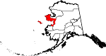
Nome Census Area, Alaska
Encyclopedia
U.S. state
A U.S. state is any one of the 50 federated states of the United States of America that share sovereignty with the federal government. Because of this shared sovereignty, an American is a citizen both of the federal entity and of his or her state of domicile. Four states use the official title of...
of Alaska
Alaska
Alaska is the largest state in the United States by area. It is situated in the northwest extremity of the North American continent, with Canada to the east, the Arctic Ocean to the north, and the Pacific Ocean to the west and south, with Russia further west across the Bering Strait...
, United States
United States
The United States of America is a federal constitutional republic comprising fifty states and a federal district...
. As of the 2000 census, the population was 9,196. It is part of the unorganized borough
Unorganized Borough
The Unorganized Borough is the part of the U.S. state of Alaska not contained in any of its 18 organized boroughs. It encompasses more than half of Alaska's area, , an area larger than any other US state...
and therefore has no borough seat. Its largest community by far is the city of Nome
Nome, Alaska
Nome is a city in the Nome Census Area in the Unorganized Borough of the U.S. state of Alaska, located on the southern Seward Peninsula coast on Norton Sound of the Bering Sea. According to the 2010 Census, the city population was 3,598. Nome was incorporated on April 9, 1901, and was once the...
.
Geography
The census area has a total area of 28283 square miles (73,252.6 km²), of which, 23001 square miles (59,572.3 km²) of it is land and 5282 square miles (13,680.3 km²) of it (18.68%) is water. It also includes the large offshore St. Lawrence IslandSt. Lawrence Island
St. Lawrence Island is located west of mainland Alaska in the Bering Sea, just south of the Bering Strait, at about 63°30' North 173°20' West. The village of Gambell is located on the northwest cape, from the Chukchi Peninsula in the Russian Far East. The island is part of Alaska, but closer to...
, which has about 14 percent of the census area's population and two of its larger cities in Gambell
Gambell, Alaska
Gambell is a village on St. Lawrence Island in Alaska, United States. At the 2000 census the population was 649.-Geography:Gambell is located on the northwest cape of St. Lawrence Island in the Bering Sea, southwest of Nome...
and Savoonga
Savoonga, Alaska
Savoonga is a city in Nome Census Area, Alaska, one of two on St Lawrence Island in the Bering Sea. As of the 2000 census, Savoonga's population was 643.Savoonga was incorporated in 1969, and in 1971 became the joint owner with Gambell of the entire island....
.
Adjacent boroughs and census areas
- Northwest Arctic Borough, AlaskaNorthwest Arctic Borough, Alaska-National protected areas:* Alaska Maritime National Wildlife Refuge ** Chamisso Wilderness* Bering Land Bridge National Preserve * Cape Krusenstern National Monument* Gates of the Arctic National Park and Preserve...
- north - Yukon-Koyukuk Census Area, AlaskaYukon-Koyukuk Census Area, AlaskaYukon-Koyukuk Census Area is a census area located in the state of Alaska, United States. As of the 2010 census, the population was 5,588. It is part of the unorganized borough and therefore has no borough seat...
- east - Wade Hampton Census Area, AlaskaWade Hampton Census Area, AlaskaWade Hampton Census Area is a census area located in the U.S. state of Alaska. As of the 2000 census, the population was 7,028. It is part of the unorganized borough and therefore has no borough seat...
- south
National protected areas
- Alaska Maritime National Wildlife RefugeAlaska Maritime National Wildlife RefugeThe Alaska Maritime National Wildlife Refuge is a United States National Wildlife Refuge comprising 2,400 islands, headlands, rocks, islets, spires and reefs in Alaska, with a total area of , of which is wilderness)...
(part of the Bering Sea unit)- Besboro IslandBesboro IslandBesboro Island is a small island in the Norton Sound, Bering Sea, off the shores of Alaska. It is located west of the mainland and miles south west of Christmas Mountain, Nulato Hills....
- King Island
- Sledge IslandSledge IslandSledge Island, or Ayak Island, is a small island in the Bering Sea. It is located from the southwestern shore of the Seward Peninsula, off the shores of Alaska.Sledge island is of volcanic origin and is only across. The highest point is...
- Besboro Island
- Bering Land Bridge National PreserveBering Land Bridge National PreserveThe Bering Land Bridge National Preserve is one of the most remote United States national park areas, located on the Seward Peninsula. The National Preserve protects a remnant of the Bering Land Bridge that connected Asia with North America more than 13,000 years ago during the Pleistocene ice age...
(part) - Yukon Delta National Wildlife RefugeYukon Delta National Wildlife RefugeThe Yukon Delta National Wildlife Refuge is a United States National Wildlife Refuge covering about in southwestern Alaska. It is the second-largest National Wildlife Refuge in the country, only slightly smaller than the Arctic National Wildlife Refuge. It is a coastal plain extending to the...
(part)- Andreafsky WildernessAndreafsky WildernessAndreafsky Wilderness is a wilderness area in the U.S. state of Alaska. Located within the Yukon Delta National Wildlife Refuge, it is about in area, and was designated by the United States Congress in 1980.-External links:**...
(part)
- Andreafsky Wilderness
Demographics
As of the censusCensus
A census is the procedure of systematically acquiring and recording information about the members of a given population. It is a regularly occurring and official count of a particular population. The term is used mostly in connection with national population and housing censuses; other common...
of 2000, there were 9,196 people, 2,693 households, and 1,898 families residing in the census area. The population density
Population density
Population density is a measurement of population per unit area or unit volume. It is frequently applied to living organisms, and particularly to humans...
was 0 people per square mile (0/km²). There were 3,649 housing units at an average density of 0/sq mi (0/km²). The racial makeup of the census area was 19.32% White
Race (United States Census)
Race and ethnicity in the United States Census, as defined by the Federal Office of Management and Budget and the United States Census Bureau, are self-identification data items in which residents choose the race or races with which they most closely identify, and indicate whether or not they are...
, 0.38% Black
Race (United States Census)
Race and ethnicity in the United States Census, as defined by the Federal Office of Management and Budget and the United States Census Bureau, are self-identification data items in which residents choose the race or races with which they most closely identify, and indicate whether or not they are...
or African American
Race (United States Census)
Race and ethnicity in the United States Census, as defined by the Federal Office of Management and Budget and the United States Census Bureau, are self-identification data items in which residents choose the race or races with which they most closely identify, and indicate whether or not they are...
, 75.20% Native American
Race (United States Census)
Race and ethnicity in the United States Census, as defined by the Federal Office of Management and Budget and the United States Census Bureau, are self-identification data items in which residents choose the race or races with which they most closely identify, and indicate whether or not they are...
, 0.67% Asian
Race (United States Census)
Race and ethnicity in the United States Census, as defined by the Federal Office of Management and Budget and the United States Census Bureau, are self-identification data items in which residents choose the race or races with which they most closely identify, and indicate whether or not they are...
, 0.02% Pacific Islander
Race (United States Census)
Race and ethnicity in the United States Census, as defined by the Federal Office of Management and Budget and the United States Census Bureau, are self-identification data items in which residents choose the race or races with which they most closely identify, and indicate whether or not they are...
, 0.20% from other races
Race (United States Census)
Race and ethnicity in the United States Census, as defined by the Federal Office of Management and Budget and the United States Census Bureau, are self-identification data items in which residents choose the race or races with which they most closely identify, and indicate whether or not they are...
, and 4.21% from two or more races. 1.00% of the population were Hispanic
Race (United States Census)
Race and ethnicity in the United States Census, as defined by the Federal Office of Management and Budget and the United States Census Bureau, are self-identification data items in which residents choose the race or races with which they most closely identify, and indicate whether or not they are...
or Latino
Race (United States Census)
Race and ethnicity in the United States Census, as defined by the Federal Office of Management and Budget and the United States Census Bureau, are self-identification data items in which residents choose the race or races with which they most closely identify, and indicate whether or not they are...
of any race. 16.32% reported speaking a Yupik language
Yupik language
The Yupik languages are the several distinct languages of the several Yupik peoples of western and southcentral Alaska and northeastern Siberia. The Yupik languages differ enough from one another that speakers of different ones cannot understand each other, although they may understand the general...
at home, while 8.75% speak Inupiaq
Inuit language
The Inuit language is traditionally spoken across the North American Arctic and to some extent in the subarctic in Labrador. The related Yupik languages are spoken in western and southern Alaska and Russian Far East, particularly the Diomede Islands, but is severely endangered in Russia today and...
; a further 2.02% reported speaking "Eskimo", a term that covers both Yupik and Inupiaq http://www.mla.org/map_data_results&state_id=2&county_id=180&mode=geographic&zip=&place_id=&cty_id=&ll=&a=&ea=&order=r.
There were 2,693 households out of which 45.80% had children under the age of 18 living with them, 42.40% were married couples
Marriage
Marriage is a social union or legal contract between people that creates kinship. It is an institution in which interpersonal relationships, usually intimate and sexual, are acknowledged in a variety of ways, depending on the culture or subculture in which it is found...
living together, 15.30% had a female householder with no husband present, and 29.50% were non-families. 23.20% of all households were made up of individuals and 3.30% had someone living alone who was 65 years of age or older. The average household size was 3.33 and the average family size was 4.01.
In the census area the population was spread out with 37.10% under the age of 18, 9.30% from 18 to 24, 29.00% from 25 to 44, 18.60% from 45 to 64, and 5.90% who were 65 years of age or older. The median age was 28 years. For every 100 females there were 117.60 males. For every 100 females age 18 and over, there were 122.70 males.
Cities and towns
- Brevig MissionBrevig Mission, AlaskaBrevig Mission is a city in Nome Census Area, Alaska. The population was 276 at the 2000 census.-Geography:Brevig Mission is located at ....
- DiomedeDiomede, AlaskaDiomede is a city in the Nome Census Area of the Unorganized Borough of the U.S. state of Alaska, located on Little Diomede Island...
- ElimElim, AlaskaElim is a city in Nome Census Area, Alaska, United States. At the 2000 census the population was 313.-Geography:Elim is located at ....
- GambellGambell, AlaskaGambell is a village on St. Lawrence Island in Alaska, United States. At the 2000 census the population was 649.-Geography:Gambell is located on the northwest cape of St. Lawrence Island in the Bering Sea, southwest of Nome...
- GolovinGolovin, AlaskaGolovin is a city in Nome Census Area, Alaska, United States. At the 2000 census the population was 144.-Geography:Golovin is located at ....
- KoyukKoyuk, AlaskaKoyuk is a city in the Nome Census Area, Alaska, United States. The population was 297 at the 2000 census.-Geography:Koyuk is located at...
- NomeNome, AlaskaNome is a city in the Nome Census Area in the Unorganized Borough of the U.S. state of Alaska, located on the southern Seward Peninsula coast on Norton Sound of the Bering Sea. According to the 2010 Census, the city population was 3,598. Nome was incorporated on April 9, 1901, and was once the...
- Port ClarencePort Clarence, AlaskaPort Clarence is a census-designated place in Nome Census Area, Alaska. The population was 21 at the 2000 census. It is located on the spit separating the bay of Port Clarence from the Bering Strait.-History:...
- SavoongaSavoonga, AlaskaSavoonga is a city in Nome Census Area, Alaska, one of two on St Lawrence Island in the Bering Sea. As of the 2000 census, Savoonga's population was 643.Savoonga was incorporated in 1969, and in 1971 became the joint owner with Gambell of the entire island....
- ShaktoolikShaktoolik, AlaskaShaktoolik is a city in Nome Census Area, Alaska, United States. At the 2000 census the population was 230. Shaktoolik is one of a number of Alaskan communities threatened by erosion and related global warming effects. The community has been relocated twice.-History:According to the Alaska Dept...
- ShishmarefShishmaref, AlaskaShishmaref is a village in the Nome Census Area, Alaska, United States, located on Sarichef Island in the Chukchi Sea, just north of the Bering Strait and five miles from the mainland. It lies within the Bering Land Bridge National Preserve...
- St. MichaelSt. Michael, AlaskaSt. Michael is a city in Nome Census Area, Alaska, United States. At the 2000 census the population was 368.-Geography:St. Michael is located at on the east side of St...
- StebbinsStebbins, AlaskaStebbins is a city in Nome Census Area, Alaska, United States. At the 2000 census the population was 547.-Geography:Stebbins is located at , on the north side of St...
- TellerTeller, AlaskaTeller is a city in Nome Census Area, Alaska, United States. At the 2000 census the population was 268. According to a 2009 estimate, the population had increased by exactly one person....
- UnalakleetUnalakleet, AlaskaUnalakleet is a city in Nome Census Area, Alaska, United States, in the western part of the state. At the 2000 census the population was 747. Unalakleet is known in the region and around Alaska for its salmon and king crab harvests; the residents rely heavily on caribou, ptarmigan, oogruk , and...
- WalesWales, AlaskaWales is a town in the Nome Census Area, Alaska, United States. At the 2000 census the population was 152. It is the westernmost town on the American mainland.-Geography:...
- White MountainWhite Mountain, AlaskaWhite Mountain is a city in Nome Census Area, Alaska, United States. At the 2000 census the population is between 220 and 250. The city is an Iġaluiђmuit Iñupiat village, with historical influences from and relationships with Kawerak and Yupiaq Eskimos. 86.2% of the population is Alaska Native or...