

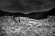
Nine Mile Burn
Encyclopedia

Hamlet (place)
A hamlet is usually a rural settlement which is too small to be considered a village, though sometimes the word is used for a different sort of community. Historically, when a hamlet became large enough to justify building a church, it was then classified as a village...
in Midlothian
Midlothian
Midlothian is one of the 32 council areas of Scotland, and a lieutenancy area. It borders the Scottish Borders, East Lothian and the City of Edinburgh council areas....
, Scotland
Scotland
Scotland is a country that is part of the United Kingdom. Occupying the northern third of the island of Great Britain, it shares a border with England to the south and is bounded by the North Sea to the east, the Atlantic Ocean to the north and west, and the North Channel and Irish Sea to the...
when heading south on the A702 road
A702 road
The A702 is a major road in Scotland, that runs from Edinburgh to St. John's Town of Dalry in Dumfries and Galloway. It is the last section of a sometimes recommended route between London and Edinburgh, the English and Scottish capitals, which now follows the M1, M6, A74 and A702 roads, rather than...
.
It is located next to the Pentland Hills
Pentland Hills
The Pentland Hills are a range of hills to the south-west of Edinburgh, Scotland. The range is around 20 miles in length, and runs south west from Edinburgh towards Biggar and the upper Clydesdale.Some of the peaks include:* Scald Law...
, about 2 km north-east of the village of Carlops
Carlops
Carlops is a small village in the Pentland Hills, within the Scottish Borders area of Scotland, close to the boundary with Midlothian.The village was founded in 1784 and developed cotton weaving, coalmining and limestone mining....
.