
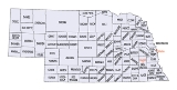
Nebraska census statistical areas
Encyclopedia
The United States Census Bureau
has defined two Combined Statistical Area
s (CSAs), three Metropolitan Statistical Areas (MSAs), and ten Micropolitan Statistical Areas (μSAs) in the State of Nebraska. The following table describes these areas with the following information:

United States Census Bureau
The United States Census Bureau is the government agency that is responsible for the United States Census. It also gathers other national demographic and economic data...
has defined two Combined Statistical Area
Combined Statistical Area
The United States Office of Management and Budget defines micropolitan and metropolitan statistical areas. Metropolitan and micropolitan statistical areas consist of one or more counties...
s (CSAs), three Metropolitan Statistical Areas (MSAs), and ten Micropolitan Statistical Areas (μSAs) in the State of Nebraska. The following table describes these areas with the following information:
- The name of the Combined Statistical Area (CSA), if any.
- The population of the CSA as of 2006-07-01, as estimated by the United States Census Bureau.
- The name of the Core Based Statistical AreaCore based statistical areaA Core Based Statistical Area is a U.S. geographic area defined by the Office of Management and Budget based around an urban center of at least 10,000 people and adjacent areas that are socioeconomically tied to the urban center by commuting. Areas defined on the basis of these standards applied...
(CBSA). - The population of the CBSA as of 2006-07-01, as estimated by the United States Census Bureau.
- The name of the countyCounty (United States)In the United States, a county is a geographic subdivision of a state , usually assigned some governmental authority. The term "county" is used in 48 of the 50 states; Louisiana is divided into parishes and Alaska into boroughs. Parishes and boroughs are called "county-equivalents" by the U.S...
. - The population of the county as of 2006-07-01, as estimated by the United States Census Bureau.
| Combined Statistical Area | 2006 Pop | Core Based Statistical Area | 2006 Pop | County | 2006 Pop |
|---|---|---|---|---|---|
| Omaha-Council Bluffs-Fremont, NE-IA CSA | 858,720 737,162 |
Omaha-Council Bluffs, NE-IA MSA | 822,549 700,991 |
Douglas County, Nebraska Douglas County, Nebraska -Demographics:As of the census of 2000, there were 463,585 people, 182,194 households, and 115,146 families residing in the county. The population density was 1,401 people per square mile . There were 192,672 housing units at an average density of 582 per square mile... |
492,003 |
| Sarpy County, Nebraska Sarpy County, Nebraska -Demographics:As of the census of 2000, there were 122,595 people, 43,426 households, and 33,220 families residing in the county. The population density was 510 people per square mile . There were 44,981 housing units at an average density of 187 per square mile... |
142,637 | ||||
| Pottawattamie County, Iowa Pottawattamie County, Iowa Pottawattamie County is a county located in the U.S. state of Iowa. The population was 93,158 in the 2010 census, an increase from 87,704 in the 2000 census and is the second largest county by area in Iowa. The Pottawattamie county seat is located at Council Bluffs. It is one of three Iowa... |
90,218 | ||||
| Cass County, Nebraska Cass County, Nebraska -Other Geographical notes:Due to its proximity to Cass County, Iowa, and because both of those counties receive most of their broadcasts from Omaha, Nebraska, references to 'Cass County' must be frequently disambiguated, or result in confusion.-Demographics:... |
25,963 | ||||
| Saunders County, Nebraska Saunders County, Nebraska -History:Saunders County was established by an 1856 act of the Nebraska Territorial Legislature; its boundaries were redefined in 1858. The county was originally named after John C... |
20,344 | ||||
| Washington County, Nebraska Washington County, Nebraska -National protected areas:*Boyer Chute National Wildlife Refuge*DeSoto National Wildlife Refuge -Demographics:As of the census of 2000, there were 18,780 people, 6,940 households, and 5,149 families residing in the county. The population density was 48 people per square mile . There were 7,408... |
20,044 | ||||
| Harrison County, Iowa Harrison County, Iowa -2010 census:The 2010 census recorded a population of 14,928 in the county, with a population density of . There were 6,731 housing units, of which 5,987 were occupied.-2000 census:... |
15,745 | ||||
| Mills County, Iowa Mills County, Iowa -2010 census:The 2010 census recorded a population of 15,059 in the county, with a population density of . There were 6,109 housing units, of which 5,605 were occupied.-2000 census:... |
15,595 | ||||
| Fremont, NE μSA | 36,171 | Dodge County, Nebraska Dodge County, Nebraska - History :Dodge County was formed in 1855. It was named after the US Senator Augustus Caesar Dodge.- Demographics :As of the census of 2000, there were 36,160 people, 14,433 households, and 9,756 families residing in the county. The population density was 68 people per square mile . There were... |
36,171 | ||
| primary census statistical area | 283,970 | Lincoln, NE MSA | 283,970 | Lancaster County, Nebraska Lancaster County, Nebraska -Demographics:As of the census of 2000, there were 250,291 people, 99,187 households, and 60,702 families residing in the county. The population density was 298 people per square mile . There were 104,217 housing units at an average density of 124 per square mile... |
267,135 |
| Seward County, Nebraska Seward County, Nebraska -Demographics:As of the census of 2000, there were 16,496 people, 6,013 households, and 4,215 families residing in the county. The population density was 29 people per square mile . There were 6,428 housing units at an average density of 11 per square mile... |
16,835 | ||||
| primary census statistical area | 70,245 | Grand Island, NE μSA | 70,245 | Hall County, Nebraska Hall County, Nebraska -History:Hall County was formed in 1858. It was named after Augustus Hall, an early judge of this territory.- Demographics :As of the census of 2000, there were 53,534 people, 20,356 households, and 14,086 families residing in the county. The population density was 98 people per square mile... |
55,555 |
| Merrick County, Nebraska Merrick County, Nebraska -Demographics:As of the census of 2000, there were 8,204 people, 3,209 households, and 2,307 families residing in the county. The population density was 17 people per square mile . There were 3,649 housing units at an average density of 8 per square mile... |
7,954 | ||||
| Howard County, Nebraska Howard County, Nebraska -History:Howard County was formed in 1871. It was named after the Union General Oliver Otis Howard.-Demographics:As of the census of 2000, there were 6,567 people, 2,546 households, and 1,797 families residing in the county. The population density was 12 people per square mile . There were 2,782... |
6,736 | ||||
| primary census statistical area | 50,655 | Kearney, NE μSA | 50,655 | Buffalo County, Nebraska Buffalo County, Nebraska -Demographics:As of the census of 2000, there were 42,259 people, 15,930 households, and 10,227 families residing in the county. The population density was 44 people per square mile . There were 16,830 housing units at an average density of 17 per square mile... |
43,954 |
| Kearney County, Nebraska Kearney County, Nebraska -History:Kearney County was formed in 1860. It was named after Fort Kearny, which in turn was named after Brigade General Stephen W. Kearny.-Demographics:... |
6,701 | ||||
| primary census statistical area | 49,413 | Norfolk, NE μSA | 49,413 | Madison County, Nebraska Madison County, Nebraska -Demographics:As of the census of 2000, there were 35,226 people, 13,436 households, and 8,894 families residing in the county. The population density was 62 people per square mile . There were 14,432 housing units at an average density of 25 per square mile... |
35,279 |
| Pierce County, Nebraska Pierce County, Nebraska -History:Pierce County was formed in 1856. It was named after President Franklin Pierce.-Demographics:As of the census of 2000, there were 7,857 people, 2,979 households, and 2,141 families residing in the county. The population density was 14 people per square mile . There were 3,247 housing... |
7,564 | ||||
| Stanton County, Nebraska Stanton County, Nebraska -History:Stanton County was formed in 1865. It was named after the Secretary of War Edwin M. Stanton during the administration of President Abraham Lincoln.-Demographics:... |
6,570 | ||||
| primary census statistical area | 39,749 | Hastings, NE μSA | 39,749 | Adams County, Nebraska Adams County, Nebraska Adams County is a county located in the U.S. state of Nebraska. As of July 1, 2006, the population estimate was 33,185. Its name is in honor of the second President of the United States, John Adams... |
33,185 |
| Clay County, Nebraska Clay County, Nebraska -Demographics:As of the census of 2000, there were 7,039 people, 2,756 households, and 1,981 families residing in the county. The population density was 12 people per square mile . There were 3,066 housing units at an average density of 5 per square mile... |
6,564 | ||||
| primary census statistical area | 37,329 | Scottsbluff, NE μSA | 37,329 | Scotts Bluff County, Nebraska Scotts Bluff County, Nebraska -National protected area:* North Platte National Wildlife Refuge* Scotts Bluff National Monument-Demographics:As of the census of 2000, there were 36,951 people, 14,887 households, and 10,167 families residing in the county. The population density was 50 people per square mile . There were 16,119... |
36,546 |
| Banner County, Nebraska Banner County, Nebraska Banner County is a county located in the U.S. state of Nebraska. The population was 690 at the 2010 census. Its county seat is Harrisburg.Banner County is part of the Scottsbluff, Nebraska Micropolitan Statistical Area.... |
783 | ||||
| primary census statistical area | 37,111 | North Platte, NE μSA | 37,111 | Lincoln County, Nebraska Lincoln County, Nebraska -Demographics:As of the census of 2000, there were 34,632 people, 14,076 households, and 9,444 families residing in the county. The population density was 14 people per square mile . There are 15,438 housing units in Lincoln.... |
35,865 |
| Logan County, Nebraska Logan County, Nebraska -History:Logan County was formed in 1885. It was named after the Union General John A. Logan.-Demographics:As of the census of 2000, there were 774 people, 316 households, and 229 families residing in the county. The population density was 1 people per square mile . There were 386 housing units... |
749 | ||||
| McPherson County, Nebraska McPherson County, Nebraska -History:McPherson County was formed in 1887. It was named after Union General James B. McPherson.-Demographics:As of the census of 2000, there were 533 people, 202 households, and 157 families residing in the county. The population density was 1 people per square mile . There were 283 housing... |
497 | ||||
| primary census statistical area | 31,962 | Columbus, NE μSA | 31,962 | Platte County, Nebraska Platte County, Nebraska -Demographics:As of the census of 2000, there were 31,662 people, 12,076 households, and 8,465 families residing in the county. The population density was 47 people per square mile . There were 12,916 housing units at an average density of 19 per square mile... |
31,962 |
| primary census statistical area | 26,996 | Lexington, NE μSA | 26,996 | Dawson County, Nebraska Dawson County, Nebraska Dawson County is a county located in the U.S. state of Nebraska. As of 2010, the population was 24,326. Its county seat is Lexington.Dawson County is part of the Lexington, Nebraska, Micropolitan Statistical Area.... |
25,018 |
| Gosper County, Nebraska Gosper County, Nebraska -History:Gosper County was formed in 1873. It was named after John J. Gosper, a Secretary of State of Nebraska.-Demographics:As of the census of 2000, there were 2,143 people, 863 households, and 655 families residing in the county. The population density was 5 people per square mile . There were... |
1,978 | ||||
| Sioux City-Vermillion, IA-NE-SD CSA | 156,341 26,757 |
Sioux City, IA-NE-SD MSA | 143,474 26,757 |
Woodbury County, Iowa Woodbury County, Iowa -2010 census:The 2010 census recorded a population of 102,172 in the county, with a population density of . There were 41,454 housing units, of which 39,052 were occupied.-2000 census:... |
102,972 |
| Dakota County, Nebraska Dakota County, Nebraska -Demographics:As of the census of 2000, there were 20,253 people, 7,095 households, and 5,087 families residing in the county. The population density was 77 people per square mile . There were 7,528 housing units at an average density of 28 per square mile... |
20,587 | ||||
| Union County, South Dakota Union County, South Dakota As of the census of 2000, there were 12,584 people, 4,927 households, and 3,517 families residing in the county. The population density was 27 people per square mile . There were 5,345 housing units at an average density of 12 per square mile... |
13,745 | ||||
| Dixon County, Nebraska Dixon County, Nebraska -Demographics:As of the census of 2000, there were 6,339 people, 2,413 households, and 1,705 families residing in the county. The population density was 13 people per square mile . There were 2,673 housing units at an average density of 6 per square mile... |
6,170 | ||||
| Vermillion, SD μSA | 12,867 | Clay County, South Dakota | 12,867 | ||
| primary census statistical area | 23,365 | Beatrice, NE μSA | 23,365 | Gage County, Nebraska Gage County, Nebraska -History:Gage County was formed with land taken from the Oto in an 1854 treaty. It was named after the minister William D. Gage.-Demographics:As of the census of 2000, there were 22,993 people, 9,316 households, and 6,204 families residing in the county. The population density was 27 people per... |
23,365 |
| none | Otoe County, Nebraska Otoe County, Nebraska -History:Otoe County was formed in 1854. It was named after the Otoe Indian tribe.-Demographics:As of the census of 2000, there were 15,396 people, 6,060 households, and 4,229 families residing in the county. The population density was 25 people per square mile . There were 6,567 housing units... |
15,747 | |||
| York County, Nebraska York County, Nebraska -History:York County was formed in 1855. It was either named after the city York in England or for York County in Pennsylvania.-Demographics:As of the census of 2000, there were 14,598 people, 5,722 households, and 3,931 families residing in the county. The population density was 25 people per... |
14,502 | ||||
| Saline County, Nebraska Saline County, Nebraska -Demographics:As of the census of 2000, there were 13,843 people, 5,188 households, and 3,507 families residing in the county. The population density was 24 people per square mile . There were 5,611 housing units at an average density of 10 per square mile... |
14,155 | ||||
| Custer County, Nebraska Custer County, Nebraska -History:Custer County was formed in 1877. It was named after General George Armstrong Custer, who was killed at the Battle of Little Bighorn.-Demographics:... |
11,242 | ||||
| Box Butte County, Nebraska Box Butte County, Nebraska -Demographics:As of the census of 2000, there were 12,158 people, 4,780 households, and 3,298 families residing in the county. The population density was 11 people per square mile . There were 5,488 housing units at an average density of 5 per square mile... |
11,132 | ||||
| Red Willow County, Nebraska Red Willow County, Nebraska -History:Red Willow County was formed in 1873. It was named after the Red Willow Creek.-Demographics:As of the census of 2000, there were 11,448 people, 4,710 households, and 3,188 families residing in the county. The population density was 16 people per square mile . There were 5,278 housing... |
10,865 | ||||
| Holt County, Nebraska Holt County, Nebraska -History:The county was created by an act of the Nebraska Legislature in 1862. It is named for Joseph Holt of Kentucky, who was Postmaster General and Secretary of War under President James Buchanan... |
10,610 | ||||
| Colfax County, Nebraska Colfax County, Nebraska -Demographics:As of the census of 2000, there were 10,441 people, 3,682 households, and 2,592 families residing in the county. The population density was 25 people per square mile . There were 4,088 housing units at an average density of 10 per square mile... |
10,113 | ||||
| Cheyenne County, Nebraska Cheyenne County, Nebraska -History:Cheyenne County was formed in 1871. It was named after the Cheyenne Native American tribe.-Demographics:As of the census of 2000, of 2000, there were 9,830 people, 4,071 households, and 2,686 families residing in the county. The population density was 8 people per square mile . There... |
9,865 | ||||
| Cuming County, Nebraska Cuming County, Nebraska -History:Cuming County was formed in 1855. It was named after Thomas B. Cuming, an early governor of this territory.-Demographics:As of the census of 2000, there were 10,203 people, 3,945 households, and 2,757 families residing in the county. The population density was 18 people per square mile... |
9,660 | ||||
| Hamilton County, Nebraska Hamilton County, Nebraska -Demographics:As of the census of 2000, there were 9,403 people, 3,503 households, and 2,676 families residing in the county. The population density was 17 people per square mile . There were 3,850 housing units at an average density of 7 per square mile... |
9,490 | ||||
| Phelps County, Nebraska Phelps County, Nebraska -History:Phelps County was formed in 1873. It was named after William Phelps, an early settler in this area.-Demographics:As of the census of 2000, there were 9,747 people, 3,844 households, and 2,683 families residing in the county. The population density was 18 people per square mile . There... |
9,442 | ||||
| Wayne County, Nebraska Wayne County, Nebraska -Demographics:As of the census of 2000, there were 9,851 people, 3,437 households, and 2,206 families residing in the county. The population density was 22 people per square mile . There were 3,662 housing units at an average density of 8 per square mile... |
9,196 | ||||
| Cedar County, Nebraska Cedar County, Nebraska -History:Cedar County was formed in 1855. It was named for the great number of cedars that grow there.-Demographics:As of the census of 2000, there were 9,615 people, 3,623 households, and 2,565 families residing in the county. The population density was 13 people per square mile . There were... |
8,819 | ||||
| Knox County, Nebraska Knox County, Nebraska -History:The Lewis and Clark Expedition passed through the area on 4 September 1804.The US Treaty with the Ponca tribe was signed at White Paint Creek on 9 June 1825.Knox County was formed in 1854. It was named after Major General Henry Knox.-Demographics:... |
8,812 | ||||
| Richardson County, Nebraska Richardson County, Nebraska -Demographics:As of the census of 2000, there were 9,531 people, 3,993 households, and 2,567 families residing in the county. The population density was 17 people per square mile . There were 4,560 housing units at an average density of 8 per square mile... |
8,656 | ||||
| Butler County, Nebraska Butler County, Nebraska -Demographics:As of the census of 2000, there were 8,767 people, 3,426 households, and 2,350 families residing in the county. The population density was 15 people per square mile . There were 3,901 housing units at an average density of 7 per square mile... |
8,595 | ||||
| Dawes County, Nebraska Dawes County, Nebraska -National protected areas:*Nebraska National Forest *Oglala National Grassland *Pine Ridge National Recreation Area-Demographics:As of the census of 2000, there were 9,060 people, 3,512 households, and 2,086 families residing in the county. The population density was 6 people per square mile... |
8,466 | ||||
| Keith County, Nebraska Keith County, Nebraska -History:Keith County was formed in 1873. It was named after Morrill C. Keith, the grandfather of Governor Keith Neville.-Demographics:As of the census of 2000, there were 8,875 people, 3,707 households, and 2,535 families residing in the county. The population density was 8 people per square mile... |
8,250 | ||||
| Jefferson County, Nebraska Jefferson County, Nebraska -Demographics:As of the census of 2000, there were 8,333 people, 3,527 households, and 2,352 families residing in the county. The population density was 14 people per square mile . There were 3,942 housing units at an average density of 7 per square mile... |
7,874 | ||||
| Burt County, Nebraska Burt County, Nebraska -History:Burt County was formed in 1854. It was named after Francis Burt, the first governor of Nebraska Territory.-Demographics:As of the census of 2000, there were 7,791 people, 3,155 households, and 2,240 families residing in the county. The population density was 16 people per square mile . ... |
7,341 | ||||
| Thurston County, Nebraska Thurston County, Nebraska -History:Varying cultures of indigenous peoples lived along the rivers for thousands of years before European encounter.Thurston County was organized by European Americans in 1889 from land that had been divided between Dakota and Burt counties since the dissolution of Blackbird County in 1879. It... |
7,273 | ||||
| Nemaha County, Nebraska Nemaha County, Nebraska -Demographics:As of the census of 2000, there were 7,576 people, 3,047 households, and 1,980 families residing in the county. The population density was 18 people per square mile . There were 3,439 housing units at an average density of 8 per square mile... |
7,247 | ||||
| Antelope County, Nebraska Antelope County, Nebraska Antelope County is a county located in the U.S. state of Nebraska, and was formed in 1871. As of 2010, the population estimate was 6,685. Its county seat is Neligh... |
6,931 | ||||
| Fillmore County, Nebraska Fillmore County, Nebraska -Hunting:Fillmore is popular with hunters of pheasant, deer, Canada goose and other popular game animals.-Organizations:Fillmore County is home to a nonprofit organization which promotes education and the development of habitat for butterflies in Nebraska.... |
6,259 | ||||
| Cherry County, Nebraska Cherry County, Nebraska Cherry County is unusual in being split between two time zones, Mountain Time and Central Time. The lines between the two runs roughly north to south along the eastern third of the county. Cherry County is also the location of the Valentine National Wildlife Refuge, the Fort Niobrara National... |
5,934 | ||||
| Boone County, Nebraska Boone County, Nebraska -Demographics:As of the census of 2000, there were 6,259 people, 2,454 households, and 1,700 families residing in the county. The population density was 9 people per square mile . There were 2,733 housing units at an average density of 4 per square mile... |
5,668 | ||||
| Sheridan County, Nebraska Sheridan County, Nebraska -History:Sheridan County was formed in 1885. It was named after General Philip H. Sheridan.-Demographics:As of the census of 2000, there were 6,198 people, 2,549 households, and 1,728 families residing in the county. The population density was 2 people per square mile . There were 3,013 housing... |
5,571 | ||||
| Polk County, Nebraska Polk County, Nebraska -Demographics:As of the census of 2000, there were 5,639 people, 2,259 households, and 1,570 families residing in the county. The population density was 5/km² . There were 2,717 housing units at an average density of 2/km²... |
5,349 | ||||
| Thayer County, Nebraska Thayer County, Nebraska -History:Thayer County was formed in 1872. It was named after the General and Governor John Milton Thayer.-Demographics:As of the census of 2000, there were 6,055 people, 2,541 households, and 1,689 families residing in the county. The population density was 10 people per square mile . There were... |
5,317 | ||||
| Morrill County, Nebraska Morrill County, Nebraska -History:Morrill County was formed in 1908 "carved out of Cheyenne County". It was named after Charles Henry Morrill, a president of the Lincoln Land Company.-Demographics:... |
5,171 | ||||
| Furnas County, Nebraska Furnas County, Nebraska -Demographics:As of the census of 2000, there were 5,324 people, 2,278 households, and 1,489 families residing in the county. The population density was 7 people per square mile . There were 2,730 housing units at an average density of 4 per square mile... |
5,003 | ||||
| Johnson County, Nebraska Johnson County, Nebraska -History:Johnson County was formed in 1855. It was named after Vice President Richard M. Johnson.-Demographics:As of the census of 2000, there were 4,488 people, 1,887 households, and 1,254 families residing in the county. The population density was 12 people per square mile . There were 2,116... |
4,683 | ||||
| Nuckolls County, Nebraska Nuckolls County, Nebraska Nuckolls County is a county located in the U.S. state of Nebraska. As of the 2010 census, the county population was 4,500. Its county seat is Nelson.... |
4,650 | ||||
| Valley County, Nebraska Valley County, Nebraska -Demographics:As of the census of 2000, there were 4,647 people, 1,965 households, and 1,298 families residing in the county. The population density was 8 people per square mile . There were 2,273 housing units at an average density of 4 per square mile... |
4,373 | ||||
| Chase County, Nebraska Chase County, Nebraska -Demographics:As of the census of 2000, there were 4,068 people, 1,662 households, and 1,163 families residing in the county. The population density was 4 people per square mile . There were 1,927 housing units at an average density of 2 per square mile... |
3,811 | ||||
| Kimball County, Nebraska Kimball County, Nebraska -History:Kimball County was formed in 1888. It was named after railroad pioneer Thomas L. Kimball.-Demographics:As of the census of 2000, there were 4,089 people, 1,727 households, and 1,136 families residing in the county. The population density was 4 people per square mile . There were 1,972... |
3,710 | ||||
| Nance County, Nebraska Nance County, Nebraska -History:The land that comprises Nance County was originally part of the Pawnee Reservation, created in 1857 when the Pawnee Indians signed a treaty with the United States ceding its lands in exchange for the reservation. After the state of Nebraska was admitted into the Union, the state government... |
3,705 | ||||
| Webster County, Nebraska Webster County, Nebraska -History:Webster County was formed in 1871. It was named after the statesman Daniel Webster.-Demographics:As of the census of 2000, there were 4,061 people, 1,708 households, and 1,118 families residing in the county. The population density was 7 people per square mile . There were 1,972 housing... |
3,701 | ||||
| Harlan County, Nebraska Harlan County, Nebraska -History:Prior to 1870, the portion of the Republican valley that now includes Harlan County was a prized hunting ground for the Native Americans; and the threat of attack deterred white settlement in the area... |
3,446 | ||||
| Brown County, Nebraska Brown County, Nebraska -Demographics:As of the census of 2000, there were 3,525 people, 1,530 households, and 996 families residing in the county. The population density was 3 people per square mile . There were 1,916 housing units at an average density of 2 per square mile... |
3,354 | ||||
| Franklin County, Nebraska Franklin County, Nebraska -Demographics:As of the census of 2000, there were 3,574 people, 1,485 households, and 1,021 families residing in the county. The population density was 6 people per square mile . There were 1,746 housing units at an average density of 3 per square mile... |
3,348 | ||||
| Sherman County, Nebraska Sherman County, Nebraska -History:Sherman County was formed in 1871. It was named after General William Tecumseh Sherman.-Demographics:As of the census of 2000, there were 3,318 people, 1,394 households, and 935 families residing in the county. The population density was 6 people per square mile . There were 1,839... |
3,083 | ||||
| Perkins County, Nebraska Perkins County, Nebraska -History:Perkins County was formed in 1887. It was named after Charles E. Perkins, the president of a railroad.-Demographics:As of the census of 2000, there were 3,200 people, 1,275 households, and 893 families residing in the county. The population density was 4 people per square mile . There... |
2,992 | ||||
| Hitchcock County, Nebraska Hitchcock County, Nebraska -History:Hitchcock County was formed in 1873. It was named after the US Senator Phineas Warren Hitchcock.-Demographics:As of the census of 2000, there were 3,111 people, 1,287 households, and 899 families residing in the county. The population density was 4 people per square mile . There were... |
2,926 | ||||
| Pawnee County, Nebraska Pawnee County, Nebraska -Demographics:As of the census of 2000, there were 3,087 people, 1,339 households, and 850 families residing in the county. The population density was 7 people per square mile . There were 1,587 housing units at an average density of 4 per square mile... |
2,804 | ||||
| Frontier County, Nebraska Frontier County, Nebraska -History:Frontier County was formed in 1872. It was named for its location along the frontier border in the late 19th century.-Demographics:As of the census of 2000, there were 3,099 people, 1,192 households, and 828 families residing in the county. The population density was 3 people per square... |
2,729 | ||||
| Greeley County, Nebraska Greeley County, Nebraska -History:Greeley County was formed in 1871. It was named after Horace Greeley, a newspaper editor and politician of the mid-19th century.-Demographics:... |
2,454 | ||||
| Boyd County, Nebraska Boyd County, Nebraska Boyd County is a county located in the U.S. state of Nebraska. As of 2010, the population is 2,099. Its county seat is Butte.In the Nebraska license plate system, Boyd County is represented by the prefix 63 .-Geography:According to the U.S... |
2,185 | ||||
| Dundy County, Nebraska Dundy County, Nebraska -Demographics:As of the census of 2000, there were 2,292 people, 961 households, and 637 families residing in the county. The population density was 2 people per square mile . There were 1,196 housing units at an average density of 1 per square mile... |
2,109 | ||||
| Garden County, Nebraska Garden County, Nebraska -History:Garden County was formed in 1909 by popular vote. Voters in the general election of November 2, 1909, approved making the northern part of Deuel County into its own county... |
1,995 | ||||
| Deuel County, Nebraska Deuel County, Nebraska -History:Deuel County was formed in 1889. It was named after Harry Porter Deuel, an early pioneer in this area.-Demographics:As of the census of 2000, there were 2,098 people, 908 households, and 601 families residing in the county. The population density was 5 people per square mile . There were... |
1,958 | ||||
| Garfield County, Nebraska Garfield County, Nebraska -Demographics:As of the census of 2000, there were 1,902 people, 813 households, and 529 families residing in the county. The population density was 3 people per square mile . There were 1,021 housing units at an average density of 2 per square mile... |
1,790 | ||||
| Rock County, Nebraska Rock County, Nebraska -National protected areas:* John and Louise Seier National Wildlife Refuge* Niobrara National Scenic River -Demographics:As of the census of 2000, there were 1,756 people, 763 households, and 501 families residing in the county. The population density was 2 people per square mile . There were 935... |
1,544 | ||||
| Sioux County, Nebraska Sioux County, Nebraska -National protected areas:* Agate Fossil Beds National Monument* Nebraska National Forest * Oglala National Grassland -Demographics:... |
1,403 | ||||
| Hayes County, Nebraska Hayes County, Nebraska -History:Hayes County was formed in 1877. It was named after President Rutherford B. Hayes.-Demographics:As of the census of 2000, there were 1,068 people, 430 households, and 312 families residing in the county. The population density was 2 people per square mile . There were 526 housing units... |
1,029 | ||||
| Keya Paha County, Nebraska Keya Paha County, Nebraska -Demographics:As of the census of 2000, there were 983 people, 409 households, and 292 families residing in the county. The population density was 1 people per square mile . There were 548 housing units at an average density of 1 per square mile . The racial makeup of the county was 99.39%... |
892 | ||||
| Wheeler County, Nebraska Wheeler County, Nebraska -History:Wheeler County was formed in 1877. It was named after Major Daniel H. Wheeler.-Demographics:As of the census of 2000, there were 886 people, 352 households, and 243 families residing in the county. The population density was 2 people per square mile . There were 561 housing units at an... |
823 | ||||
| Hooker County, Nebraska Hooker County, Nebraska -History:Hooker County was formed in 1889. It was named after General Joseph Hooker.-Demographics:As of the census of 2000, there were 783 people, 335 households, and 220 families residing in the county. The population density was 1 person per square mile . There were 440 housing units at an... |
756 | ||||
| Grant County, Nebraska Grant County, Nebraska -Demographics:As of the census of 2000, there were 747 people, 292 households, and 226 families residing in the county. The population density was 0.95 people per square mile . There were 449 housing units at an average density of 0.57 per square mile . The racial makeup of the county was... |
660 | ||||
| Loup County, Nebraska Loup County, Nebraska -Demographics:As of the census of 2010, there were 632 people, 289 households, and 206 families residing in the county. The population density was 1 people per square mile . There were 377 housing units at an average density of 1 per square mile... |
656 | ||||
| Thomas County, Nebraska Thomas County, Nebraska -History:Thomas County was formed in 1887. It was named after General George H. Thomas.-Demographics:As of the census of 2000, there were 729 people, 325 households, and 216 families residing in the county. The population density was 1 person per square mile . There were 446 housing units at an... |
629 | ||||
| Blaine County, Nebraska Blaine County, Nebraska -History:Blaine County was formed in 1885. It was named after presidential candidate James G. Blaine.-Demographics:As of the census of 2000, there were 583 people, 238 households, and 168 families residing in the county. The population density was 1 people per square mile . There were 333 housing... |
492 | ||||
| Arthur County, Nebraska Arthur County, Nebraska -Demographics:As of the census of 2000, there were 444 people, 185 households, and 138 families residing in the county. The population density was 0.618 people per square mile . There were 273 housing units at an average density of 0.380 per square mile... |
372 | ||||
See also
- State of Nebraska
- Demographics of Nebraska
- Geography of Nebraska
- United StatesUnited StatesThe United States of America is a federal constitutional republic comprising fifty states and a federal district...
- United States Census BureauUnited States Census BureauThe United States Census Bureau is the government agency that is responsible for the United States Census. It also gathers other national demographic and economic data...
- Table of United States Combined Statistical AreasTable of United States Combined Statistical Areasthumb|An enlargeable map of the 125 [[Combined Statistical Area]]s of the [[United States]]The United States Office of Management and Budget has defined 125 Combined Statistical Areas for the United States of America...
(CSA) - Table of United States Core Based Statistical Areas (CBSA)
- Table of United States Metropolitan Statistical AreasTable of United States Metropolitan Statistical Areasthumb|An enlargeable map of the 942 [[Core Based Statistical Area]]s of the [[United States]]. The 367 [[Metropolitan Statistical Area]]s are shown in red....
(MSA) - Table of United States Micropolitan Statistical AreasTable of United States Micropolitan Statistical Areasthumb|An enlargeable map of the 942 [[Core Based Statistical Area]]s of the [[United States]]. The 576 [[Micropolitan Statistical Area]]s are shown in blue....
(μSA) - Table of United States primary census statistical areas (PCSA)
- Table of United States Combined Statistical Areas
- United States Census Bureau