

National Register of Historic Places listings in Washington County, Virginia
Encyclopedia
This list includes properties and districts listed on the National Register of Historic Places
in Washington County, Virginia
. Click the "Map of all coordinates" link to the right to view a Google map of all properties and districts with latitude and longitude coordinates in the table below.
National Register of Historic Places
The National Register of Historic Places is the United States government's official list of districts, sites, buildings, structures, and objects deemed worthy of preservation...
in Washington County, Virginia
Washington County, Virginia
As of the census of 2000, there were 51,103 people, 21,056 households, and 14,949 families residing in the county. The population density was 91 people per square mile . There were 22,985 housing units at an average density of 41 per square mile...
. Click the "Map of all coordinates" link to the right to view a Google map of all properties and districts with latitude and longitude coordinates in the table below.
| Landmark name | Image | Date listed | Location | City or Town | Summary | |
|---|---|---|---|---|---|---|
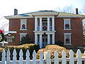
| 1 | Abingdon Bank | 225 E. Main St. 36°42′46"N 81°58′11"W |
Abingdon Abingdon, Virginia Abingdon is a town in Washington County, Virginia, USA, 133 miles southwest of Roanoke. The population was 8,191 at the 2010 census. It is the county seat of Washington County and is a designated Virginia Historic Landmark... |
|||
| 2 | Abingdon Historic District | Both sides of Main St. between Cummings and Deadmore Sts. 36°42′33"N 81°58′18"W |
Abingdon Abingdon, Virginia Abingdon is a town in Washington County, Virginia, USA, 133 miles southwest of Roanoke. The population was 8,191 at the 2010 census. It is the county seat of Washington County and is a designated Virginia Historic Landmark... |
Boundary increase (listed September 17, 1986): Roughly bounded by Russell Rd. and Jackson St., Whites Mill Rd., E. Main and E. Park and W. Main Sts., and Academy Dr. | ||
| 3 | Baker-St. John House | 18254 Providence Rd. (Route 611) 36°41′8"N 82°2′28"W |
Abingdon Abingdon, Virginia Abingdon is a town in Washington County, Virginia, USA, 133 miles southwest of Roanoke. The population was 8,191 at the 2010 census. It is the county seat of Washington County and is a designated Virginia Historic Landmark... vicinity |
|||
| 4 | Brook Hall | 13160 Byars Ln. 36°45′42"N 81°48′10"W |
Glade Spring Glade Spring, Virginia As of the census of 2000, there were 1,374 people, 565 households, and 402 families residing in the town. The population density was 1,093.4 people per square mile . There were 626 housing units at an average density of 498.2 per square mile... |
Even though the DHR website says Brook Hall is located in Abingdon, Brook Hall is actually located in Glade Spring. | ||
| 5 | Crabtree-Blackwell Farm | 1 mi. S of Blackwell on SR 686 36°49′1"N 81°51′9"W |
Blackwell Blackwell, Virginia Blackwell is an unincorporated community in Washington County, in the U.S. state of Virginia.-Reference:... |
|||
| 6 | Edmondson Hall Edmondson Hall Edmondson Hall was built in 1856 just outside of Meadowview, this brick, Greek Revival house has withstood time very well. William Campbell Edmondson, an early pioneer and merchant, built the house, and the original parcel included in the fertile valley... |
 |
Lindell Rd., 0.25 mi. N of jct. of VA 80 and VA 609 36°45′45"N 81°51′53"W |
Meadowview Meadowview, Virginia Meadowview is a census-designated place in Washington County, Virginia, United States. The population was 967 at the 2010 census... |
||
| 7 | Emory and Henry College Emory and Henry College Emory & Henry College, known as E&H, Emory, or the College, is a private liberal arts college located in Emory, Virginia, United States. The campus comprises of Washington County, Virginia, which is part of the mountain region of Southwest Virginia... |
VA 609 36°46′19"N 81°49′56"W |
Emory Emory, Virginia Emory is a census-designated place in Washington County, Virginia, United States. The population was 1,251 at the 2010 census. It is part of the Kingsport–Bristol –Bristol Metropolitan Statistical Area, which is a component of the Johnson City–Kingsport–Bristol, TN-VA... |
|||
| 8 | The Grove | 14071 Lee Hwy 36°38′24"N 82°6′39"W |
Bristol Bristol, Virginia Bristol is an independent city in Virginia, United States, bounded by Washington County, Virginia, Bristol, Tennessee, and Sullivan County, Tennessee.... |
|||
| 9 | Mont Calm | W of VA 75 36°42′25"N 81°58′25"W |
Abingdon Abingdon, Virginia Abingdon is a town in Washington County, Virginia, USA, 133 miles southwest of Roanoke. The population was 8,191 at the 2010 census. It is the county seat of Washington County and is a designated Virginia Historic Landmark... |
|||
| 10 | Moonlite Theatre | 17555 Lee Highway 36°40′26.25"N 82°2′59.91"W |
Abingdon Abingdon, Virginia Abingdon is a town in Washington County, Virginia, USA, 133 miles southwest of Roanoke. The population was 8,191 at the 2010 census. It is the county seat of Washington County and is a designated Virginia Historic Landmark... |
Drive-in theater Drive-in theater A drive-in theater is a form of cinema structure consisting of a large outdoor screen, a projection booth, a concession stand and a large parking area for automobiles. Within this enclosed area, customers can view movies from the privacy and comfort of their cars.The screen can be as simple as a... built in 1949. |
||
| 11 | Dr. William H. Pitts House | 247 E. Main St. 36°42′45"N 81°58′5"W |
Abingdon Abingdon, Virginia Abingdon is a town in Washington County, Virginia, USA, 133 miles southwest of Roanoke. The population was 8,191 at the 2010 census. It is the county seat of Washington County and is a designated Virginia Historic Landmark... |
|||
| 12 | Saltville Battlefields Historic District | Virginia State Route 91 Virginia State Route 91 Virginia State Route 91 is a primary state highway in the U.S. state of Virginia. The state highway runs from the Tennessee state line near Damascus, where the highway continues as Tennessee State Route 91 , north to U.S. Route 19 Business and US 460 Business at Frog Level... , Virginia State Route 107 Virginia State Route 107 Virginia State Route 107 is a primary state highway in the U.S. state of Virginia. The state highway runs from Interstate 81 in Chilhowie north to SR 91 in Saltville in western Smyth County.-Route description:... , County Route 632 36°53′27.14"N 81°43′35.83"W |
Saltville Saltville, Virginia As of the census of 2000, there were 2,204 people, 909 households, and 660 families residing in the town. The population density was 273.7 people per square mile . There were 1,003 housing units at an average density of 124.5 per square mile... |
Extends into Smyth County National Register of Historic Places listings in Smyth County, Virginia This list includes properties and districts listed on the National Register of Historic Places in Smyth County, Virginia. Click the "Map of all coordinates" link to the right to view a Google map of all properties and districts with latitude and longitude coordinates in the table below.-See... |
||
| 13 | Solar Hill Historic District | Roughly along Johnson, Solar, West, King, Cumberland, and Sycamore Sts. 36°35′56.4"N 82°11′6.48"W |
Bristol Bristol, Virginia Bristol is an independent city in Virginia, United States, bounded by Washington County, Virginia, Bristol, Tennessee, and Sullivan County, Tennessee.... |
|||
| 14 | Walnut Grove | 14081 Lee Highway 36°38′22"N 82°7′6"W |
Bristol Bristol, Virginia Bristol is an independent city in Virginia, United States, bounded by Washington County, Virginia, Bristol, Tennessee, and Sullivan County, Tennessee.... |
|||
| 15 | White's Mill | NW of Abingdon on White Mill Rd. 36°46′4"N 81°59′18"W |
Abingdon Abingdon, Virginia Abingdon is a town in Washington County, Virginia, USA, 133 miles southwest of Roanoke. The population was 8,191 at the 2010 census. It is the county seat of Washington County and is a designated Virginia Historic Landmark... |
See also
- National Register of Historic Places listings in VirginiaNational Register of Historic Places listings in VirginiaBuildings, sites, districts, and objects in Virginia listed on the National Register of Historic Places:As of November 25, 2011, there are 2,768 properties and districts listed on the National Register of Historic Places in all 95 Virginia counties and 36 of 39 independent cities, including 119...
- National Register of Historic Places listings in Bristol, Virginia
- List of National Historic Landmarks in Virginia