

National Register of Historic Places listings in Vance County, North Carolina
Encyclopedia
National Register of Historic Places
The National Register of Historic Places is the United States government's official list of districts, sites, buildings, structures, and objects deemed worthy of preservation...
in Vance County, North Carolina
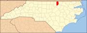
Vance County, North Carolina
-Demographics:As of the census of 2000, there were 42,954 people, 16,199 households, and 11,647 families residing in the county. The population density was 169 people per square mile . There were 18,196 housing units at an average density of 72 per square mile...
. Click the "Map of all coordinates" link to the right to view a Google map of all properties and districts with latitude and longitude coordinates in the table below.
| Landmark name | Image | Date listed | Location | City or Town | Summary | |
|---|---|---|---|---|---|---|
| 1 | Ashburn Hall | W of Kittrell on SR 1101 36°12′18.97"N 78°30′9.13"W |
Kittrell | |||
| 2 | Ashland | N of Henderson on Satterwhite Point Rd. 36°25′55.32"N 78°22′8.66"W |
Henderson | |||
| 3 | Belvidere | NC 1329, NE end 36°28′14"N 78°23′5"W |
Williamsboro | |||
| 4 | Burnside Plantation House | On SR 1335 36°26′2.22"N 78°27′44.78"W |
Williamsboro | |||
| 5 | Thomas Capehart House | W of Kittrell on SR 1105 36°13′46.81"N 78°27′59.86"W |
Kittrell | |||
| 6 | Josiah Crudup House | S of Kittrell on US 1 36°11′16.63"N 78°26′59.09"W |
Kittrell | |||
| 7 | Henderson Central Business Historic District | Garnett St. from Church to Young Sts. 36°19′34"N 78°24′19"W |
Henderson | |||
| 8 | Henderson Fire Station and Municipal Building | Garnett and Young Sts. 36°19′40"N 78°24′8"W |
Henderson | |||
| 9 | LaGrange LaGrange (Harris Crossroads, North Carolina) LaGrange in or near Harris Crossroads, North Carolina is a historic district that was listed on the National Register of Historic Places in 1982.... |
S of Townsville off SR 1308 36°24′14"N 78°24′45"W |
Harris Crossroads | |||
| 10 | Library and Laboratory Building-Henderson Institute | Rock Spring St. 36°20′18"N 78°24′9"W |
Henderson | |||
| 11 | Machpelah | 12079 NC 39, approx. 0.5 mi (0.80467 km). S of Townsville 36°29′10.96"N 78°25′58.01"W |
Townsville | |||
| 12 | Mistletoe Villa Mistletoe Villa The Hughes-Young house, most commonly known as Mistletoe Villa, is a historic house in Henderson, NC. The house is often cited for its ornate Victorian detail and architectural elements. The first house on the site was built for William H. Hughes and completed in 1855. From 1883 to 1885 the house... |
Young Ave. 36°19′14"N 78°24′33"W |
Henderson | |||
| 13 | Maria Parham Hospital | 406 S. Chestnut St. 36°19′37"N 78°24′30"W |
Henderson | |||
| 14 | Pleasant Hill/Hawkins House | W of Middleburg on SR 1371 36°24′2"N 78°20′34"W |
Middleburg | |||
| 15 | Pool Rock Plantation | NE of Williamsboro on SR 1380 36°27′15"N 78°25′4"W |
Williamsboro | |||
| 16 | St. James Episcopal Church and Rectory St. James Episcopal Church and Rectory (Kittrell, North Carolina) St. James Episcopal Church and Rectory is a historic church at the junction of SR 1551 and SR 1555 in Kittrell, North Carolina.It was added to the National Register in 1978.-References:... |
Jct. of SR 1551 and SR 1555 36°13′21.69"N 78°26′24.92"W |
Kittrell | |||
| 17 | St. John's Episcopal Church St. John's Episcopal Church (Williamsboro, North Carolina) St. John's Episcopal Church is a historic church on SR 1329 in Williamsboro, North Carolina.It was built in 1773 and added to the National Register of Historic Places in 1971.-References:... |
SR 1329 36°25′46.25"N 78°26′2.88"W |
Williamsboro | |||
| 18 | Daniel Stone Plank House | Address Restricted | Henderson | |||
| 19 | Vance County Courthouse | Young St. 36°19′43"N 78°24′9"W |
Henderson | |||
| 20 | West End School | 1000 S. Chestnut St. 36°19′24"N 78°24′48"W |
Henderson | |||
| 21 | Zollicoffer's Law Office | 215 N. Garnett St. 36°19′41"N 78°24′6"W |
Henderson |
See also
- National Register of Historic Places listings in North Carolina
- List of National Historic Landmarks in North Carolina