
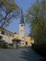
Naila
Encyclopedia

Frankenwald
thumb|View to DöbrabergThe Franconian Forest is a mid-altitude mountain range in Northern Bavaria, Germany. It is located in the district of Upper Franconia and forms the geological connection between the Fichtelgebirge and the Thuringian Forest...
hills, in the Hof
Hof (district)
Hof is a district in Bavaria, Germany. It is bounded by the districts of Wunsiedel, Bayreuth, Kulmbach and Kronach, the states of Thuringia and Saxony , and the Czech Republic...
district
Districts of Germany
The districts of Germany are known as , except in the states of North Rhine-Westphalia and Schleswig-Holstein where they are known simply as ....
of Bavaria
Bavaria
Bavaria, formally the Free State of Bavaria is a state of Germany, located in the southeast of Germany. With an area of , it is the largest state by area, forming almost 20% of the total land area of Germany...
. Naila is situated some 18 km from the larger city of Hof
Hof, Germany
Hof is a city located on the banks of the Saale in the northeastern corner of the German state of Bavaria, in the Franconia region, at the Czech border and the forested Fichtelgebirge and Frankenwald upland regions....
.
History
The earliest documentation of Naila dates at 1.9.1343. The first settlements in the area around Naila probably happened between the 12. and 14. century. The name Naila which first appeared as "Neulins" and variations thereof, has its origins most likely in the meaning "Small new settlement".Up until 1972 it was the seat of the then district
Districts of Germany
The districts of Germany are known as , except in the states of North Rhine-Westphalia and Schleswig-Holstein where they are known simply as ....
of Naila.
The village of Marxgrün incorporated to Naila in 1978.
After WW2 the Iron Curtain
Iron Curtain
The concept of the Iron Curtain symbolized the ideological fighting and physical boundary dividing Europe into two separate areas from the end of World War II in 1945 until the end of the Cold War in 1989...
, just 8 km north of Naila, cut off a large part of the market for the local industries.
See also: German Wikipedia
- Naila
- Frankenwald (Frankonian forrest)
- Wilder Mann (Wild Man)
- Das Höllental (Hell-Valley)
- the river Selbitz
External links (German)
- Map of Naila
- History of the city-seal
- Description of the balloon-escape from the GDR
- official website of the city of Naila