
Minnesota State Highway 258
Encyclopedia
Minnesota State Highway 258 is a highway
in southwest Minnesota
, which runs from its intersection
with Brown County Road 17 in Comfrey
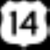
and continues north to its northern terminus at its intersection with U.S. Highway 14
in Burnstown Township, four miles east of Springfield
.
The route is 10.8 miles (17.4 km) in length.
and U.S. Highway 14.
Highway 258 crosses the Little Cottonwood River
near its intersection with County Road 20 in Bashaw Township. The route crosses the Cottonwood River
near its intersection with County Road 24 in Burnstown Township.
Highway
A highway is any public road. In American English, the term is common and almost always designates major roads. In British English, the term designates any road open to the public. Any interconnected set of highways can be variously referred to as a "highway system", a "highway network", or a...
in southwest Minnesota
Minnesota
Minnesota is a U.S. state located in the Midwestern United States. The twelfth largest state of the U.S., it is the twenty-first most populous, with 5.3 million residents. Minnesota was carved out of the eastern half of the Minnesota Territory and admitted to the Union as the thirty-second state...
, which runs from its intersection
Intersection (road)
An intersection is a road junction where two or more roads either meet or cross at grade . An intersection may be 3-way - a T junction or fork, 4-way - a crossroads, or 5-way or more...
with Brown County Road 17 in Comfrey
Comfrey, Minnesota
For the plant, see ComfreyComfrey is a city in Brown and Cottonwood counties in the U.S. state of Minnesota. The population was 382 at the 2010 census...
and continues north to its northern terminus at its intersection with U.S. Highway 14
U.S. Route 14
U.S. Route 14 , an east–west route, is one of the original United States highways of 1926. It currently has a length of 1,398 miles , but it had a peak length of 1,429 miles . For much of its length, it runs roughly parallel to Interstate 90.As of 2004, the highway's eastern terminus is in...
in Burnstown Township, four miles east of Springfield
Springfield, Minnesota
As of the census of 2000, there were 2,215 people, 897 households, and 562 families residing in the city. The population density was 1,223.9 people per square mile . There were 968 housing units at an average density of 534.9 per square mile...
.
The route is 10.8 miles (17.4 km) in length.
Route description
Highway 258 serves as a north–south route in southwest Minnesota between the town of ComfreyComfrey, Minnesota
For the plant, see ComfreyComfrey is a city in Brown and Cottonwood counties in the U.S. state of Minnesota. The population was 382 at the 2010 census...
and U.S. Highway 14.
Highway 258 crosses the Little Cottonwood River
Little Cottonwood River
The Little Cottonwood River is a tributary of the Minnesota River, 83 miles long, in southwestern Minnesota in the United States...
near its intersection with County Road 20 in Bashaw Township. The route crosses the Cottonwood River
Cottonwood River (Minnesota)
The Cottonwood River is a tributary of the Minnesota River, 152 miles long, in southwestern Minnesota in the United States. Via the Minnesota River, it is part of the watershed of the Mississippi River, draining an area of in an agricultural region...
near its intersection with County Road 24 in Burnstown Township.