
Minnesota State Highway 104
Encyclopedia
Minnesota State Highway 104 is a highway
in west-central Minnesota
, which runs from its intersection
with State Highway 9
in Norway Lake Township near Sunburg
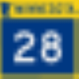
and continues north to its northern terminus at its intersection with State Highways 28
and 29
in the city of Glenwood
.
Highway 104 is 27 miles (43.5 km) in length.
and Glenwood
in west-central Minnesota.
Highway 104 changes direction to east–west in Chippewa Falls Township and continues as east–west for 6 miles before returning again to a north–south direction in Barsness Township for the remainder of its route to Glenwood.
The highway is officially marked as a north–south route by its highway shields from beginning to end.
The route serves as the county line in northwest Kandiyohi County
and northeast Swift County
.
Highway 104 is also known as Franklin Street South in the city of Glenwood.
Monson Lake State Park
is located west of Sunburg
and west of the junction
of Highway 104 and State Highway 9
. The park entrance is located off Highway 9 via County Road 95.
The route is legally defined as Route 143 in the Minnesota Statutes. It is not marked with this number.
The route was completely paved by 1960.
From 1934 until 2005, State Highway 104 had continued farther south. The section of present day Kandiyohi County Road 7 between State Highway 9
(at Sunburg
) and U.S. Highway 12
(west of Pennock
and Willmar
) was originally designated Highway 104 until 2005. The original length of 104 was 41 miles.
|colspan=2 align='center'|Swift
-Kandiyohi
county line
|14.446
|
|West end of MN 9 overlap
Highway
A highway is any public road. In American English, the term is common and almost always designates major roads. In British English, the term designates any road open to the public. Any interconnected set of highways can be variously referred to as a "highway system", a "highway network", or a...
in west-central Minnesota
Minnesota
Minnesota is a U.S. state located in the Midwestern United States. The twelfth largest state of the U.S., it is the twenty-first most populous, with 5.3 million residents. Minnesota was carved out of the eastern half of the Minnesota Territory and admitted to the Union as the thirty-second state...
, which runs from its intersection
Intersection (road)
An intersection is a road junction where two or more roads either meet or cross at grade . An intersection may be 3-way - a T junction or fork, 4-way - a crossroads, or 5-way or more...
with State Highway 9
Minnesota State Highway 9
Minnesota State Highway 9 is a highway in west-central and northwest Minnesota, which runs from its intersection with State Highway 23 in New London and continues west and then north to its northern terminus at its intersection with U.S. Highway 2 in Fairfax Township near Crookston.This highway has...
in Norway Lake Township near Sunburg
Sunburg, Minnesota
Sunburg is a city in Kandiyohi County, Minnesota, United States. The population was 100 at the 2010 census. The community is famous for its celebration of its Norwegian-American heritage. The local Sunburg Creamery Cafe serves Norwegian dishes including Klub and Lutefisk. The community is home to...
and continues north to its northern terminus at its intersection with State Highways 28
Minnesota State Highway 28
Minnesota State Highway 28 is a highway in west-central and central Minnesota, which runs from South Dakota Highway 10 at the South Dakota state line near Browns Valley and continues east to its eastern terminus at its intersection with the former route of U.S...
and 29
Minnesota State Highway 29
Minnesota State Highway 29 is a highway in west-central Minnesota, which runs from its junction with U.S. Highways 59 and 212 in Montevideo and continues north to its northern terminus at its intersection with U.S...
in the city of Glenwood
Glenwood, Minnesota
As of the census of 2000, there were 2,594 people, 1,131 households, and 629 families residing in the city. The population density was 466.0 people per square mile . There were 1,202 housing units at an average density of 215.9 per square mile...
.
Highway 104 is 27 miles (43.5 km) in length.
Route description
State Highway 104 serves as a north–south and an east–west route between SunburgSunburg, Minnesota
Sunburg is a city in Kandiyohi County, Minnesota, United States. The population was 100 at the 2010 census. The community is famous for its celebration of its Norwegian-American heritage. The local Sunburg Creamery Cafe serves Norwegian dishes including Klub and Lutefisk. The community is home to...
and Glenwood
Glenwood, Minnesota
As of the census of 2000, there were 2,594 people, 1,131 households, and 629 families residing in the city. The population density was 466.0 people per square mile . There were 1,202 housing units at an average density of 215.9 per square mile...
in west-central Minnesota.
Highway 104 changes direction to east–west in Chippewa Falls Township and continues as east–west for 6 miles before returning again to a north–south direction in Barsness Township for the remainder of its route to Glenwood.
The highway is officially marked as a north–south route by its highway shields from beginning to end.
The route serves as the county line in northwest Kandiyohi County
Kandiyohi County, Minnesota
Kandiyohi County is a county located in the U.S. state of Minnesota. As of 2010, its population was 42,239. Its county seat is Willmar.- History :...
and northeast Swift County
Swift County, Minnesota
As of the census of 2000, there were 11,956 people, 4,353 households, and 2,881 families residing in the county. The population density was 16 people per square mile . There were 4,821 housing units at an average density of 6 per square mile...
.
Highway 104 is also known as Franklin Street South in the city of Glenwood.
Monson Lake State Park
Monson Lake State Park
Monson Lake State Park is a state park of Minnesota, USA, originally established as a memorial to 13 Swedish American pioneers who were killed there in the Dakota War of 1862. A district of 1930s New Deal structures is on the National Register of Historic Places. Despite being nearly doubled in...
is located west of Sunburg
Sunburg, Minnesota
Sunburg is a city in Kandiyohi County, Minnesota, United States. The population was 100 at the 2010 census. The community is famous for its celebration of its Norwegian-American heritage. The local Sunburg Creamery Cafe serves Norwegian dishes including Klub and Lutefisk. The community is home to...
and west of the junction
Junction (traffic)
A junction, when discussed in the context of transport, is a location where traffic can change between different routes, directions, or sometimes modes, of travel.-Historical significance:...
of Highway 104 and State Highway 9
Minnesota State Highway 9
Minnesota State Highway 9 is a highway in west-central and northwest Minnesota, which runs from its intersection with State Highway 23 in New London and continues west and then north to its northern terminus at its intersection with U.S. Highway 2 in Fairfax Township near Crookston.This highway has...
. The park entrance is located off Highway 9 via County Road 95.
The route is legally defined as Route 143 in the Minnesota Statutes. It is not marked with this number.
History
State Highway 104 was authorized on April 22, 1933.The route was completely paved by 1960.
From 1934 until 2005, State Highway 104 had continued farther south. The section of present day Kandiyohi County Road 7 between State Highway 9
Minnesota State Highway 9
Minnesota State Highway 9 is a highway in west-central and northwest Minnesota, which runs from its intersection with State Highway 23 in New London and continues west and then north to its northern terminus at its intersection with U.S. Highway 2 in Fairfax Township near Crookston.This highway has...
(at Sunburg
Sunburg, Minnesota
Sunburg is a city in Kandiyohi County, Minnesota, United States. The population was 100 at the 2010 census. The community is famous for its celebration of its Norwegian-American heritage. The local Sunburg Creamery Cafe serves Norwegian dishes including Klub and Lutefisk. The community is home to...
) and U.S. Highway 12
U.S. Route 12 in Minnesota
U.S. Route 12 is a highway in west-central and east-central Minnesota, which runs from the South Dakota state line at Ortonville near Big Stone Lake and continues east to the St. Croix River at the Wisconsin state line. U.S. 12 in Minnesota is in length...
(west of Pennock
Pennock, Minnesota
Pennock is a city in Kandiyohi County, Minnesota, United States. The population was 508 at the 2010 census.-Geography:According to the United States Census Bureau, the city has a total area of , all of it land....
and Willmar
Willmar, Minnesota
As of the census of 2000, there were 18,351 people, 7,302 households, and 4,461 families residing in the city. The population density was 1,549.9 people per square mile . There were 7,789 housing units at an average density of 657.8 per square mile...
) was originally designated Highway 104 until 2005. The original length of 104 was 41 miles.
Major intersections
|-|colspan=2 align='center'|Swift
Swift County, Minnesota
As of the census of 2000, there were 11,956 people, 4,353 households, and 2,881 families residing in the county. The population density was 16 people per square mile . There were 4,821 housing units at an average density of 6 per square mile...
-Kandiyohi
Kandiyohi County, Minnesota
Kandiyohi County is a county located in the U.S. state of Minnesota. As of 2010, its population was 42,239. Its county seat is Willmar.- History :...
county line
|14.446
|
|West end of MN 9 overlap