
Maryland Route 514
Encyclopedia
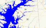
Maryland Route 514 is a state highway
in the U.S. state
of Maryland
. The state highway runs 4.89 miles (7.9 km) from MD 20
in Chestertown
north to MD 298
in Melitota. MD 514 was built in the early 1950s from the Chestertown end and extended to Melitota in the late 1980s.
.
{|class=wikitable
!Location
!Mile
!Destinations
!Notes
|-
|rowspan=1|Chestertown
|0.00
|
|Southern terminus
|-
|rowspan=3|Melitota
|3.76
|Hanesville Road north
|MD 514 turns west onto Melitota Road
|-
|rowspan=2|4.89
|
|rowspan=2|Northern terminus
|-
|Handy Point Road west
State highway
State highway, state road or state route can refer to one of three related concepts, two of them related to a state or provincial government in a country that is divided into states or provinces :#A...
in the U.S. state
U.S. state
A U.S. state is any one of the 50 federated states of the United States of America that share sovereignty with the federal government. Because of this shared sovereignty, an American is a citizen both of the federal entity and of his or her state of domicile. Four states use the official title of...
of Maryland
Maryland
Maryland is a U.S. state located in the Mid Atlantic region of the United States, bordering Virginia, West Virginia, and the District of Columbia to its south and west; Pennsylvania to its north; and Delaware to its east...
. The state highway runs 4.89 miles (7.9 km) from MD 20
Maryland Route 20
Maryland Route 20 is a state highway in the U.S. state of Maryland. The state highway runs from Beach Road and Lawton Avenue in Rock Hall east to MD 291 in Chestertown. MD 20, which connects Chestertown with several villages in western Kent County, was designated one of the original state roads...
in Chestertown
Chestertown, Maryland
Chestertown is a town in Kent County, Maryland, United States. The population was 4,746 at the 2000 census. It is the county seat of Kent County. The ZIP code is 21620 and the area codes are 410 and 443...
north to MD 298
Maryland Route 298
Maryland Route 298 is a state highway in the U.S. state of Maryland. The state highway runs from MD 20 in Fairlee east to MD 291 near Chesterville. MD 298 is a C-shaped highway that connects Fairlee, MD 213, and Millington with several villages in central Kent County, including Worton, Lynch,...
in Melitota. MD 514 was built in the early 1950s from the Chestertown end and extended to Melitota in the late 1980s.
Route description
MD 514 begins at an intersection with MD 20 (Chestertown Road) just outside the town limits of Chestertown. The state highway, known as Flatland Road, enters the town limits briefly and heads northwest as businesses and residential subdivisions give way to farmland. Near Melitota, MD 514 turns west onto Melitota Road while the roadway continues north as a county highway, Hanesville Road. The state highway reaches its terminus at MD 298 (Fairlee Road) in Melitota opposite county-maintained Handy Point Road.History
MD 514 was constructed in two sections from MD 20 to the intersection with Melitota Road and Hanesville Road in 1950 and 1952. The state highway was extended west along Melitota Road to its present northern terminus around 1989.Junction list
The entire route is in Kent CountyKent County, Maryland
Kent County is a county located in the U.S. state of Maryland, on its Eastern Shore. It was named for the county of Kent in England. Its county seat is Chestertown. In 2010, the county population was 20,197...
.
{|class=wikitable
!Location
!Mile
!Destinations
!Notes
|-
|rowspan=1|Chestertown
Chestertown, Maryland
Chestertown is a town in Kent County, Maryland, United States. The population was 4,746 at the 2000 census. It is the county seat of Kent County. The ZIP code is 21620 and the area codes are 410 and 443...
|0.00
|
|Southern terminus
|-
|rowspan=3|Melitota
|3.76
|Hanesville Road north
|MD 514 turns west onto Melitota Road
|-
|rowspan=2|4.89
|
|rowspan=2|Northern terminus
|-
|Handy Point Road west