
Maryland Route 288
Encyclopedia
Maryland Route 288 is a state highway
in the U.S. state
of Maryland
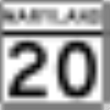
. Known as Crosby Road, the state highway runs 3.33 miles (5.4 km) from MD 20
in Rock Hall
east to Long Cove Public Landing on the Piney Neck peninsula in western Kent County
. MD 288 was constructed in the mid 1920s.
.
.
{|class=wikitable
!Location
!Mile
!Destinations
!Notes
|-
|Rock Hall
|0.00
|
|Western terminus
|-
|Piney Neck
|3.33
|Entrance to Long Cove Public Landing
|Eastern terminus
State highway
State highway, state road or state route can refer to one of three related concepts, two of them related to a state or provincial government in a country that is divided into states or provinces :#A...
in the U.S. state
U.S. state
A U.S. state is any one of the 50 federated states of the United States of America that share sovereignty with the federal government. Because of this shared sovereignty, an American is a citizen both of the federal entity and of his or her state of domicile. Four states use the official title of...
of Maryland
Maryland
Maryland is a U.S. state located in the Mid Atlantic region of the United States, bordering Virginia, West Virginia, and the District of Columbia to its south and west; Pennsylvania to its north; and Delaware to its east...
. Known as Crosby Road, the state highway runs 3.33 miles (5.4 km) from MD 20
Maryland Route 20
Maryland Route 20 is a state highway in the U.S. state of Maryland. The state highway runs from Beach Road and Lawton Avenue in Rock Hall east to MD 291 in Chestertown. MD 20, which connects Chestertown with several villages in western Kent County, was designated one of the original state roads...
in Rock Hall
Rock Hall, Maryland
Rock Hall is a town in Kent County, Maryland, United States. The population was 1,396 at the 2000 census.The town is a center for the fishing, crabbing, and oystering industries in Kent County as well as a home to marinas that cater to the pleasure craft that sail the Chesapeake Bay...
east to Long Cove Public Landing on the Piney Neck peninsula in western Kent County
Kent County, Maryland
Kent County is a county located in the U.S. state of Maryland, on its Eastern Shore. It was named for the county of Kent in England. Its county seat is Chestertown. In 2010, the county population was 20,197...
. MD 288 was constructed in the mid 1920s.
Route description
MD 288 begins at an intersection with MD 20 (Rock Hall Road) just east of Rock Hall. The state highway heads south through a mix of farmland and forest. At Skinners Neck Road, MD 288 turns east and then south again at Edesville Road. The state highway turns east again in the hamlet of Crosby while Piney Neck Road continues south. MD 288 veers south while McKinleyville Road continues southeast, reaching its eastern terminus at Long Cove Public Landing on Long Cove, an inlet of Langford Creek just north of where the creek empties into the Chester RiverChester River
The Chester River is a major tributary of the Chesapeake Bay on the Delmarva Peninsula. It is about long, and its watershed encompasses , which includes of land. Thus the total watershed area is 20% water. It forms the border between Kent County and Queen Anne's County, Maryland, with its...
.
History
MD 288 was constructed in 1925 and 1926. The highway has changed very little since then.Junction list
The entire route is in Kent CountyKent County, Maryland
Kent County is a county located in the U.S. state of Maryland, on its Eastern Shore. It was named for the county of Kent in England. Its county seat is Chestertown. In 2010, the county population was 20,197...
.
{|class=wikitable
!Location
!Mile
!Destinations
!Notes
|-
|Rock Hall
Rock Hall, Maryland
Rock Hall is a town in Kent County, Maryland, United States. The population was 1,396 at the 2000 census.The town is a center for the fishing, crabbing, and oystering industries in Kent County as well as a home to marinas that cater to the pleasure craft that sail the Chesapeake Bay...
|0.00
|
|Western terminus
|-
|Piney Neck
|3.33
|Entrance to Long Cove Public Landing
|Eastern terminus