
Louisiana Highway 948
Encyclopedia
Louisiana Highway 948 is a state highway
in Louisiana
that serves East Baton Rouge Parish
. It spans 0.35 mile (0.563269 km) in a west to east direction. It is known locally as Highland Road.
/Highland Road intersection in extreme southern East Baton Rouge Parish
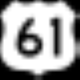
. Highland Road carries LA 42
to the west; Airline Highway
carries US 61
to the north and south. At this point, LA 42
merges onto Airline Highway
in the southeast direction. LA 948 connects these highways to the paralleling LA 73
(Jefferson Highway) just to the east (where it ends).
LA 948 is an undivded, two-lane highway for its entire length.
State highway
State highway, state road or state route can refer to one of three related concepts, two of them related to a state or provincial government in a country that is divided into states or provinces :#A...
in Louisiana
Louisiana
Louisiana is a state located in the southern region of the United States of America. Its capital is Baton Rouge and largest city is New Orleans. Louisiana is the only state in the U.S. with political subdivisions termed parishes, which are local governments equivalent to counties...
that serves East Baton Rouge Parish
East Baton Rouge Parish, Louisiana
East Baton Rouge Parish is a parish located in the U.S. state of Louisiana. The parish seat is Baton Rouge, Louisiana's state capital. As of the 2010 census, the population was 440,171. The parish has a total area of , of which is land and is water. It is the most populous parish in the state...
. It spans 0.35 mile (0.563269 km) in a west to east direction. It is known locally as Highland Road.
Route description
From the west, LA 948 begins at the Airline HighwayAirline Highway
Airline Highway is a divided highway in the U.S. state of Louisiana, built in the 1930s and 1940s to bypass the older Jefferson Highway. It carries U.S. Highway 61 from New Orleans northwest to Baton Rouge, and U.S. Highway 190 from Baton Rouge west over the Mississippi River on the Huey P. Long...
/Highland Road intersection in extreme southern East Baton Rouge Parish
East Baton Rouge Parish, Louisiana
East Baton Rouge Parish is a parish located in the U.S. state of Louisiana. The parish seat is Baton Rouge, Louisiana's state capital. As of the 2010 census, the population was 440,171. The parish has a total area of , of which is land and is water. It is the most populous parish in the state...
. Highland Road carries LA 42
Louisiana Highway 42
Louisiana Highway 42 is a state highway in Louisiana that serves East Baton Rouge, Ascension Parish, Livingston Parish and Tangipahoa Parish. It spans in roughly a East North East direction.-Route description:...
to the west; Airline Highway
Airline Highway
Airline Highway is a divided highway in the U.S. state of Louisiana, built in the 1930s and 1940s to bypass the older Jefferson Highway. It carries U.S. Highway 61 from New Orleans northwest to Baton Rouge, and U.S. Highway 190 from Baton Rouge west over the Mississippi River on the Huey P. Long...
carries US 61
U.S. Route 61
U.S. Route 61 is the official designation for a United States highway that runs from New Orleans, Louisiana, to the city of Wyoming, Minnesota. The highway generally follows the course of the Mississippi River, and is designated the Great River Road for much of its route. As of 2004, the highway's...
to the north and south. At this point, LA 42
Louisiana Highway 42
Louisiana Highway 42 is a state highway in Louisiana that serves East Baton Rouge, Ascension Parish, Livingston Parish and Tangipahoa Parish. It spans in roughly a East North East direction.-Route description:...
merges onto Airline Highway
Airline Highway
Airline Highway is a divided highway in the U.S. state of Louisiana, built in the 1930s and 1940s to bypass the older Jefferson Highway. It carries U.S. Highway 61 from New Orleans northwest to Baton Rouge, and U.S. Highway 190 from Baton Rouge west over the Mississippi River on the Huey P. Long...
in the southeast direction. LA 948 connects these highways to the paralleling LA 73
Louisiana Highway 73
Highway 73 is a highway stretching from Geismar, Louisiana, to Baton Rouge, Louisiana. Hwy. 73 was built as a bypass to the backbends of River Road. It was soon after bypassed itself in a more complete way with U.S...
(Jefferson Highway) just to the east (where it ends).
LA 948 is an undivded, two-lane highway for its entire length.
Junction list
| Parish | Location | Mile | Junction | Notes | |
|---|---|---|---|---|---|
| East Baton Rouge East Baton Rouge Parish, Louisiana East Baton Rouge Parish is a parish located in the U.S. state of Louisiana. The parish seat is Baton Rouge, Louisiana's state capital. As of the 2010 census, the population was 440,171. The parish has a total area of , of which is land and is water. It is the most populous parish in the state... |
Baton Rouge Baton Rouge, Louisiana Baton Rouge is the capital of the U.S. state of Louisiana. It is located in East Baton Rouge Parish and is the second-largest city in the state.Baton Rouge is a major industrial, petrochemical, medical, and research center of the American South... |
Western terminus of  LA 948 LA 948 |
|||
| 0.00 |  US 61 US 61U.S. Route 61 U.S. Route 61 is the official designation for a United States highway that runs from New Orleans, Louisiana, to the city of Wyoming, Minnesota. The highway generally follows the course of the Mississippi River, and is designated the Great River Road for much of its route. As of 2004, the highway's...  LA 42 LA 42Louisiana Highway 42 Louisiana Highway 42 is a state highway in Louisiana that serves East Baton Rouge, Ascension Parish, Livingston Parish and Tangipahoa Parish. It spans in roughly a East North East direction.-Route description:... (Airline Highway Airline Highway Airline Highway is a divided highway in the U.S. state of Louisiana, built in the 1930s and 1940s to bypass the older Jefferson Highway. It carries U.S. Highway 61 from New Orleans northwest to Baton Rouge, and U.S. Highway 190 from Baton Rouge west over the Mississippi River on the Huey P. Long... to the north and south) (Highland Road to the west) |
||||
| 0.35 |  LA 73 LA 73Louisiana Highway 73 Highway 73 is a highway stretching from Geismar, Louisiana, to Baton Rouge, Louisiana. Hwy. 73 was built as a bypass to the backbends of River Road. It was soon after bypassed itself in a more complete way with U.S... (Jefferson Highway) |
Southeastern end of Highland Road | |||
| Eastern terminus of LA 948 |
|||||