
Louisiana Highway 408
Encyclopedia
Louisiana Highway 408 is a state highway
in Louisiana
that serves East Baton Rouge Parish
. It spans 13.04 miles (21 km) in a west to east direction. It is known locally as Harding Boulevard and Hooper Road.
(Scenic Highway) on the grounds of Southern University
in Baton Rouge
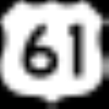
. It crosses a railroad overpass and heads eastward toward US 61
(Scenic Highway) and I-110
(Exit 6), passing to the south of Baton Rouge Metropolitan Airport
. LA 408 becomes Hooper Road east of a junction with LA 67 and then crosses the Comite River
. It then crosses LA 410
(Blackwater Road), LA 946
(Joor Road), and LA 3034
(Sullivan Road). It comes to an end just west of the Amite River
at a junction with LA 37 and LA 64 (Greenwell Springs Road).
From its western terminus, LA 408 begins as an undivided, two lane highway before dividing and expanding to four lanes before a railroad overpass on the eastern edge of Southern University
. It again becomes an undivided, two lane highway about a half mile past LA 410
(Blackwater Road). It stays that way for the remainder of the route with the exceptions of brief changes near LA 946
(Joor Road) (undivided, five lane highway (with a middle turning lane) and LA 3034
(Sullivan Road) (undivided, three lane highway (with a middle turning lane).
State highway
State highway, state road or state route can refer to one of three related concepts, two of them related to a state or provincial government in a country that is divided into states or provinces :#A...
in Louisiana
Louisiana
Louisiana is a state located in the southern region of the United States of America. Its capital is Baton Rouge and largest city is New Orleans. Louisiana is the only state in the U.S. with political subdivisions termed parishes, which are local governments equivalent to counties...
that serves East Baton Rouge Parish
East Baton Rouge Parish, Louisiana
East Baton Rouge Parish is a parish located in the U.S. state of Louisiana. The parish seat is Baton Rouge, Louisiana's state capital. As of the 2010 census, the population was 440,171. The parish has a total area of , of which is land and is water. It is the most populous parish in the state...
. It spans 13.04 miles (21 km) in a west to east direction. It is known locally as Harding Boulevard and Hooper Road.
Route description
From the west, LA 408 begins along Harding Boulevard one mile (1.6 km) west of US 61U.S. Route 61
U.S. Route 61 is the official designation for a United States highway that runs from New Orleans, Louisiana, to the city of Wyoming, Minnesota. The highway generally follows the course of the Mississippi River, and is designated the Great River Road for much of its route. As of 2004, the highway's...
(Scenic Highway) on the grounds of Southern University
Southern University
Southern University and A&M College is a historically black college located in Baton Rouge, Louisiana. The Baton Rouge campus is located on Scott’s Bluff overlooking the Mississippi River in the northern section...
in Baton Rouge
Baton Rouge, Louisiana
Baton Rouge is the capital of the U.S. state of Louisiana. It is located in East Baton Rouge Parish and is the second-largest city in the state.Baton Rouge is a major industrial, petrochemical, medical, and research center of the American South...
. It crosses a railroad overpass and heads eastward toward US 61
U.S. Route 61
U.S. Route 61 is the official designation for a United States highway that runs from New Orleans, Louisiana, to the city of Wyoming, Minnesota. The highway generally follows the course of the Mississippi River, and is designated the Great River Road for much of its route. As of 2004, the highway's...
(Scenic Highway) and I-110
Interstate 110 (Louisiana)
Interstate 110 is an spur route in Baton Rouge, running from Interstate 10 in the city's downtown area north to U.S. Highway 61 and the Baton Rouge Metropolitan Airport in the northern part of the city...
(Exit 6), passing to the south of Baton Rouge Metropolitan Airport
Baton Rouge Metropolitan Airport
Baton Rouge Metropolitan Airport , also known as Ryan Field, is a public use airport located four nautical miles north of the central business district of Baton Rouge, a city in East Baton Rouge Parish, Louisiana, United States....
. LA 408 becomes Hooper Road east of a junction with LA 67 and then crosses the Comite River
Comite River
The Comite River is a right bank tributary of the Amite River, with a confluence near the city of Denham Springs, east of Baton Rouge, Louisiana. The river is long. Its drainage basin comprises approximately and includes portions of Wilkinson and Amite counties in Mississippi, and East Feliciana...
. It then crosses LA 410
Louisiana Highway 410
Louisiana Highway 410 is a state highway in Louisiana that serves East Baton Rouge Parish. It spans in a south to north direction. It is known locally as Blackwater Road.-Route description:...
(Blackwater Road), LA 946
Louisiana Highway 946
Louisiana Highway 946 is a state highway in Louisiana that serves East Baton Rouge Parish. It spans in a south to north direction. It is known locally as Joor Road.-Route description:...
(Joor Road), and LA 3034
Louisiana Highway 3034
Louisiana Highway 3034 is a state highway in Louisiana that serves East Baton Rouge Parish. It spans in a west to east direction. It is known locally as Sullivan Road, Wax Road, and Magnolia Bridge Road.-Route description:...
(Sullivan Road). It comes to an end just west of the Amite River
Amite River
The Amite River is a tributary of Lake Maurepas in Mississippi and Louisiana in the United States. It is about long. It starts as two forks in southwestern Mississippi and flows south through Louisiana, passing Greater Baton Rouge, to Lake Maurepas. The lower of the river is navigable...
at a junction with LA 37 and LA 64 (Greenwell Springs Road).
From its western terminus, LA 408 begins as an undivided, two lane highway before dividing and expanding to four lanes before a railroad overpass on the eastern edge of Southern University
Southern University
Southern University and A&M College is a historically black college located in Baton Rouge, Louisiana. The Baton Rouge campus is located on Scott’s Bluff overlooking the Mississippi River in the northern section...
. It again becomes an undivided, two lane highway about a half mile past LA 410
Louisiana Highway 410
Louisiana Highway 410 is a state highway in Louisiana that serves East Baton Rouge Parish. It spans in a south to north direction. It is known locally as Blackwater Road.-Route description:...
(Blackwater Road). It stays that way for the remainder of the route with the exceptions of brief changes near LA 946
Louisiana Highway 946
Louisiana Highway 946 is a state highway in Louisiana that serves East Baton Rouge Parish. It spans in a south to north direction. It is known locally as Joor Road.-Route description:...
(Joor Road) (undivided, five lane highway (with a middle turning lane) and LA 3034
Louisiana Highway 3034
Louisiana Highway 3034 is a state highway in Louisiana that serves East Baton Rouge Parish. It spans in a west to east direction. It is known locally as Sullivan Road, Wax Road, and Magnolia Bridge Road.-Route description:...
(Sullivan Road) (undivided, three lane highway (with a middle turning lane).
Junction list
| Parish | Location | Mile | Junction | Notes | |
|---|---|---|---|---|---|
| East Baton Rouge East Baton Rouge Parish, Louisiana East Baton Rouge Parish is a parish located in the U.S. state of Louisiana. The parish seat is Baton Rouge, Louisiana's state capital. As of the 2010 census, the population was 440,171. The parish has a total area of , of which is land and is water. It is the most populous parish in the state... |
Baton Rouge Baton Rouge, Louisiana Baton Rouge is the capital of the U.S. state of Louisiana. It is located in East Baton Rouge Parish and is the second-largest city in the state.Baton Rouge is a major industrial, petrochemical, medical, and research center of the American South... |
Western terminus of  LA 408 LA 408 |
|||
| 0.00 | Begin State Mainteance 1 miles (1.6 km) west of US 61 U.S. Route 61 U.S. Route 61 is the official designation for a United States highway that runs from New Orleans, Louisiana, to the city of Wyoming, Minnesota. The highway generally follows the course of the Mississippi River, and is designated the Great River Road for much of its route. As of 2004, the highway's... (Scenic Highway) on the grounds of Southern University Southern University Southern University and A&M College is a historically black college located in Baton Rouge, Louisiana. The Baton Rouge campus is located on Scott’s Bluff overlooking the Mississippi River in the northern section... |
||||
| 1.0 |  US 61 US 61U.S. Route 61 U.S. Route 61 is the official designation for a United States highway that runs from New Orleans, Louisiana, to the city of Wyoming, Minnesota. The highway generally follows the course of the Mississippi River, and is designated the Great River Road for much of its route. As of 2004, the highway's... (Scenic Highway) |
||||
| 2.0 |  I-110 I-110Interstate 110 (Louisiana) Interstate 110 is an spur route in Baton Rouge, running from Interstate 10 in the city's downtown area north to U.S. Highway 61 and the Baton Rouge Metropolitan Airport in the northern part of the city... |
Exit 6/Partial cloverleaf-diamond interchange | |||
| 3.0 |  LA 67 (Plank Road) LA 67 (Plank Road) |
||||
| 6.7 |  LA 410 LA 410Louisiana Highway 410 Louisiana Highway 410 is a state highway in Louisiana that serves East Baton Rouge Parish. It spans in a south to north direction. It is known locally as Blackwater Road.-Route description:... (Blackwater Road) |
Southern terminus of LA 410 | |||
| 8.9 |  LA 946 LA 946Louisiana Highway 946 Louisiana Highway 946 is a state highway in Louisiana that serves East Baton Rouge Parish. It spans in a south to north direction. It is known locally as Joor Road.-Route description:... (Joor Road) |
Northern terminus of LA 946 | |||
| Greenwell Springs | 10.0 |  LA 3034 LA 3034Louisiana Highway 3034 Louisiana Highway 3034 is a state highway in Louisiana that serves East Baton Rouge Parish. It spans in a west to east direction. It is known locally as Sullivan Road, Wax Road, and Magnolia Bridge Road.-Route description:... (Sullivan Road) |
Western terminus of LA 3034 | ||
| 13.04 |   LA 37/LA 64 (Greenwell Springs Road). LA 37/LA 64 (Greenwell Springs Road). |
||||
| Eastern terminus of LA 408 |
|||||