
Louisiana Highway 30
Encyclopedia
Louisiana Highway 30 is a state highway
in Louisiana
that serves East Baton Rouge
, Iberville, and Ascension Parishes. It spans 28.66 miles (46.1 km) in roughly a southeast/northwest direction.
in Gonzales. It passes the Tanger Factory Mall at its intersection with Interstate 10. LA 30 then turns northwestward and crosses LA 73
. While passing various chemical enterprises, the highway enters Iberville Parish before crossing LA 74 at St. Gabriel. The highway then enters East Baton Rouge Parish
and eventually the city of Baton Rouge proper, at which time it becomes Nicholson Drive. After passing LA 42 and LSU, it widens to four lanes and turns northward. In its final stretch, it moves into downtown Baton Rouge and crosses Interstate 10 one last time and ends at LA 73 (Government Street).
State highway
State highway, state road or state route can refer to one of three related concepts, two of them related to a state or provincial government in a country that is divided into states or provinces :#A...
in Louisiana
Louisiana
Louisiana is a state located in the southern region of the United States of America. Its capital is Baton Rouge and largest city is New Orleans. Louisiana is the only state in the U.S. with political subdivisions termed parishes, which are local governments equivalent to counties...
that serves East Baton Rouge
East Baton Rouge Parish, Louisiana
East Baton Rouge Parish is a parish located in the U.S. state of Louisiana. The parish seat is Baton Rouge, Louisiana's state capital. As of the 2010 census, the population was 440,171. The parish has a total area of , of which is land and is water. It is the most populous parish in the state...
, Iberville, and Ascension Parishes. It spans 28.66 miles (46.1 km) in roughly a southeast/northwest direction.
Route description
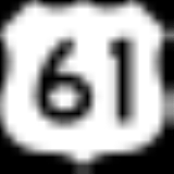
From the southeast, LA 30 begins at an intersection with US 61 and LA 431 halfway between Gonzales and Sorrento. LA 30 then runs due west, intersecting LA 44 and I-10Interstate 10 in Louisiana
Interstate 10, a major transcontinental Interstate Highway in the Southern U.S., runs across the southern part of the U.S. state of Louisiana. It passes through Lake Charles, Lafayette and Baton Rouge before dipping south of Lake Pontchartrain to serve the New Orleans area and then passing through...
in Gonzales. It passes the Tanger Factory Mall at its intersection with Interstate 10. LA 30 then turns northwestward and crosses LA 73
Louisiana Highway 73
Highway 73 is a highway stretching from Geismar, Louisiana, to Baton Rouge, Louisiana. Hwy. 73 was built as a bypass to the backbends of River Road. It was soon after bypassed itself in a more complete way with U.S...
. While passing various chemical enterprises, the highway enters Iberville Parish before crossing LA 74 at St. Gabriel. The highway then enters East Baton Rouge Parish
East Baton Rouge Parish, Louisiana
East Baton Rouge Parish is a parish located in the U.S. state of Louisiana. The parish seat is Baton Rouge, Louisiana's state capital. As of the 2010 census, the population was 440,171. The parish has a total area of , of which is land and is water. It is the most populous parish in the state...
and eventually the city of Baton Rouge proper, at which time it becomes Nicholson Drive. After passing LA 42 and LSU, it widens to four lanes and turns northward. In its final stretch, it moves into downtown Baton Rouge and crosses Interstate 10 one last time and ends at LA 73 (Government Street).