
Lotsee, Oklahoma
Encyclopedia
Lotsee is a town in Tulsa County
, Oklahoma
, United States
. The population was two at the 2010 Census, compared to 11 in the 2000 census. The entire town is a 2000 acres (8.1 km²) family-owned cattle and pecan ranch, the Flying G Ranch, whose owner, George Campbell, incorporated it in 1963. The population peaked at 16 in 1970, then declined to seven in 1980.
According to the United States Census Bureau
, the town has a total area of 0.0 square miles (0.1 km²), all of it land.
As of the census
of 2000, there were 11 people, 3 households, and 3 families residing in the town. The population density
was 576.1 people per square mile (212.4/km²). There were 3 housing units at an average density of 157.1 per square mile (57.9/km²). The racial makeup of the town was 27.27% White and 72.73% Native American.
There were 3 households out of which 33.3% had children under the age of 18 living with them, all were married couples
living together, and none were non-families. No households were made up of individuals and none had someone living alone who was 65 years of age or older. The average household size was 3.67 and the average family size was 3.67.
In the town the population was spread out with 27.3% under the age of 18, 36.4% from 25 to 44, and 36.4% from 45 to 64. The median age was 32 years. For every 100 females there were 83.3 males. For every 100 females age 18 and over, there were 100.0 males.
The median income for a household in the town was $152,338, and the median income for a family was $152,338. Males had a median income of $11,250 versus $51,875 for females. The per capita income
for the town was $41,917. None of the population and none of the families were below the poverty line.
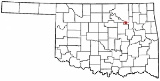
Tulsa County, Oklahoma
Tulsa County is a county located in the U.S. state of Oklahoma. According to the 2010 U.S. Census, the population is 603,403. Its county seat is Tulsa.-History of Tulsa County:The history of Tulsa County greatly overlaps the history of the city of Tulsa...
, Oklahoma
Oklahoma
Oklahoma is a state located in the South Central region of the United States of America. With an estimated 3,751,351 residents as of the 2010 census and a land area of 68,667 square miles , Oklahoma is the 28th most populous and 20th-largest state...
, United States
United States
The United States of America is a federal constitutional republic comprising fifty states and a federal district...
. The population was two at the 2010 Census, compared to 11 in the 2000 census. The entire town is a 2000 acres (8.1 km²) family-owned cattle and pecan ranch, the Flying G Ranch, whose owner, George Campbell, incorporated it in 1963. The population peaked at 16 in 1970, then declined to seven in 1980.
Geography
Lotsee is located at 36°8′0"N 96°12′34"W (36.133434, -96.209454).According to the United States Census Bureau
United States Census Bureau
The United States Census Bureau is the government agency that is responsible for the United States Census. It also gathers other national demographic and economic data...
, the town has a total area of 0.0 square miles (0.1 km²), all of it land.
Demographics
In 2010, the only residents were Lotsee Spradling, daughter of the founder, and her husband George. They have no plans to dissolve the town.As of the census
Census
A census is the procedure of systematically acquiring and recording information about the members of a given population. It is a regularly occurring and official count of a particular population. The term is used mostly in connection with national population and housing censuses; other common...
of 2000, there were 11 people, 3 households, and 3 families residing in the town. The population density
Population density
Population density is a measurement of population per unit area or unit volume. It is frequently applied to living organisms, and particularly to humans...
was 576.1 people per square mile (212.4/km²). There were 3 housing units at an average density of 157.1 per square mile (57.9/km²). The racial makeup of the town was 27.27% White and 72.73% Native American.
There were 3 households out of which 33.3% had children under the age of 18 living with them, all were married couples
Marriage
Marriage is a social union or legal contract between people that creates kinship. It is an institution in which interpersonal relationships, usually intimate and sexual, are acknowledged in a variety of ways, depending on the culture or subculture in which it is found...
living together, and none were non-families. No households were made up of individuals and none had someone living alone who was 65 years of age or older. The average household size was 3.67 and the average family size was 3.67.
In the town the population was spread out with 27.3% under the age of 18, 36.4% from 25 to 44, and 36.4% from 45 to 64. The median age was 32 years. For every 100 females there were 83.3 males. For every 100 females age 18 and over, there were 100.0 males.
The median income for a household in the town was $152,338, and the median income for a family was $152,338. Males had a median income of $11,250 versus $51,875 for females. The per capita income
Per capita income
Per capita income or income per person is a measure of mean income within an economic aggregate, such as a country or city. It is calculated by taking a measure of all sources of income in the aggregate and dividing it by the total population...
for the town was $41,917. None of the population and none of the families were below the poverty line.
External links
- http://factfinder.census.gov/servlet/SAFFFacts?_event=Search&geo_id=16000US4042860&_geoContext=01000US%7C04000US40%7C16000US4042860&_street=&_county=lotsee&_cityTown=lotsee&_state=04000US40&_zip=&_lang=en&_sse=on&ActiveGeoDiv=geoSelect&_useEV=&pctxt=fph&pgsl=160&_submenuId=factsheet_1&ds_name=DEC_2000_SAFF&_ci_nbr=null&qr_name=null®=null%3Anull&_keyword=&_industry=Fact Sheet, Lotsee town, Oklahoma]. (accessed February 9, 2007)
- Census Place Map 3, Tulsa County, Oklahoma. (accessed February 9, 2007)