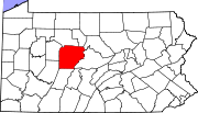
List of Pennsylvania state historical markers in Clearfield County
Encyclopedia

This is intended to be a complete list of the official state historical markers placed in Clearfield County, Pennsylvania
Clearfield County, Pennsylvania
Clearfield County is a county located in the U.S. state of Pennsylvania. As of 2010, the population was 81,642.Clearfield County was created on March 26, 1804, from parts of Huntingdon and Lycoming Counties but was administered as part of Centre County until 1812...
by the Pennsylvania Historical and Museum Commission
Pennsylvania Historical and Museum Commission
The Pennsylvania Historical and Museum Commission is the governmental agency of the Commonwealth of Pennsylvania responsible for the collection, conservation and interpretation of Pennsylvania's historic heritage...
(PHMC). The locations of the historical markers, as well as the latitude and longitude coordinates as provided by the PHMC's database, are included below when available. There are 12 historical markers located in Clearfield County.
Historical markers
| Marker title | Image | Date dedicated | Location | Marker type | Topics |
|---|---|---|---|---|---|
| Canoe Place |  |
U.S. 219, .5 miles N of Stifflertown (Missing) °N °W |
Roadside | Native American, Transportation | |
| A. W. Tozer (1897-1963) |  |
1598 Mahaffey Grampian Hwy. (Rt. 219), Mahaffey, near camp entrance °N °W |
Roadside | Religion, Writers | |
| Arnold N. Nawrocki (1925-2003) |  |
424 State St., (Rt. 879), Curwensville °N °W |
City | Business & Industry, Invention, Professions & Vocations | |
| Big Spring, The |  |
Pa. 410, .5 mile SW of Luthersburg 41.05056°N 78.72498°W |
Roadside | Military, Native American, Paths & Trails, Sports | |
| Chinklacamoose |  |
U.S. 322 E end & Pa. 879 W end of Clearfield (Missing) 40.01723°N 78.40645°W |
Roadside | Early Settlement, Government & Politics 18th Century, Native American | |
| Clearfield County Clearfield County, Pennsylvania Clearfield County is a county located in the U.S. state of Pennsylvania. As of 2010, the population was 81,642.Clearfield County was created on March 26, 1804, from parts of Huntingdon and Lycoming Counties but was administered as part of Centre County until 1812... |
County Historical Museum, E. Pine St. & Front St., Clearfield 41.02446°N 78.43965°W |
City | Government & Politics, Government & Politics 19th Century, Transportation | ||
| George Rosenkrans |  |
Pa. 255 at Methodist Church, Penfield 41.21048°N 78.57254°W |
City | Music & Theater, Performers, Religion, Writers | |
| Karthaus Furnace |  |
Pa. 879 in Karthaus 41.12009°N 78.11807°W |
Roadside | Business & Industry, Coal, Furnaces, Iron | |
| Old State Road (Milesburg to Waterford) |  |
U.S. 322, 6 miles NW of Luthersburg 41.09024°N 78.80356°W |
Roadside | Military, Paths & Trails, Roads, Transportation | |
| Philip P. Bliss Philip Bliss Philip Paul Bliss was an American composer, conductor, bass-baritone writer of hymns and a Gospel singer. He wrote many well-known hymns, including Almost Persuaded, Hallelujah, What a Saviour!, Let the Lower Lights Be Burning, Wonderful Words of Life, and the tune for Horatio Spafford's It Is... |
 |
Pa. 255, 2.2 miles NE of Penfield 41.24017°N 78.54666°W |
Roadside | Agriculture, Business & Industry, Music & Theater, Performers, Religion, Writers | |
| William Bigler (1814-1880) William Bigler William Bigler was the 12th Governor of Pennsylvania from 1852 to 1855, and later a U.S. Senator for the Democratic Party.... |
11 North Second St., Clearfield °N °W |
City | Civil War, Government & Politics, Government & Politics 19th Century, Governors | ||
| Zenas Leonard (1809-1857) Zenas Leonard Zenas Leonard was an American mountain man, explorer and trader, best known for his journal Narrative of the Adventures of Zenas Leonard... |
 |
Corner of Daisy St. Ext. (Rt. 322) and Leonard St., Clearfield 41.02065°N 78.41185°W |
Roadside | Exploration |
See also
- List of Pennsylvania state historical markers
- National Register of Historic Places listings in Clearfield County, PennsylvaniaNational Register of Historic Places listings in Clearfield County, PennsylvaniaThis is a list of the National Register of Historic Places listings in Clearfield County, Pennsylvania.This is intended to be a complete list of the properties and districts on the National Register of Historic Places in Clearfield County, Pennsylvania, United States...

