

List of National Natural Landmarks in Kentucky
Encyclopedia
From List of National Natural Landmarks, these are the National Natural Landmark
s in Kentucky
. There are 7 in total, 1 is shared with Indiana
.
National Natural Landmark
The National Natural Landmark program recognizes and encourages the conservation of outstanding examples of the natural history of the United States. It is the only natural areas program of national scope that identifies and recognizes the best examples of biological and geological features in...
s in Kentucky
Kentucky
The Commonwealth of Kentucky is a state located in the East Central United States of America. As classified by the United States Census Bureau, Kentucky is a Southern state, more specifically in the East South Central region. Kentucky is one of four U.S. states constituted as a commonwealth...
. There are 7 in total, 1 is shared with Indiana
Indiana
Indiana is a US state, admitted to the United States as the 19th on December 11, 1816. It is located in the Midwestern United States and Great Lakes Region. With 6,483,802 residents, the state is ranked 15th in population and 16th in population density. Indiana is ranked 38th in land area and is...
.
| Name | Image | Date | Location | County | Description | |
|---|---|---|---|---|---|---|
| 1 | Creelsboro Natural Bridge Creelsboro Natural Bridge Creelsboro Natural Bridge is a natural bridge in southwestern Russell County, Kentucky, USA . It is located near the community of Creelsboro, approximately seven miles downstream from Wolf Creek Dam, which impounds Lake Cumberland... |
Russell Russell County, Kentucky Russell County is a county located in the U.S. state of Kentucky. The population was 17,565 in the 2010 Census. Its county seat is Jamestown. The county is named for William Russell... |
An outstanding illustration of subterranean stream diversion. | |||
| 2 | Henderson Sloughs | Henderson Henderson County, Kentucky Henderson County is a county located in the U.S. state of Kentucky. It was formed in 1799. As the latest census data update of 2010, the population was counted 46,250. The county seat is the City of Henderson. The county was named for Colonel Richard Henderson who originally purchased of land... , Union Union County, Kentucky Union County is a county located in the U.S. state of Kentucky. It was formed in 1811. As of 2010, the population was 15,007. Its county seat is Morganfield.-Geography:Union County is part of the Western Coal Fields region of Kentucky... |
One of the largest wetlands remaining in Kentucky | |||
| 3 | Lilley Cornett Woods | Letcher Letcher County, Kentucky Letcher County is a county located in the U.S. state of Kentucky. As of 2000, the population was 25,277. Its county seat is Whitesburg. The county is named for Robert P... |
Virgin tract of mixed mesophytic forest. | |||
| 4 | Red River Gorge Red River Gorge The Red River Gorge is a canyon system on the Red River in east-central Kentucky. Geologically, it is part of the Pottsville Escarpment.Much of the Gorge is located inside the Daniel Boone National Forest and has been subsequently reserved as the Red River Gorge Geological Area, an area of around... |
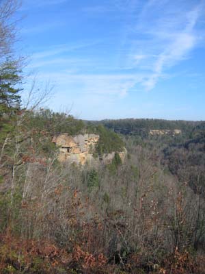 |
Menifee Menifee County, Kentucky Menifee County is a county located in the U.S. state of Kentucky. As of 2000, the population was 6,556. Its county seat is Frenchburg. The county is named for Richard Hickman Menefee, U.S. Congressman, although the spelling has changed. It is a prohibition or dry county.Menifee County is located... , Powell Powell County, Kentucky Powell County is a county located in the U.S. state of Kentucky. As of 2000, the population is 13,237. Its county seat is Stanton. The county was formed January 7, 1852, by Kentucky Governor Lazarus W. Powell... , Wolfe Wolfe County, Kentucky Wolfe County is a county located in the U.S. state of Kentucky. As of 2000, the population was 7,065. Its county seat is Campton. The county is named for Nathaniel Wolfe.- Geography :... |
Contains examples of many geological formations, including 41 natural bridges. | ||
| 5 | Rock Creek Research Natural Area Daniel Boone National Forest Daniel Boone National Forest is the only national forest completely within the boundary of Kentucky. Established in 1937, it was originally named the Cumberland National Forest, after the core region called the Cumberland Purchase Unit... |
Laurel Laurel County, Kentucky Laurel County is a county in the U.S. state of Kentucky. The population was 58,849 in the 2010 Census. Its county seat is London.The London Micropolitan Statistical Area includes all of Laurel County.... |
One of the few virgin hemlock hardwood forests remaining in Kentucky. | |||
| 6 | Big Bone Lick | Boone Boone County, Kentucky Boone County is a county located in the U.S. state of Kentucky. It was formed in 1798. The population was 118,811 in the 2010 Census. Its county seat is Burlington. The county is named for frontiersman Daniel Boone... |
Combination of salt springs and associated Late Pleistocene Pleistocene The Pleistocene is the epoch from 2,588,000 to 11,700 years BP that spans the world's recent period of repeated glaciations. The name pleistocene is derived from the Greek and .... bone beds. |
|||
| 7 | Ohio Coral Reef | Jefferson Jefferson County, Kentucky As of the census of 2000, there were 693,604 people, 287,012 households, and 183,113 families residing in the county. The population density was . There were 305,835 housing units at an average density of... |
A classic example of a Silurian and Devonian coral community. Extends into Indiana. | |||