

Linda Valley
Encyclopedia
West Coast Range (Tasmania)
The West Coast Range of Tasmania is a group of mountains in the West Coast area of Tasmania in Australia that lies to the west of the Franklin-Gordon Wild Rivers National Park...
of Tasmania
Tasmania
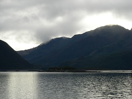
Tasmania is an Australian island and state. It is south of the continent, separated by Bass Strait. The state includes the island of Tasmania—the 26th largest island in the world—and the surrounding islands. The state has a population of 507,626 , of whom almost half reside in the greater Hobart...
. It was earlier known as the Vale of Chamouni. It is between Mount Owen and Mount Lyell.
Linda Valley is the location of two historical settlements, Linda
Linda, Tasmania
Linda was a mining town in the Linda Valley in the West Coast Range of Tasmania, Australia. It was the town supporting the North Mount Lyell mine...
and Gormanston
Gormanston, Tasmania
Gormanston is a town in Tasmania on the slopes of Mount Owen, above the town of Queenstown in Tasmania's West Coast. At the 2006 census, Gormanston had a population of 167....
. These settlements were close to the Mount Lyell mines and workings, at the western edge of Lake Burbury
Lake Burbury
Lake Burbury is a man-made lake created by the Crotty Dam made by Hydro Tasmania inundating the upper King River valley that lies east of the West Coast Range. It has a surface area of 54 square kilometres....
, and east of the old Mount Lyell Mining and Railway Company
Mount Lyell Mining and Railway Company
Mount Lyell Mining and Railway Company was a Tasmanian mining company formed on the 29 March 1893, most commonly referred to as Mount Lyell. Mount Lyell was the dominant copper mining company of the West Coast from 1893 to 1994, and was based in Queenstown, Tasmania.Following consolidation of...
operations.
The terminus of the North Mount Lyell Railway
North Mount Lyell Railway
The North Mount Lyell Railway was built to service the North Mount Lyell mine in West Coast Tasmania at the start of the Twentieth century to take ore from Gormanston east of the West Coast Range to the Crotty smelters, and then on to Pillinger in the Kelly Basin of Macquarie Harbour, from where...
was at Gormanston and the Comstock Tram was proposed to circumnavigate Mount Lyell but was never completed.
The valley suffered from extensive bushfires in the early twentieth century, and as a consequence the forested valley became denuded. Large numbers of tree stumps line the Mount Lyell slopes in the valley a hundred years after the fires.
The valley is the site of extensive evidence of glaciation in the West Coast Range with a particular stage known as the Linda Glacial stage
The valley's glacial morraine is the only Late Pliocene site with plant fossil assemblages in Tasmania and one of only a few in Australia.
The valley has been part of recent mineral exploration lease areas - however prospective mineral deposits have not been located to date, possibly due to the glacial morraine.