
Lechtal Alps
Encyclopedia
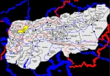
The Lechtal Alps are a mountain-range in western Austria
, and part of the greater Northern Limestone Alps
range. Named for the Lech River
which drains them north-ward into Germany, the Lechtal Alps occupy the Austrian states of Tyrol
and Vorarlberg
and are known for their diverse rock structure.
The highest peaks are, in descending order:
Austria
Austria , officially the Republic of Austria , is a landlocked country of roughly 8.4 million people in Central Europe. It is bordered by the Czech Republic and Germany to the north, Slovakia and Hungary to the east, Slovenia and Italy to the south, and Switzerland and Liechtenstein to the...
, and part of the greater Northern Limestone Alps
Northern Limestone Alps
The Northern Limestone Alps are the ranges of the Eastern Alps north of the Central Eastern Alps located in Austria and the adjacent Bavarian lands of southeastern Germany. The distinction from the latter group, where the higher peaks are located, is based on differences in geological composition...
range. Named for the Lech River
Lech River
The Lech is a river in Austria and Germany. It is a right tributary of the Danube in length with a drainage basin of .Its source is located in the Austrian state of Vorarlberg, where the river rises from lake Formarinsee in the Alps at an altitude of...
which drains them north-ward into Germany, the Lechtal Alps occupy the Austrian states of Tyrol
Tyrol (state)
Tyrol is a state or Bundesland, located in the west of Austria. It comprises the Austrian part of the historical region of Tyrol.The state is split into two parts–called North Tyrol and East Tyrol–by a -wide strip of land where the state of Salzburg borders directly on the Italian province of...
and Vorarlberg
Vorarlberg
Vorarlberg is the westernmost federal-state of Austria. Although it is the second smallest in terms of area and population , it borders three countries: Germany , Switzerland and Liechtenstein...
and are known for their diverse rock structure.
The highest peaks are, in descending order:
- ParseierspitzeParseierspitzeParseierspitze is, at 3,036 metres tall, the highest mountain of the Northern Limestone Alps and the only one that exceeds the 3,000 m mark. The peak consists of Radiolarite rocks preventing it from erosion....
, 3040 metres (9,973.8 ft) - DawinkopfDawinkopfDawinkopf is a mountain in Tyrol, Austria. At an elevation of , it is the second-highest mountain of the Lechtal Alps and the third highest in the Northern Limestone Alps....
, 2970 metres (9,744.1 ft) - Südlicher Schwarzer Kopf, 2949 metres (9,675.2 ft)
- Gatschkopf, 2947 metres (9,668.6 ft)
- Bocksgartenspitze, 2939 metres (9,642.4 ft)
- Holzgauer WetterspitzeHolzgauer WetterspitzeHolzgauer Wetterspitze is a mountain in the Lechtal Alps of Tyrol, Austria. The elevation at its peak is . It is located in the district of Reutte, south of Holzgau, for which its name is derived, and east of Kaisers. It is also about north of Feuerspitze.The mountain consists primarily of...
, 2898 metres (9,507.9 ft) - Oberer Bocksgartenkopf, 2888 metres (9,475.1 ft)
- Vorderseespitze, 2888 metres (9,475.1 ft)
- Freispitze, 2887 metres (9,471.8 ft)
- Eisenspitze, 2859 metres (9,379.9 ft)