
.gif)
K-17 (Kansas highway)
Encyclopedia
K-17 is a Kansas
state highway
originating at US-54 and US-400 between Kingman
and Cheney
near the unincorporated community of Waterloo. It ends at K-96
near South Hutchinson, Kansas
.
K-17 is 21 miles (33.8 km) long. It passes to the east of Pretty Prairie
, which is accessible by a county road (West Pretty Prairie Road).
After its southern terminus at US-54/US-400, the road continues as Kingman County route 430 (SE 100 Ave), going through Murdock
before ending at K-42
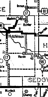
K-17 originally went through Hutchinson and ended at US-81 south of McPherson
. Sometime between 1956 and 1962, the segment of K-17 between South Hutchinson and McPherson was switched with K-61
Kansas
Kansas is a US state located in the Midwestern United States. It is named after the Kansas River which flows through it, which in turn was named after the Kansa Native American tribe, which inhabited the area. The tribe's name is often said to mean "people of the wind" or "people of the south...
state highway
State highway
State highway, state road or state route can refer to one of three related concepts, two of them related to a state or provincial government in a country that is divided into states or provinces :#A...
originating at US-54 and US-400 between Kingman
Kingman, Kansas
Kingman is a city in and the county seat of Kingman County, Kansas, United States. As of the 2010 census, the city population was 3,177.-Geography:Kingman is located at...
and Cheney
Cheney, Kansas
Cheney is a city in Sedgwick County, Kansas, United States. As of the 2010 census, the city population was 2,094.-Geography:According to the United States Census Bureau, Cheney has a total area of , all of it land.-Area attractions:...
near the unincorporated community of Waterloo. It ends at K-96
K-96 (Kansas highway)
K-96 is a state highway in central and southern Kansas. Its western terminus is at the Colorado state line east of Towner, Colorado, where it continues as Colorado State Highway 96; its eastern terminus since 1999 is at U.S. Route 54/U.S. Route 400 east of Wichita.The eastern terminus was once at...
near South Hutchinson, Kansas
South Hutchinson, Kansas
South Hutchinson is a city in Reno County, Kansas, United States, and a suburb of Hutchinson. As of the 2010 census, the city population was 2,457.-History:Founded in 1887 by Benjamin Blanchard of Terre Haute, Indiana.-Geography:...
.
K-17 is 21 miles (33.8 km) long. It passes to the east of Pretty Prairie
Pretty Prairie, Kansas
Pretty Prairie is a city in Reno County, Kansas, United States. As of the 2010 census, the city population was 680.-Geography:Pretty Prairie is located at...
, which is accessible by a county road (West Pretty Prairie Road).
After its southern terminus at US-54/US-400, the road continues as Kingman County route 430 (SE 100 Ave), going through Murdock
Murdock, Kansas
Murdock is an unincorporated community in Kingman County, Kansas, United States. Murdock is east-southeast of Kingman. Murdock has a post office with ZIP code 67111....
before ending at K-42
K-42 (Kansas highway)
K-42 is a state highway in the U.S. state of Kansas. The highway serves as a connection to Wichita for communities between the US-160 and US-54 corridors.-Route description:...
History
K-17 was commissioned by 1932. It appears on the 1932 state highway map.K-17 originally went through Hutchinson and ended at US-81 south of McPherson
McPherson, Kansas
McPherson is a city in and the county seat of McPherson County, Kansas, United States, in the central part of the state. As of the 2010 census, the city population was 13,155. The city is named after Union General James Birdseye McPherson, a Civil War general...
. Sometime between 1956 and 1962, the segment of K-17 between South Hutchinson and McPherson was switched with K-61
K-61 (Kansas highway)
K-61 is a Kansas state highway originating at US-54 and US-400 on the east side of Pratt. Signed as a north–south highway, K-61 is a diagonal highway running southwest and northeast. K-61 is long.-Route description:...