
Indiana State Road 526
Encyclopedia
State Road 526 is a short north–south highway connecting the Purdue University Airport
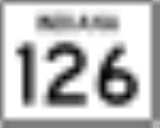
with State Road 126
in West Lafayette
.
campus. It is a child of, and intersects with, State Road 26
. It begins at the airport and runs north to State Road 26, which is also State Street. Continuing north, it is concurrent with McCormick Road; it passes Third Street, then veers to the northwest and terminates at State Road 126, which is also Cherry Lane. McCormick Road continues along the same line.
Purdue University Airport
Purdue University Airport is a public-use airport in Tippecanoe County, Indiana, United States. Owned by Purdue University, the airport is southwest of the central business district of Lafayette, in West Lafayette...
with State Road 126
Indiana State Road 126
State Road 126 in the U.S. State of Indiana is a short east–west highway connecting State Road 526 with U.S. Route 231 in West Lafayette.-Route description:...
in West Lafayette
West Lafayette, Indiana
As of the census of 2010, there were 29,596 people, 12,591 households, and 3,588 families residing in the city. The population density was 5,381.1 people per square mile . The racial makeup of the city was 74.3% White, 17.3% Asian, 2.7% African American, 0.16% Native American, 0.03% Pacific...
.
Route description
State Road 526 runs along the approximate western boundary of the Purdue UniversityPurdue University
Purdue University, located in West Lafayette, Indiana, U.S., is the flagship university of the six-campus Purdue University system. Purdue was founded on May 6, 1869, as a land-grant university when the Indiana General Assembly, taking advantage of the Morrill Act, accepted a donation of land and...
campus. It is a child of, and intersects with, State Road 26
Indiana State Road 26
State Road 26 is an east–west road in central Indiana in the United States that crosses the entire state from east to west, covering a distance of about .-Route description:...
. It begins at the airport and runs north to State Road 26, which is also State Street. Continuing north, it is concurrent with McCormick Road; it passes Third Street, then veers to the northwest and terminates at State Road 126, which is also Cherry Lane. McCormick Road continues along the same line.