
Indiana State Road 167
Encyclopedia
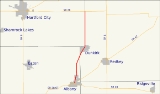
State Road 167 is a short north–south highway in the northeastern portion of the U.S. State
of Indiana
.
in Delaware County
at its parent route, State Road 67
. Going north and slightly east, it passes through Dunkirk
after about 5 miles (8 km), then goes straight north for another 5 miles (8 km) along the border between Blackford
and Jay
counties, until it intersects with State Road 26
east of Hartford City
.
U.S. state
A U.S. state is any one of the 50 federated states of the United States of America that share sovereignty with the federal government. Because of this shared sovereignty, an American is a citizen both of the federal entity and of his or her state of domicile. Four states use the official title of...
of Indiana
Indiana
Indiana is a US state, admitted to the United States as the 19th on December 11, 1816. It is located in the Midwestern United States and Great Lakes Region. With 6,483,802 residents, the state is ranked 15th in population and 16th in population density. Indiana is ranked 38th in land area and is...
.
Route description
State Road 167 begins in AlbanyAlbany, Indiana
Albany is a town in Delaware and Randolph counties in the U.S. state of Indiana, along the Mississinewa River. The population was 2,165 at the 2010 census...
in Delaware County
Delaware County, Indiana
As of the census of 2000, there were 118,769 people, 47,131 households, and 29,692 families residing in the county. The population density was 302 people per square mile . There were 51,032 housing units at an average density of 130 per square mile...
at its parent route, State Road 67
Indiana State Road 26
State Road 26 is an east–west road in central Indiana in the United States that crosses the entire state from east to west, covering a distance of about .-Route description:...
. Going north and slightly east, it passes through Dunkirk
Dunkirk, Indiana
-Demographics:As of the census of 2000, there were 2,646 people, 1,093 households, and 746 families residing in the city. The population density was 2,351.4 people per square mile . There were 1,214 housing units at an average density of 1,078.8 per square mile...
after about 5 miles (8 km), then goes straight north for another 5 miles (8 km) along the border between Blackford
Blackford County, Indiana
Blackford County is located in the east central portion of the U.S. state of Indiana. The county is named for Judge Isaac Blackford, who was the first speaker of the Indiana General Assembly and a long-time chief justice of the Indiana Supreme Court. Created in 1838, Blackford County is divided...
and Jay
Jay County, Indiana
As of the census of 2000, there were 21,806 people, 8,405 households, and 6,017 families residing in the county. The population density was 57 people per square mile . There were 9,074 housing units at an average density of 24 per square mile...
counties, until it intersects with State Road 26
Indiana State Road 26
State Road 26 is an east–west road in central Indiana in the United States that crosses the entire state from east to west, covering a distance of about .-Route description:...
east of Hartford City
Hartford City, Indiana
Hartford City is a city in the U.S. state of Indiana, and the county seat of Blackford County. Located in the northeast central portion of the state, the small farming community experienced a 15-year “boom” beginning in the late 1880s...
.