
Illinois Route 89
Encyclopedia
Illinois Route 89 is a rural, north–south state highway in central Illinois
. It runs from U.S. Route 34
in La Moille
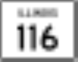
to Illinois Route 116
in Metamora
. Routes 26
and 89 are the main north–south roads between Interstate 39
/U.S. Route 51
and Illinois Route 29
. This is a distance of 55.48 miles (89.29 km)
, Cherry
, and Ladd
, where it crosses Interstate 80
. After passing Spring Valley
and crossing the Illinois River
, Illinois 89 crosses Illinois Route 71
near Granville
, then passes through McNabb
. After crossing Illinois Route 18
in Magnolia
and Illinois Route 17
at Varna
, it then passes through LaRose and Washburn
as only state highway in those two towns. It becomes North Niles Street in Metamora and ends at Mount Vernon Street, Illinois Route 116
.
to Metamora along Illinois Route 26
and Illinois 71. It was truncated north at Granville
in 1938 and rerouted to La Moille.
Illinois
Illinois is the fifth-most populous state of the United States of America, and is often noted for being a microcosm of the entire country. With Chicago in the northeast, small industrial cities and great agricultural productivity in central and northern Illinois, and natural resources like coal,...
. It runs from U.S. Route 34
U.S. Route 34
U.S. Route 34 is an east–west United States highway that runs for 1,122 miles from north-central Colorado to the western suburbs of Chicago. Through Rocky Mountain National Park it is known as the Trail Ridge Road where it reaches 12,183 ft , making it the highest paved through highway in...
in La Moille
La Moille, Illinois
La Moille is a village in Bureau County, Illinois, United States. The population was 773 at the 2000 census. It is part of the Ottawa–Streator Micropolitan Statistical Area.-Geography:La Moille is located at ....
to Illinois Route 116
Illinois Route 116
Illinois Route 116 is a cross-state rural state highway that runs from U.S. Route 34 by Gladstone east to the intersection of U.S. Route 45 and Old U.S. Route 45, on the north side of Ashkum...
in Metamora
Metamora, Illinois
Metamora is a village in Woodford County, Illinois, United States. The population was 2,700 at the 2000 census. Metamora is a growing suburb of Peoria and is part of the Peoria, Illinois Metropolitan Statistical Area.-Geography:...
. Routes 26
Illinois Route 26
Illinois Route 26 is a north–south state road in central and north-central Illinois. It runs from Illinois Route 116 just north of East Peoria to Highway 69 at the Wisconsin border near Orangeville. This is a distance of .- Route description :...
and 89 are the main north–south roads between Interstate 39
Interstate 39
Interstate 39 is a highway in the midwestern United States. I-39 runs from Normal, Illinois at Interstate 55 to Highway 29 in Rothschild, Wisconsin, approximately six miles south of Wausau. I-39 was designed to replace US Highway 51, which in the early 1980s was one of the busiest two-lane...
/U.S. Route 51
U.S. Route 51
U.S. Route 51 is a north–south United States highway that runs for 1,286 miles from the western suburbs of New Orleans, Louisiana to within of the Wisconsin-Michigan border. Much of the highway in Illinois and southern Wisconsin runs parallel to or overlaps Interstate 39...
and Illinois Route 29
Illinois Route 29
Illinois Route 29 is a two to four lane state road that runs south from U.S. Route 6/Illinois Route 89 at Spring Valley to U.S. Route 51/Illinois Route 16 at Pana, running through Pekin, Peoria and Springfield. The nearest major north–south highway, Interstate 39, runs parallel to Illinois...
. This is a distance of 55.48 miles (89.29 km)
Route description
Starting at La Moille, Route 89 travels south and passes through the small towns of ArlingtonArlington, Illinois
Arlington is a village in Bureau County, Illinois, United States. The population was 211 at the 2000 census. It is part of the Ottawa–Streator Micropolitan Statistical Area, located east of the Quad Cities, north of Peoria and Galesburg, west of LaSalle and Peru, and southwest of Rockford and...
, Cherry
Cherry, Illinois
Cherry is a village in Bureau County, Illinois, United States. The population was 509 at the 2000 census. It is part of the Ottawa–Streator Micropolitan Statistical Area...
, and Ladd
Ladd, Illinois
Ladd is a village in Bureau County, Illinois, United States. The population was 1,313 at the 2000 census. It is part of the Ottawa–Streator Micropolitan Statistical Area...
, where it crosses Interstate 80
Interstate 80
Interstate 80 is the second-longest Interstate Highway in the United States, following Interstate 90. It is a transcontinental artery running from downtown San Francisco, California to Teaneck, New Jersey in the New York City Metropolitan Area...
. After passing Spring Valley
Spring Valley, Illinois
Spring Valley is a city situated on the Illinois River in Bureau County, Illinois. The population was 5,398 at the 2000 census. It is part of the Ottawa–Streator Micropolitan Statistical Area.-Geography:...
and crossing the Illinois River
Illinois River
The Illinois River is a principal tributary of the Mississippi River, approximately long, in the State of Illinois. The river drains a large section of central Illinois, with a drainage basin of . This river was important among Native Americans and early French traders as the principal water route...
, Illinois 89 crosses Illinois Route 71
Illinois Route 71
Illinois Route 71 is a long southwest-to-northeast state highway in north central Illinois. It runs from the end of Interstate 180 in Hennepin to U.S. Route 34 in Oswego...
near Granville
Granville, Illinois
Granville is a village in Putnam County, Illinois, United States. The population was 1,414 at the 2000 census, making it the largest community in Putnam County...
, then passes through McNabb
McNabb, Illinois
McNabb is a village in Putnam County, Illinois, United States. The population was 310 at the 2000 census. It is part of the Ottawa–Streator Micropolitan Statistical Area.-Geography:McNabb is located at ....
. After crossing Illinois Route 18
Illinois Route 18
Illinois Route 18 is a rural east–west state road in central Illinois. It runs east from the town of Henry at Illinois Route 29 to the town of Blackstone at Illinois Route 17. This is a distance of .- Route description :...
in Magnolia
Magnolia, Illinois
Magnolia is a village in Putnam County, Illinois, United States. The population was 279 at the 2000 census. It is part of the Ottawa–Streator Micropolitan Statistical Area.-Geography:Magnolia is located at ....
and Illinois Route 17
Illinois Route 17
Illinois Route 17 is a rural, arterial east–west state road that runs east from a former ferry crossing in New Boston along the banks of the Mississippi River to State Road 2 west of Lowell, Indiana. It is long.- Route description :...
at Varna
Varna, Illinois
Varna is a village in Marshall County, Illinois, United States. The population was 436 at the 2000 census. It is part of the Peoria, Illinois Metropolitan Statistical Area...
, it then passes through LaRose and Washburn
Washburn, Illinois
Washburn is a village in Marshall and Woodford Counties in the U.S. state of Illinois. The population was 1,147 at the 2000 census. It is part of the Peoria, Illinois Metropolitan Statistical Area....
as only state highway in those two towns. It becomes North Niles Street in Metamora and ends at Mount Vernon Street, Illinois Route 116
Illinois Route 116
Illinois Route 116 is a cross-state rural state highway that runs from U.S. Route 34 by Gladstone east to the intersection of U.S. Route 45 and Old U.S. Route 45, on the north side of Ashkum...
.
History
SBI Route 89 originally ran from DixonDixon, Illinois
Dixon is a city in Lee County, Illinois, United States. The population was 15,733 as of the 2010 census, down from 15,941 at the 2000 census. Named for its founder, John Dixon , it is the county seat of Lee County. Located on the Rock River, Dixon was the boyhood home of former U.S...
to Metamora along Illinois Route 26
Illinois Route 26
Illinois Route 26 is a north–south state road in central and north-central Illinois. It runs from Illinois Route 116 just north of East Peoria to Highway 69 at the Wisconsin border near Orangeville. This is a distance of .- Route description :...
and Illinois 71. It was truncated north at Granville
Granville, Illinois
Granville is a village in Putnam County, Illinois, United States. The population was 1,414 at the 2000 census, making it the largest community in Putnam County...
in 1938 and rerouted to La Moille.