

Ibiaí
Encyclopedia
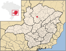
Minas Gerais
Minas Gerais is one of the 26 states of Brazil, of which it is the second most populous, the third richest, and the fourth largest in area. Minas Gerais is the Brazilian state with the largest number of Presidents of Brazil, the current one, Dilma Rousseff, being one of them. The capital is the...
. In 2007 the population was 7,571 in a total area of 870 km². It became a municipality in 1963.
Location and Distances
Ibiaí is located on the right bank of the São Francisco RiverSão Francisco River
The São Francisco is a river in Brazil. With a length of , it is the longest river that runs entirely in Brazilian territory, and the fourth longest in South America and overall in Brazil...
at an elevation of 470 meters, 72 km. north of Pirapora
Pirapora
Pirapora is a municipality in northcentral Minas Gerais in Brazil. Its population in 2007 was 51,636 in a total area of 577 km². The name Pirapora comes from the Tupi words for "fish" + "jump", referring to the piracema season when a mass migration of fishes ascends the São Francisco River...
. Neighboring municipalties are: Buritizeiro
Buritizeiro
Buritizeiro is a municipality in the north of the Brazilian state of Minas Gerais. Its population in 2007 was 26,133 inhabitants in a total area of 7,226 km². It is a major producer of cattle and grains.-Location:...
, Lagoa dos Patos
Lagoa dos Patos, Minas Gerais
Lagoa dos Patos is a Brazilian municipality located in the north of the state of Minas Gerais. In 2007 the population was 4,448 in a total area of 599 km². It became a municipality in 1962....
, Ponto Chique
Ponto Chique
Ponto Chique is a municipality in the north of the Brazilian state of Minas Gerais. As of 2007 the population was 4,046 in a total area of 602 km². It became a municipality in 1997.-Location:...
, and Campo Azul
Campo Azul
Campo Azul, which is Spanish for "Blue Camp," was, according to The Oregonian, the most heavily fined migrant camp in the state of Oregon. The camp, which was founded in the 1970s, was named for the color of the shacks on the farm...
.
Ibiaí is part of the statistical microregion of Pirapora.
Economic activities
The most important economic activities are cattle raising (37,000 head in 2006) and agriculture. The GDP in 2005 was R$ 24,287,000. The most important agricultural crops are rice, sugarcane, beans and corn. There were 190 automobiles. In the rural area there were 296 producers. The total area of agricultural land was 128,000 hectares in 2006, of which 36,000 ha. were planted in crops. As of 2006 there were 58 tractors. In the urban area there was one banking agency in 2006.Health and education
This municipality is isolated from major population centers and suffers from drought and poor soils.- Municipal Human Development IndexHuman Development IndexThe Human Development Index is a composite statistic used to rank countries by level of "human development" and separate "very high human development", "high human development", "medium human development", and "low human development" countries...
: .687 (2000) - State ranking: 603 out of 853 municipalities as of 2000
- National ranking: 3,209 out of 5,138 municipalities as of 2000
The highest ranking municipality in Minas Gerais in 2000 was Poços de Caldas
Poços de Caldas
Poços de Caldas is a city and municipality in south-western Minas Gerais state, Brazil, in the microregion of the same name. Its estimated population in 2009 was 151,449 inhabitants...
with 0.841, while the lowest was Setubinha
Setubinha
Setubinha is a municipality in the northeast of the Brazilian state of Minas Gerais. As of 2007 the population was 10,834 in a total area of 536 km². The elevation is 729 metres. It is part of the IBGE statistical microregion of Teófilo Otoni...
with 0.568. Nationally the highest was São Caetano do Sul
São Caetano do Sul
São Caetano do Sul is a city in São Paulo state in Brazil, located in the Greater São Paulo Metropolitan Area. It is the city with the highest per capita income in Brazil and it also has the highest Human Development Index .-Geography:São Caetano do Sul is located on a plateau that is part of the...
in São Paulo with 0.919, while the lowest was Setubinha.
- Degree of urbanization: 70.90% (2000)
- Infant mortality rate: 22.22 (2000) The rate for Minas Gerais was 17.40; the rate for Brazil was 18.91.
- Illiteracy rate: 24.56% (15 years old or older)(Data from 2000) The rate for Minas Gerais was 11.96; the rate for Brazil was 13.63
- Urban area covered by sewage system: 1.20%--the rate for Minas Gerais was 81.39%
- Health centers and hospitals: 03 health centers. There were no hospitals. The nearest hospital was in PiraporaPiraporaPirapora is a municipality in northcentral Minas Gerais in Brazil. Its population in 2007 was 51,636 in a total area of 577 km². The name Pirapora comes from the Tupi words for "fish" + "jump", referring to the piracema season when a mass migration of fishes ascends the São Francisco River...
.