
.gif)
Highway 36 (Wisconsin)
Encyclopedia
State Trunk Highway 36 is a state highway in the U.S. state
of Wisconsin
. It runs in a diagonal southwest-northeast direction across southeastern Wisconsin from Springfield
which is north of Lake Geneva
to Milwaukee
.
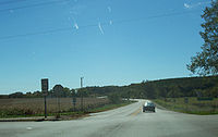 WIS 36 begins at its intersection with WIS 120, and travels in a general northeasterly direction to an intersection with WIS 11 in Burlington
. The road continues northeast, passing through Waterford
where it connects with WIS 164, then to Wind Lake
and Muskego
before heading to Franklin
, where it runs concurrent to US 45 for a short distance, and crosses WIS 100. The highway then follows Loomis Road through Greendale
and Greenfield
, where it intersects with I-43
and I-894
before terminating at WIS 241 in Milwaukee
.
. In 1921, the route was shortened to end at the junction with what was then WIS 57, which later became US 41, and is now WIS 241. In 1919, WIS 36 was extended to the west along WIS 50 to Williams Bay, then turned to the south into Walworth County to join WIS 89 (now US 14) to its end at the Illinois state line.
The route would change again in 1968, with WIS 36 terminating at Lake Geneva, and the portion from Williams Bay to Walworth being redesignated as WIS 67. Later, in 1987-88, WIS 120 was extended north from Lake Geneva via WIS 36 to Springfield, and then north along County Highway G toward East Troy
, placing the end of the highway at its present location.
U.S. state
A U.S. state is any one of the 50 federated states of the United States of America that share sovereignty with the federal government. Because of this shared sovereignty, an American is a citizen both of the federal entity and of his or her state of domicile. Four states use the official title of...
of Wisconsin
Wisconsin
Wisconsin is a U.S. state located in the north-central United States and is part of the Midwest. It is bordered by Minnesota to the west, Iowa to the southwest, Illinois to the south, Lake Michigan to the east, Michigan to the northeast, and Lake Superior to the north. Wisconsin's capital is...
. It runs in a diagonal southwest-northeast direction across southeastern Wisconsin from Springfield
Springfield, Wisconsin
Springfield is the name of some places in the U.S. state of Wisconsin:*Springfield, Dane County, Wisconsin, a town*Springfield, Jackson County, Wisconsin, a town*Springfield, Marquette County, Wisconsin, a town*Springfield, St...
which is north of Lake Geneva
Lake Geneva, Wisconsin
Lake Geneva is a city in Walworth County, Wisconsin, United States. The population was 7,148 at the 2000 census. A resort city located on Geneva Lake, it is southwest of Milwaukee and popular with tourists from metropolitan Chicago and Milwaukee.-History:...
to Milwaukee
Milwaukee, Wisconsin
Milwaukee is the largest city in the U.S. state of Wisconsin, the 28th most populous city in the United States and 39th most populous region in the United States. It is the county seat of Milwaukee County and is located on the southwestern shore of Lake Michigan. According to 2010 census data, the...
.
Route description
Burlington, Wisconsin
Burlington is a city in Racine and Walworth counties in the U.S. state of Wisconsin, with the majority of the city located in Racine County. The population was 10,421 at the 2009 census.-History:...
. The road continues northeast, passing through Waterford
Waterford, Wisconsin
Waterford is a village in Racine County, Wisconsin, United States. The population was 4,048 at the 2000 census. The village is located mostly within the Town of Waterford...
where it connects with WIS 164, then to Wind Lake
Wind Lake, Wisconsin
Wind Lake is a census-designated place in Racine County, Wisconsin, United States. The population was 5,342 at the 2010 census. Wind Lake is in the town of Norway.-Geography:Wind Lake is located at ....
and Muskego
Muskego, Wisconsin
Muskego is a city in Waukesha County, Wisconsin, United States. As of the 2000 census, the city had a population of 21,397. Its 2006-2008 estimated population was 22,851. Muskego is the fifth largest community in Waukesha County. The name Muskego is derived from the Potawatomi Indian name for the...
before heading to Franklin
Franklin, Milwaukee County, Wisconsin
Franklin is a city in Milwaukee County, Wisconsin, United States. Franklin is a suburb of Milwaukee with a population of 35,451 as of the 2010 census.-Transportation:...
, where it runs concurrent to US 45 for a short distance, and crosses WIS 100. The highway then follows Loomis Road through Greendale
Greendale, Wisconsin
Greendale is a village in Milwaukee County, Wisconsin, United States. The population was 14,405 at the 2000 census.-History:Greendale was settled in 1938 as a public cooperative community in the New Deal Era...
and Greenfield
Greenfield, Wisconsin
Greenfield is a city in Milwaukee County, Wisconsin, United States. The population was 35,476 at the 2000 census.-History:Greenfield was originally created as the Town of Kinnickinnic around 1839. On Feb. 19, 1841, the name of the town was changed to Greenfield, taking its name from the name of the...
, where it intersects with I-43
Interstate 43
Interstate 43 is a intrastate Interstate Highway located entirely within the U.S. state of Wisconsin, connecting Interstate 39 and Interstate 90 in Beloit with Milwaukee and U.S. Route 41 and U.S. Route 141 in Green Bay. I-43 is the 5th longest intrastate Interstate Highway of the Interstate...
and I-894
Interstate 894
Interstate 894 is a auxiliary Interstate Highway in Milwaukee County in the US state of Wisconsin. The route serves as a bypass of downtown Milwaukee, connecting with I-94 at the Zoo Interchange west of downtown and the Mitchell Interchange south of downtown...
before terminating at WIS 241 in Milwaukee
Milwaukee, Wisconsin
Milwaukee is the largest city in the U.S. state of Wisconsin, the 28th most populous city in the United States and 39th most populous region in the United States. It is the county seat of Milwaukee County and is located on the southwestern shore of Lake Michigan. According to 2010 census data, the...
.
History
WIS 36 is unusual in that its route has seen few changes since it was designated in 1918. The road originally began in Lake Geneva, approximately four miles south of its current terminus, and ended near downtown MilwaukeeMilwaukee, Wisconsin
Milwaukee is the largest city in the U.S. state of Wisconsin, the 28th most populous city in the United States and 39th most populous region in the United States. It is the county seat of Milwaukee County and is located on the southwestern shore of Lake Michigan. According to 2010 census data, the...
. In 1921, the route was shortened to end at the junction with what was then WIS 57, which later became US 41, and is now WIS 241. In 1919, WIS 36 was extended to the west along WIS 50 to Williams Bay, then turned to the south into Walworth County to join WIS 89 (now US 14) to its end at the Illinois state line.
The route would change again in 1968, with WIS 36 terminating at Lake Geneva, and the portion from Williams Bay to Walworth being redesignated as WIS 67. Later, in 1987-88, WIS 120 was extended north from Lake Geneva via WIS 36 to Springfield, and then north along County Highway G toward East Troy
East Troy, Wisconsin
East Troy is a village in Walworth County, Wisconsin, United States. The population was 3,564 at the 2000 census. The village is located southeast of the Town of East Troy. A small portion extends into the adjacent Town of Troy...
, placing the end of the highway at its present location.