
Hager Hill, Kentucky
Encyclopedia
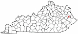
Hager Hill is an unincorporated community
in Johnson County
, Kentucky
, United States
. Hager Hill is located approximately four miles south of Paintsville
, the county seat
of Johnson County.
of 2000, there were 1,780 people, 692 households and 534 families residing in the ZIP Code Tabulation Area
(ZCTA) for Hager Hill's ZIP code
.
The racial makeup of the ZCTA was 99.0% White, 0.1% African American, 0.3% Native American, 0.1% Asian and 0.4% from two or more races. Hispanic or Latino of any race were 0.8% of the population.
In the ZCTA there were 692 households out of which 56.06% had children under the age of 18 living with them, 47.68% were married couples living together, 6.5% had a female householder with no husband present, and 25.14% were non-families. 23.12% of all households were made up of individuals and the average family size was 2.96.
The median income for a household in the ZCTA was $24,352 (as of 1999), and the median income for a family was $28,625. Males had a median income of $34,342 versus $20,446 for females. The per capita income for the ZCTA was $12,427. About 21.0% of families and 25.4% of the population were below the poverty line, including 32.0% of those under age 18 and 15.3% of those age 65 or over.
Most high school students living in Hager Hill attend Johnson Central High School
or Paintsville High School
, located in nearby Paintsville.
Unincorporated area
In law, an unincorporated area is a region of land that is not a part of any municipality.To "incorporate" in this context means to form a municipal corporation, a city, town, or village with its own government. An unincorporated community is usually not subject to or taxed by a municipal government...
in Johnson County
Johnson County, Kentucky
Johnson County is a county located in the U.S. state of Kentucky. It was formed in 1843. As of 2000, the population was 23,445. Its county seat is Paintsville...
, Kentucky
Kentucky
The Commonwealth of Kentucky is a state located in the East Central United States of America. As classified by the United States Census Bureau, Kentucky is a Southern state, more specifically in the East South Central region. Kentucky is one of four U.S. states constituted as a commonwealth...
, United States
United States
The United States of America is a federal constitutional republic comprising fifty states and a federal district...
. Hager Hill is located approximately four miles south of Paintsville
Paintsville, Kentucky
-Demographics:As of the census of 2000, there were 4,132 people, 1,681 households, and 1,079 families residing in the city. The population density was 786.1 people per square mile . There were 1,901 housing units at an average density of 361.7 per square mile...
, the county seat
County seat
A county seat is an administrative center, or seat of government, for a county or civil parish. The term is primarily used in the United States....
of Johnson County.
Demographics
As of the censusCensus
A census is the procedure of systematically acquiring and recording information about the members of a given population. It is a regularly occurring and official count of a particular population. The term is used mostly in connection with national population and housing censuses; other common...
of 2000, there were 1,780 people, 692 households and 534 families residing in the ZIP Code Tabulation Area
ZIP Code Tabulation Area
ZIP Code Tabulation Areas are statistical entities developed by the United States Census Bureau for tabulating summary statistics from Census 2000. This new entity was developed to overcome the difficulties in precisely defining the land area covered by each ZIP code...
(ZCTA) for Hager Hill's ZIP code
ZIP Code
ZIP codes are a system of postal codes used by the United States Postal Service since 1963. The term ZIP, an acronym for Zone Improvement Plan, is properly written in capital letters and was chosen to suggest that the mail travels more efficiently, and therefore more quickly, when senders use the...
.
The racial makeup of the ZCTA was 99.0% White, 0.1% African American, 0.3% Native American, 0.1% Asian and 0.4% from two or more races. Hispanic or Latino of any race were 0.8% of the population.
In the ZCTA there were 692 households out of which 56.06% had children under the age of 18 living with them, 47.68% were married couples living together, 6.5% had a female householder with no husband present, and 25.14% were non-families. 23.12% of all households were made up of individuals and the average family size was 2.96.
The median income for a household in the ZCTA was $24,352 (as of 1999), and the median income for a family was $28,625. Males had a median income of $34,342 versus $20,446 for females. The per capita income for the ZCTA was $12,427. About 21.0% of families and 25.4% of the population were below the poverty line, including 32.0% of those under age 18 and 15.3% of those age 65 or over.
Schools
The following schools are located within the community of Hager Hill:- Porter Elementary School
- Johnson County Alternative School (an alternative secondary school, part of the Johnson County Schools district)
- Big Sandy Community and Technical CollegeBig Sandy Community and Technical CollegeBig Sandy Community and Technical College , with its headquarters in Prestonsburg, Kentucky, is one of 16 two-year, open-admissions colleges of the Kentucky Community and Technical College System . It was created in 2003 from the consolidation of Prestonsburg Community College and Mayo Technical...
(Hager Hill Campus)
Most high school students living in Hager Hill attend Johnson Central High School
Johnson Central High School
Johnson Central High School is a public secondary school located at 257 North Mayo Trail on the northwest side of Paintsville, Kentucky, United States. The school serves as the Johnson County School District's consolidated high school....
or Paintsville High School
Paintsville High School
Paintsville High School is a secondary-level school located in Paintsville, Johnson County, Kentucky and is part of the Paintsville Independent School District. Its student enrollment as of 2006 was 344 in grades 7 through 12...
, located in nearby Paintsville.