

Guaxupé
Encyclopedia
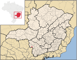
Minas Gerais
Minas Gerais is one of the 26 states of Brazil, of which it is the second most populous, the third richest, and the fourth largest in area. Minas Gerais is the Brazilian state with the largest number of Presidents of Brazil, the current one, Dilma Rousseff, being one of them. The capital is the...
. Its population as of 2007 was 47,894 people living in a total area of 286 km². The city belongs to the meso-region of Sul e Sudoeste de Minas and to the micro-region of São Sebastião do Paraíso
São Sebastião do Paraíso
São Sebastião do Paraíso is a Brazilian municipality located in the southwest of the state of Minas Gerais. Its population as of 2007 was 61,838 people living in a total area of 822 km². The city belongs to the meso-region of Sul e Sudoeste de Minas and to the micro-region of São Sebastião do...
. It became a municipality in 1837.
Location
The city center of Guaxupé is located at an elevation of 760 meters a short distance from the state boundary of São PauloSão Paulo
São Paulo is the largest city in Brazil, the largest city in the southern hemisphere and South America, and the world's seventh largest city by population. The metropolis is anchor to the São Paulo metropolitan area, ranked as the second-most populous metropolitan area in the Americas and among...
. Neighboring municipalities are: Pratinha
Pratinha
Pratinha is a Brazilian municipality located in the west of the state of Minas Gerais. Its population as of 2007 was 3,236 people living in a total area of 619 km². The city belongs to the meso-region of Triângulo Mineiro and Alto Paranaíba and to the micro-region of Araxá...
and São Pedro da União
São Pedro da União
São Pedro da União is a town and municipality in the state of Minas Gerais in the Southeast region of Brazil.-References:...
(N), Juruaia
Juruaia
Juruaia is a town and municipality in the state of Minas Gerais in the Southeast region of Brazil.-References:...
and Muzambinho
Muzambinho
Muzambinho is a town and municipality in the state of Minas Gerais in the Southeast region of Brazil.-References:...
(E), Tapiratiba
Tapiratiba
Tapiratiba is a municipality in the state of São Paulo in Brazil. The population in 2004 was 13,528 and the area is 221.24 km². The elevation is 760 m....
(S), and Guaranésia
Guaranésia
Guaranésia is a Brazilian municipality located in the southwest of the state of Minas Gerais. Its population as of 2007 was 18,649 people living in a total area of 294 km². The city belongs to the meso-region of Sul e Sudoeste de Minas and to the micro-region of São Sebastião do Paraíso. It...
(W).
Access and Distances
- BR 491(Rodovia do Café) - MG 450 - MG 169 - SP 350
- Main distances
Belo Horizonte
Belo Horizonte
Belo Horizonte is the capital of and largest city in the state of Minas Gerais, located in the southeastern region of Brazil. It is the third largest metropolitan area in the country...
: 478 km, São Paulo
São Paulo
São Paulo is the largest city in Brazil, the largest city in the southern hemisphere and South America, and the world's seventh largest city by population. The metropolis is anchor to the São Paulo metropolitan area, ranked as the second-most populous metropolitan area in the Americas and among...
: 282 km, Rio de Janeiro
Rio de Janeiro
Rio de Janeiro , commonly referred to simply as Rio, is the capital city of the State of Rio de Janeiro, the second largest city of Brazil, and the third largest metropolitan area and agglomeration in South America, boasting approximately 6.3 million people within the city proper, making it the 6th...
: 650 km, Brasília
Brasília
Brasília is the capital city of Brazil. The name is commonly spelled Brasilia in English. The city and its District are located in the Central-West region of the country, along a plateau known as Planalto Central. It has a population of about 2,557,000 as of the 2008 IBGE estimate, making it the...
: 1200 km, Campinas
Campinas
Campinas is a city and municipality located in the coastal interior of the state of São Paulo, Brazil. is the administrative center of the meso-region of the same name, with 3,783,597 inhabitants as of the 2010 Census, consisting of 49 cities....
: 200 km, Ribeirão Preto
Ribeirão Preto
Ribeirão Preto is a municipality and city in the Northeastern region of the state of São Paulo in Brazil. It is nicknamed Brazilian California, because of a combination of an economy based on agrobusiness plus high technology, wealth and sunny weather all year long. With 605,114 inhabitants,...
: 150 km,
Poços de Caldas
Poços de Caldas
Poços de Caldas is a city and municipality in south-western Minas Gerais state, Brazil, in the microregion of the same name. Its estimated population in 2009 was 151,449 inhabitants...
: 100 km, and Alfenas
Alfenas
Alfenas is a city and municipality in the southern part of the Brazilian state of Minas Gerais state. In 2007 its population was 71,628 and the area of the municipality is 849 km2. The elevation is 888m. It is served by highways MG 179, BR 491 and BR 369. The distance to the state capital...
: 100 km
Economic Activities
Agriculture, with coffee production and dairy products, is the main economic activity. Industry is also important with four major factories: Fiação e Tecelagem Guaxupé , belonging to the Kanebo group; PEMG and TECTER (electro-magnetic); Pasqua J.F. and Qualifio (copper wires). there are also about 150 small industrial units which produce dairy products, sweets, wood products, cement blocks, shoes, ammunition, surgical stitches, clothes, furniture, and coffee toasting.The GDP in 2005 was approximately R$732 million, with 80 million reais from taxes, 351 million reais from services, 265 million reais from industry, and 36 million reais from agriculture. The industrial sector employed 3,038 workers in 2005, while 3,667 were employed in commerce, and 774 were employed in public administration.
In the rural area there were 398 producers on 19,000 hectares of land. Approximately 2100 persons were occupied in agriculture. The main crops are coffee, 6,200 hectares; sugarcane, 1,275 hectares; and corn, 1,300 hectares. There were 8,000 head of cattle, of which 3,000 were milk cows (2006). Swine and poultry raising are also substantial.
There were 7 banks (2007). In the vehicle fleet there were 11,233 automobiles, 757 trucks, 1,082 pickup trucks, 137 buses, and 3,286 motorcycles (2007).
Health and Education
In the health sector there were 13 health clinics and 1 private hosptital with 100 beds (2005). Educational needs of 11,100 students were attended to by 38 primary schools, 5 middle schools, and 18 pre-primary schools.- Municipal Human Development IndexHuman Development IndexThe Human Development Index is a composite statistic used to rank countries by level of "human development" and separate "very high human development", "high human development", "medium human development", and "low human development" countries...
: 0.796 (2000) - State ranking: 53 out of 853 municipalities as of 2000
- National ranking: 639 out of 5,138 municipalities as of 2000
- Literacy rate: 90%
- Life expectancy: 73 (average of males and females)
In 2000 the per capita monthly income of R$301.00 was above the state average of R$276.00 and above the national average of R$297.00. Poços de Caldas
Poços de Caldas
Poços de Caldas is a city and municipality in south-western Minas Gerais state, Brazil, in the microregion of the same name. Its estimated population in 2009 was 151,449 inhabitants...
had the highest per capita monthly income in 2000 with R$435.00. The lowest was Setubinha
Setubinha
Setubinha is a municipality in the northeast of the Brazilian state of Minas Gerais. As of 2007 the population was 10,834 in a total area of 536 km². The elevation is 729 metres. It is part of the IBGE statistical microregion of Teófilo Otoni...
with R$73.00.
The highest ranking municipality in Minas Gerais in 2000 was Poços de Caldas
Poços de Caldas
Poços de Caldas is a city and municipality in south-western Minas Gerais state, Brazil, in the microregion of the same name. Its estimated population in 2009 was 151,449 inhabitants...
with 0.841, while the lowest was Setubinha
Setubinha
Setubinha is a municipality in the northeast of the Brazilian state of Minas Gerais. As of 2007 the population was 10,834 in a total area of 536 km². The elevation is 729 metres. It is part of the IBGE statistical microregion of Teófilo Otoni...
with 0.568. Nationally the highest was São Caetano do Sul
São Caetano do Sul
São Caetano do Sul is a city in São Paulo state in Brazil, located in the Greater São Paulo Metropolitan Area. It is the city with the highest per capita income in Brazil and it also has the highest Human Development Index .-Geography:São Caetano do Sul is located on a plateau that is part of the...
in São Paulo with 0.919, while the lowest was Setubinha. In more recent statistics (considering 5,507 municipalities) Manari in the state of Pernambuco
Pernambuco
Pernambuco is a state of Brazil, located in the Northeast region of the country. To the north are the states of Paraíba and Ceará, to the west is Piauí, to the south are Alagoas and Bahia, and to the east is the Atlantic Ocean. There are about of beaches, some of the most beautiful in the...
has the lowest rating in the country—0,467—putting it in last place.