

Great Lubyanka Street
Encyclopedia
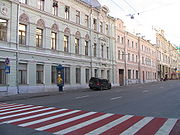
Street
A street is a paved public thoroughfare in a built environment. It is a public parcel of land adjoining buildings in an urban context, on which people may freely assemble, interact, and move about. A street can be as simple as a level patch of dirt, but is more often paved with a hard, durable...
in Moscow
Moscow
Moscow is the capital, the most populous city, and the most populous federal subject of Russia. The city is a major political, economic, cultural, scientific, religious, financial, educational, and transportation centre of Russia and the continent...
's Central Administrative Okrug. The street runs north-east from Lubyanka Square
Lubyanka Square
Lubyanka Square in Moscow is about north east of Red Square. The name is first mentioned in 1480, when Ivan III settled many Novgorodians in the area. They built the church of St Sophia, modelled after St Sophia Cathedral in Novgorod, and called the area Lubyanka after the Lubyanitsy district of...
to Sretenka Gates Square on the Boulevard Ring
Boulevard Ring
The Boulevard Ring is Moscow's second centremost ring road . Boulevards form a semicircular chain along the western, northern and eastern sides of the historical White City of Moscow; in the south the incomplete ring is terminated by the embankments of Moskva River...
. The path of Bolshaya Lubyanka is continued by Sretenka Street (to Garden Ring
Garden Ring
The Garden Ring, also known as the "B" Ring , is a circular avenue around the central Moscow, its course corresponding to what used to be the city ramparts surrounding Zemlyanoy Gorod in the 17th century....
), Prospekt Mira
Prospekt Mira
Prospekt Mira may refer to:*Mira Avenue, a street in Moscow*Prospekt Mira , a Moscow Metro station on the Koltsevaya Line*Prospekt Mira , a Moscow Metro station on the Kaluzhsko-Rizhskaya Line...
and Yaroslavskoye Shosse and is the starting stretch of the route of M8 highway
M8 highway (Russia)
The Russian route M8, also known as the Kholmogory Highway or Yaroslavl highway, is a major trunk road that links Moscow to the Russian North in general and the sea harbour of Arkhangelsk in particular...
("Kholmogory"), connecting Moscow to Sergiyev Posad
Sergiyev Posad
Sergiyev Posad is a city and the administrative center of Sergiyevo-Posadsky District of Moscow Oblast, Russia. It grew in the 15th century around one of the greatest of Russian monasteries, the Trinity Lavra established by St. Sergius of Radonezh. The town status was granted to it in 1742...
, Yaroslavl
Yaroslavl
Yaroslavl is a city and the administrative center of Yaroslavl Oblast, Russia, located northeast of Moscow. The historical part of the city, a World Heritage Site, is located at the confluence of the Volga and the Kotorosl Rivers. It is one of the Golden Ring cities, a group of historic cities...
, Vologda
Vologda
Vologda is a city and the administrative, cultural, and scientific center of Vologda Oblast, Russia, located on the Vologda River. The city is a major transport knot of the Northwest of Russia. Vologda is among the Russian cities possessing an especially valuable historical heritage...
, and Arkhangelsk
Arkhangelsk
Arkhangelsk , formerly known as Archangel in English, is a city and the administrative center of Arkhangelsk Oblast, Russia. It lies on both banks of the Northern Dvina River near its exit into the White Sea in the north of European Russia. The city spreads for over along the banks of the river...
.
The street serves as the boundary between Meshchansky District
Meshchansky District
Meschansky District is a district of Central Administrative Okrug of Moscow, Russia. Population: The district extends due north from Kitai-gorod to Kamer-Kollezhsky Val. Western boundary with Tverskoy District follows the track of Neglinnaya River...
(west from Bolshaya Lubyanka) and Krasnoselsky District
Krasnoselsky District, Moscow
Krasnoselsky District Most of the district's territory is occupied by railroads, rail yards, and the three rail terminals around Komsomolskaya Square. It also contains a narrow sector of central Moscow, extending north-east from Lubyanka Square within the boundaries of Myasnitskaya Square and...
(east).
Between 1926 and 1991 the street was known as Dzerzhinskogo Street, after Felix Dzerzhinsky.