
Gemer
Encyclopedia
- The article is about the historical region: for the village in SlovakiaSlovakiaThe Slovak Republic is a landlocked state in Central Europe. It has a population of over five million and an area of about . Slovakia is bordered by the Czech Republic and Austria to the west, Poland to the north, Ukraine to the east and Hungary to the south...
, see Gemer (village).

Latin
Latin is an Italic language originally spoken in Latium and Ancient Rome. It, along with most European languages, is a descendant of the ancient Proto-Indo-European language. Although it is considered a dead language, a number of scholars and members of the Christian clergy speak it fluently, and...
: Gömörinum) is the name of a historic administrative county (comitatus
Comitatus (Kingdom of Hungary)
A county is the name of a type of administrative units in the Kingdom of Hungary and in Hungary from the 10th century until the present day....
) of the Kingdom of Hungary
Kingdom of Hungary
The Kingdom of Hungary comprised present-day Hungary, Slovakia and Croatia , Transylvania , Carpatho Ruthenia , Vojvodina , Burgenland , and other smaller territories surrounding present-day Hungary's borders...
. In the 19th century, and in the beginning of the 20th century, it was united with the Kishont region to form Gömör-Kishont
Gömör-Kishont
Gömör-Kishont is the name of a historic administrative county of the Kingdom of Hungary. Its capital was Rimaszombat...
county (in Slovak: Gemer-Malohont). Its territory is presently in southern Slovakia
Slovakia
The Slovak Republic is a landlocked state in Central Europe. It has a population of over five million and an area of about . Slovakia is bordered by the Czech Republic and Austria to the west, Poland to the north, Ukraine to the east and Hungary to the south...
and northern Hungary
Hungary
Hungary , officially the Republic of Hungary , is a landlocked country in Central Europe. It is situated in the Carpathian Basin and is bordered by Slovakia to the north, Ukraine and Romania to the east, Serbia and Croatia to the south, Slovenia to the southwest and Austria to the west. The...
. Today Gömör is only an informal designation of the corresponding territory.
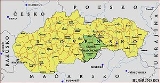
Geography
Gemer county was situated in Slovenské rudohorie approximately between the present-day Slovak-Hungarian border, the towns PoltárPoltár
Poltár is a town and municipality in the Poltár District in the Banská Bystrica Region of Slovakia.-Geography:The town is located in the Southern Slovak basin near the river Ipeľ, south of the Revúcka Hills, which is part of the Slovak Ore Mountains, around from Lučenec.It is home to a small...
and Rožňava
Rožnava
Rožňava is a town in Slovakia, approximately 71 km by road from Košice in the Košice Region, and has a population of 19,120.The town is an economic and tourist center of the Gemer. Rožňava is now a popular tourist attraction with a beautiful historic town centre. The town is an episcopal seat...
and the Low Tatra
Low Tatra
The Low Tatras or Low Tatra is a mountain range of the Inner Western Carpathians in central Slovakia.It is located south of the Tatras proper, from which it is separated by the valleys of the Váh and Poprad rivers . The valley formed by the Hron River is situated south of the Low Tatras range...
s (Nízke Tatry). The river Sajó
Sajó
The Sajó is a river in Slovakia and Hungary.Its length is 229 km, of which 110 km is in Slovakia. Its source is in the Stolica Mountains range of the Slovak Ore Mountains. It flows through the Slovak town Rožňava and the Hungarian city Miskolc. In Hungary it flows through the county of...
flowed through the county. Its area was 4,289 km² around 1910.
Capitals
The capital of Gömör/Gemer was the Gömör/Gemer Castle, and from the early 18th century Pelsőc/PlešivecPlešivec
Plešivec is a large village and municipality in the Rožňava District in the Košice Region of middle-eastern Slovakia.- Geography :The village lies at an altitude of 218 metres and covers an area of 62,142 km².It has a population of about 2440 people....
. The capital after the addition of Kishont/Malohont was Rimaszombat/Rimavská Sobota
Rimavská Sobota
Rimavská Sobota is a town in southern Slovakia, in the Banská Bystrica Region, on the Rimava river. It has 24,374 inhabitants . The town is a historical capital of the Gömör-Kishont county .-Geography:...
.
History
Gömör/Gemer is one of the oldest counties of the Kingdom of HungaryKingdom of Hungary
The Kingdom of Hungary comprised present-day Hungary, Slovakia and Croatia , Transylvania , Carpatho Ruthenia , Vojvodina , Burgenland , and other smaller territories surrounding present-day Hungary's borders...
, and was already mentioned in the 11th century. The territory approximately between the towns Tisovec
Tisovec
Tisovec is a town in central Slovakia. Its current population is approximately 4,000.- Location and landscape :Tisovec is situated in the valley of the river Rimava, at the foots of the Muránska planina plateau. The landscape there gives the impression of a small town in the mountains...
and Rimavská Sobota
Rimavská Sobota
Rimavská Sobota is a town in southern Slovakia, in the Banská Bystrica Region, on the Rimava river. It has 24,374 inhabitants . The town is a historical capital of the Gömör-Kishont county .-Geography:...
, called Kishont/Malohont, was added from 1786 until 1790, and again in 1802. The county was called Gömör-Kishont/Gemer-Malohont since. She was also ruled by Ottomans between 1553-1686 as part of Nograd
Nógrád
Nógrád is a village in Nógrád County, Hungary.- External links :*...
and Holok sanjaks in Buda and Uyvar eyalet
Uyvar Eyalet
Uyvar Eyalet was an eyalet of the Ottoman Empire.It was established during the reign of Mehmed IV. In 1663 the Ottoman expeditionary force led by Köprülü Fazıl Ahmed defeated the Austrian garrison of the city of Uyvar and conquered the region. The Peace of Vasvár recognised Ottoman control over...
s.
In 1918 (confirmed by the Treaty of Trianon
Treaty of Trianon
The Treaty of Trianon was the peace agreement signed in 1920, at the end of World War I, between the Allies of World War I and Hungary . The treaty greatly redefined and reduced Hungary's borders. From its borders before World War I, it lost 72% of its territory, which was reduced from to...
1920), most of the county became part of newly formed Czechoslovakia
Czechoslovakia
Czechoslovakia or Czecho-Slovakia was a sovereign state in Central Europe which existed from October 1918, when it declared its independence from the Austro-Hungarian Empire, until 1992...
, except 7,5% of its area (around Putnok
Putnok
Putnok is a town in Borsod-Abaúj-Zemplén county, Northern Hungary. It lies away from Miskolc, between the Bükk Mountains and the river Sajó.-History:...
), which became temporarily part of the Hungarian county Borsod-Gömör-Kishont (presently part of Borsod-Abaúj-Zemplén
Borsod-Abaúj-Zemplén
Borsod-Abaúj-Zemplén is the name of an administrative county in north-eastern Hungary , on the border with Slovakia. It shares borders with the Hungarian counties Nógrád, Heves, Hajdú-Bihar and Szabolcs-Szatmár-Bereg. The capital of Borsod-Abaúj-Zemplén county is Miskolc...
).
The Czechoslovakian part of the county was part of the Slovak Land (Slovenská krajina/zem). During World War II
World War II
World War II, or the Second World War , was a global conflict lasting from 1939 to 1945, involving most of the world's nations—including all of the great powers—eventually forming two opposing military alliances: the Allies and the Axis...
, when Czechoslovakia
Czechoslovakia
Czechoslovakia or Czecho-Slovakia was a sovereign state in Central Europe which existed from October 1918, when it declared its independence from the Austro-Hungarian Empire, until 1992...
was split temporarily, most of the county became part of Hungary under the First Vienna Award
First Vienna Award
The First Vienna Award was the result of the First Vienna Arbitration, which took place at Vienna's Belvedere Palace on November 2, 1938. The Arbitration and Award were direct consequences of the Munich Agreement...
, and the Gömör-Kishont County was recreated. This situation lasted until the end of the war, when 92.5% of the area became part of Czechoslovakia again. Today in Hungary the name of Gömör/Gemer preserved only in the name of a small village, Gömörszőlős
Gömörszolos
- External links :*...
and in that of Gömöri station
Gömöri Railway Station
Miskolc–Gömöri railway station, operated by Hungarian State Railways, is the smaller of two railway stations of the city of Miskolc, Hungary.The railway station was built in the late 19th century and got its name after the historical Gömör county. It was mainly important because it connected the...
, the smaller railway station of Miskolc
Miskolc
Miskolc is a city in northeastern Hungary, mainly with heavy industrial background. With a population close to 170,000 Miskolc is the fourth largest city of Hungary It is also the county capital of Borsod-Abaúj-Zemplén and the regional centre of Northern Hungary.- Geography :Miskolc is located...
.
Since 1993, when Czechoslovakia
Czechoslovakia
Czechoslovakia or Czecho-Slovakia was a sovereign state in Central Europe which existed from October 1918, when it declared its independence from the Austro-Hungarian Empire, until 1992...
was split, Gemer and Malohont are part of Slovakia
Slovakia
The Slovak Republic is a landlocked state in Central Europe. It has a population of over five million and an area of about . Slovakia is bordered by the Czech Republic and Austria to the west, Poland to the north, Ukraine to the east and Hungary to the south...
, Banská Bystrica Region
Banská Bystrica Region
The Banská Bystrica Region is one of the Slovak regions in the country of Slovakia in Europe.-Geography:It is located in the central part of Slovakia and has an area of 9,455 km². The region is prevailingly mountains, with several ranges within the area. The highest of them are the Low Tatras...
.