
Gawler Chain Trail
Encyclopedia
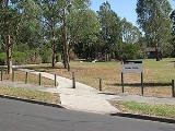
The Gawler Chain Trail is a shared use path for cyclists
and pedestrian
s in the inner eastern suburb
of Mont Albert
in Melbourne
, Victoria
, Australia
.
The trail has some short road sections and the western section is fairly rough.
. At the eastern end, proceed down Arnott Street and turn left into Box Hill Crescent. Head past the rear of Koonung Secondary College
to the end of the street. Cross Belmore Road and join the Bushy Creek Trail
at the children's playground.
West end at 37.803961°S 145.096889°E
East end at 37.802461°S 145.113628°E.
Cycling
Cycling, also called bicycling or biking, is the use of bicycles for transport, recreation, or for sport. Persons engaged in cycling are cyclists or bicyclists...
and pedestrian
Pedestrian
A pedestrian is a person traveling on foot, whether walking or running. In some communities, those traveling using roller skates or skateboards are also considered to be pedestrians. In modern times, the term mostly refers to someone walking on a road or footpath, but this was not the case...
s in the inner eastern suburb
Suburb
The word suburb mostly refers to a residential area, either existing as part of a city or as a separate residential community within commuting distance of a city . Some suburbs have a degree of administrative autonomy, and most have lower population density than inner city neighborhoods...
of Mont Albert
Mont Albert, Victoria
Mont Albert is a suburb in Melbourne, Victoria, Australia, 12 km east from Melbourne's central business district. Its Local Government Area are the Cities of Whitehorse and Boroondara. At the 2006 Census, Mont Albert had a population of 4419....
in Melbourne
Melbourne
Melbourne is the capital and most populous city in the state of Victoria, and the second most populous city in Australia. The Melbourne City Centre is the hub of the greater metropolitan area and the Census statistical division—of which "Melbourne" is the common name. As of June 2009, the greater...
, Victoria
Victoria (Australia)
Victoria is the second most populous state in Australia. Geographically the smallest mainland state, Victoria is bordered by New South Wales, South Australia, and Tasmania on Boundary Islet to the north, west and south respectively....
, Australia
Australia
Australia , officially the Commonwealth of Australia, is a country in the Southern Hemisphere comprising the mainland of the Australian continent, the island of Tasmania, and numerous smaller islands in the Indian and Pacific Oceans. It is the world's sixth-largest country by total area...
.
The trail has some short road sections and the western section is fairly rough.
Following the Path
The trail starts at the corner of Arnott and Costello Streets. This section consists of a concrete path following an easement. It crosses several quiet streets. The concrete section ends at Strabane Avenue. Head to the right up Strabane Avenue and turn left into Kerry Parade then right into Madang Avenue. At the end, head through the laneway between the houses to Union Road. Turn right and after 100m, turn left into the easement. This part is fairly rough, with only a walking track and some fairly steep, short sections. Continue to the end at the intersection of Greythorn and Belmore Roads.Connections
Connects via a road section to the Bushy Creek TrailBushy Creek Trail
The Bushy Creek Trail is a shared use path for cyclists and pedestrians in the inner eastern suburb of Box Hill North in Melbourne, Victoria, Australia.The trail has some short road sections including an unshared path along Springfield Road....
. At the eastern end, proceed down Arnott Street and turn left into Box Hill Crescent. Head past the rear of Koonung Secondary College
Koonung Secondary College
Koonung Secondary College is a secondary state school in Mont Albert North, Victoria, in the eastern suburbs of Melbourne, Australia. The school takes its name from the near-by Koonung Creek.-Facilities:...
to the end of the street. Cross Belmore Road and join the Bushy Creek Trail
Bushy Creek Trail
The Bushy Creek Trail is a shared use path for cyclists and pedestrians in the inner eastern suburb of Box Hill North in Melbourne, Victoria, Australia.The trail has some short road sections including an unshared path along Springfield Road....
at the children's playground.
West end at 37.803961°S 145.096889°E
East end at 37.802461°S 145.113628°E.