

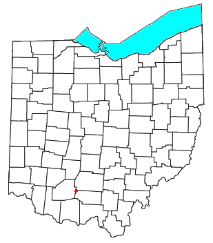
Cynthiana, Ohio
Encyclopedia
Census-designated place
A census-designated place is a concentration of population identified by the United States Census Bureau for statistical purposes. CDPs are delineated for each decennial census as the statistical counterparts of incorporated places such as cities, towns and villages...
in northwestern Perry Township
Perry Township, Pike County, Ohio
Perry Township is one of the fourteen townships of Pike County, Ohio, United States. The 2000 census found 913 people in the township.-Geography:Located in the northwestern corner of the county, it borders the following townships:...
, Pike County
Pike County, Ohio
As of the census of 2000, there were 27,695 people, 10,444 households, and 7,665 families residing in the county. The population density was 63 people per square mile . There were 11,602 housing units at an average density of 26 per square mile...
, Ohio
Ohio
Ohio is a Midwestern state in the United States. The 34th largest state by area in the U.S.,it is the 7th‑most populous with over 11.5 million residents, containing several major American cities and seven metropolitan areas with populations of 500,000 or more.The state's capital is Columbus...
, United States
United States
The United States of America is a federal constitutional republic comprising fifty states and a federal district...
. Although it is unincorporated, it has a post office
Post office
A post office is a facility forming part of a postal system for the posting, receipt, sorting, handling, transmission or delivery of mail.Post offices offer mail-related services such as post office boxes, postage and packaging supplies...
, with the ZIP code
ZIP Code
ZIP codes are a system of postal codes used by the United States Postal Service since 1963. The term ZIP, an acronym for Zone Improvement Plan, is properly written in capital letters and was chosen to suggest that the mail travels more efficiently, and therefore more quickly, when senders use the...
of 45624. It lies along State Route 41
Ohio State Route 41
State Route 41 is a north–south state highway in the southern and western portions of the U.S. state of Ohio. Its southern terminus is at the Ohio River on the Simon Kenton Memorial Bridge in Aberdeen ; and its northern terminus is along State Route 48 at U.S. Route 36 in Covington...
.