

Current Citizens Area Transit Routes
Encyclopedia
Las Vegas metropolitan area
The Las Vegas Valley is the heart of the Las Vegas-Paradise, NV MSA also known as the Las Vegas–Paradise–Henderson MSA which includes all of Clark County, Nevada, and is a metropolitan area in the southern part of the U.S. state of Nevada. The Valley is defined by the Las Vegas Valley landform, a ...
.
101 - Rainbow Blvd.
Route 101 runs from Oquendo Rd. & Rainbow Blvd. in southwest Las Vegas, to Lone Mountain Rd. & Rainbow Blvd. in Northwest Las Vegas. In northwest Las Vegas, the 101 interlines with route 219 during certain daytime hours.102 - Jones Blvd.
Route 102 runs from Hacienda Ave. & Jones Blvd. in Las Vegas, to Craig Rd. & Rancho Dr. in Northwest Las Vegas. In Las Vegas, the 102 services CSN West Charleston Campus.103 - Decatur Blvd.
Route 103 runs from Wagon Trail Rd. & South Decatur Blvd.Decatur Boulevard
Decatur Boulevard is a major north-south section line arterial in the Las Vegas metropolitan area located on the west side of the city.-Route:...
in Las Vegas, to Rome Blvd. & North Decatur Blvd.
Decatur Boulevard
Decatur Boulevard is a major north-south section line arterial in the Las Vegas metropolitan area located on the west side of the city.-Route:...
in far North Las Vegas. Between 1:00 am to 4:30 am, service is shortened at Craig Rd. to Simmons St. and uses double-deck buses.
104 - Valley View Blvd./Torrey Pines Dr.
Route 104 runs from the South Strip Transfer Terminal in south Las Vegas, to Smoke Ranch Rd. & Rainbow Blvd. in Northwest Las Vegas. In Las Vegas, the 104 services a portion of the Las Vegas Strip as well as Meadows Mall.105 - Martin Luther King Blvd.
Route 105 runs from the Bonneville Transit Center in Downtown Las Vegas, to Camino ElDorado St. & Tropical Pkwy.106 - Rancho Dr./Centennial Hills
Route 106 runs from the Bonneville Transit Center in Downtown Las Vegas, to the Centennial Hills Transit Center in Northwest Las Vegas. Between 4:00am to 12:00am, the 106 interlines with route 215 at the BTC. During the same time frame, the 106 is branched at Ann Rd. & Tenaya Wy. into an A & B routing, with 106A going in a counterclockwise loop in Centennial Hills while 106B goes in a clockwise loop. Overnight, 106 terminates at Lone Mountain Rd. and Rancho Dr.107 - Boulder Hwy.
Route 107 runs from the Bonneville Transit Center in Downtown Las Vegas, to College Dr. & Horizon Dr. in Henderson. The 107 provides service to CSN Henderson Campus, and is also serviced by double-deck buses.108 - Paradise Rd./Swenson St.
Route 108 runs from the corner of Bonanza Rd and Maryland Pkwy, to McCarran International Airport. The 108 services the Bonneville Transit Center in Downtown Las Vegas, Las Vegas Convention Center, Terrible's Casino, Hard Rock Hotel, and UNLV.109 - Maryland Pkwy.
Route 109 provides service to McCarran Airport & South Strip Transfer Terminal from Downtown Las Vegas. Route 109 also services Sunrise Hospital, Boulevard Mall, & UNLV.110 - Eastern Ave.
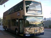
Route 110 runs from CSN Cheyenne Campus to Eastern Ave. & Horizon Ridge Pkwy., in Green Valley. the 110 services St. Rose Hospital and uses double-deck buses.111 - Pecos Rd./Green Valley Pkwy.
Route 111 runs from Lone Mountain Rd. & Mitchell St., to Green Valley Ranch Station Casino in Green Valley, via CSN Cheyenne Campus. The 111 is a branch route, running A & B service at Sunset Rd.113 - Las Vegas Blvd. North
Route 113 runs from the Bonneville Transit Center in Downtown Las Vegas, to Las Vegas Blvd. and Craig Rd. in North Las Vegas. The 113 services CSN Cheyenne Campus & Nellis Air Force Base. The MAX Line operates parallel to route 113.115 - Nellis Blvd./Stephanie St.
Route 115 runs from Las Vegas Blvd. & Craig Rd., to Nellis Blvd. & Hacienda Ave. in Las Vegas, or to Horizon Ridge Pkwy. & Stephanie St. in Henderson. The 115 alternates between servicing Stephanie St. & Hacienda Ave. mainly between 4:00am & 10:00pm. Around the same time frame, 115 is interlined with route 219 at Craig Rd. and uses double-deck buses.117 - Las Vegas Blvd. South/Silverado Ranch Blvd.
Route 117 runs from the South Strip Transfer Terminal, to Serene Ave. & Eastern Ave. via Silverado Ranch Blvd., Maryland Pkwy. & Spencer St. The 117 services the airport car rental facility & the Las Vegas Outlet Center. The route interlines with route 104 during most trips & 212 during the evening hours.119 - Simmons St.
Route 119 runs from Polaris Ave./Russell Rd. to Aliante Pkwy. & Elkhorn Rd. via Simmons St. & Rancho Dr. 119 runs on Interstate 15 between Sahara Ave. & Spring Mountain Rd. Select trips will alternate service between Martin Luther King Blvd. or Rancho Dr. in Las Vegas & Clayton St. in North Las Vegas. 119 services a portion of the Las Vegas Strip, Terrible's Casino, Tuscany Casino, Fashion Show Mall, Palace Station, University Medical Center, & Aliante Station Casino.201 - Tropicana Ave.
Route 201 is divided into a A Route and a B Route. The Route 201A assumes the previous Route 201 which runs from the corner of Hacienda Ave. & Fort Apache Rd. before traveling eastbound along Tropicana AvenueTropicana Avenue
Tropicana Avenue is a major east–west section line arterial in the Las Vegas area. The road is named after the Tropicana Resort & Casino which is located on the Las Vegas Boulevard where it intersects with Tropicana Avenue. Part of it is signed as Nevada State Route 593.-Route description:SR...
. Route 201B services a loop at Warm Springs Road, South Jones Blvd. and West Robindale Road before traveling northbound on South Rainbow Blvd.
On reaching Tropicana Ave. the route proceeds eastbound similar to the A Route.
201 services The Orleans Casino as well as the casinos on the Tropicana - Las Vegas Boulevard intersection
Tropicana - Las Vegas Boulevard intersection
The Tropicana - Las Vegas Boulevard intersection on the Las Vegas Strip , is noteworthy for several reasons...
. 201 also services Thomas & Mack Center
Thomas & Mack Center
The Thomas & Mack Center is an arena, located on the campus of the University of Nevada, Las Vegas, in Las Vegas, Nevada, USA. For ring events, the capacity is 19,522, for basketball, the capacity is 18,776.-History:...
at the University of Nevada, Las Vegas
University of Nevada, Las Vegas
University of Nevada-Las Vegas is a public, coeducational university located in the Las Vegas suburb of Paradise, Nevada, USA. The campus is located approximately east of the Las Vegas Strip. The institution includes a Shadow Lane Campus, located just east of the University Medical Center of...
. 201 completes a loop via Jimmy Durante Blvd. & Stephanie St. Once an hour the eastbound route services a loop on Buffalo Drive, Peace Way and Rainbow Blvd. The westbound bound route runs from Andover Dr. to Grand Canyon Dr. on the outer western fringes of Las Vegas completing a loop via Russell Rd. to the terminus at Hacienda Rd. and Fort Apache Rd. Overnight, 201A terminates at Fort Apache Rd. & Tee Pee Ln. Route 201B diverges at Torrey Pines Drive and proceeds westbound on Hacienda Ave. passing Spring Valley Hospital
Spring Valley Hospital
Spring Valley Hospital for-profit hospital is owned and operated by Universal Health Services. The 176 bed hospital is located in Clark County, Nevada, United States.-External links:*...
before traveling down South Rainbow Blvd to the terminus at Warm Springs Road.
202 - Flamingo Rd.
Route 202 runs from the corner of Fort Apache Rd. & Flamingo Rd. via Grand Canyon Dr. & Peace Wy. before traveling eastbound along Flamingo Road. This route passes Palms Casino, Gold Coast CasinoGold Coast Hotel and Casino
The Gold Coast Hotel & Casino is a hotel and casino located in Las Vegas, Nevada. This locals' casino is owned and operated by Boyd Gaming Corporation. The Gold Coast is located one mile west of the Las Vegas Strip on West Flamingo Road. It is located across the street from the Palms Casino...
and Rio Casino
Rio All Suite Hotel and Casino
The Rio All Suite Hotel and Casino is located off the Las Vegas Strip in the unincorporated area of Paradise, Nevada, USA. It is better known as The Rio and is owned and operated by Caesars Entertainment Inc. The Rio was the first all suite resort in the Las Vegas area...
. After crossing Interstate 15
Interstate 15 in Nevada
In the U.S. State of Nevada, Interstate 15 begins in Primm, continues through Las Vegas and it crosses the border with Arizona in Mesquite. The freeway runs entirely in Clark County. Many motorists use Interstate 15 to visit Las Vegas, as it is the only primary Interstate Highway in the city. The...
the route intersects Las Vegas Boulevard
Las Vegas Boulevard
State Route 604 is the route number designation for parts of Las Vegas Boulevard, a major north–south road in the Las Vegas metropolitan area of Nevada in the United States best known for the Las Vegas Strip and its casinos. Formerly carrying U.S...
. The route also passes Terrible's Hotel and Casino
Terrible's Hotel and Casino
Terrible’s Hotel and Casino is a locals casino east of the Las Vegas Strip, in Paradise, Nevada. It has 370 rooms and a casino.Terrible's is regularly the host hotel for the Terrible 250, Terrible 300, and Terrible's Cup Baja races sponsored by Terrible Herbst.-History:The Continental Hotel and...
and Desert Springs Hospital
Desert Springs Hospital
Desert Springs Hospital is for-profit hospital owned and operated by Universal Health Services. This 286 bed hospital is located in Paradise, Nevada.-Services:...
. The route terminates at the corner of Harmon Ave. and Boulder Highway. Westbound route 202 runs from Harmon Ave. and Jimmy Durante Dr. before traveling on Flamingo Road. Some westbound routes terminate on Rainbow Blvd. Of those that do, before proceeding on Flamingo Road the route loops via Twain Ave. and Tenaya Way.
203 - Spring Mountain Rd./Twain Ave.
Route 203 runs from the corner of Tropicana AvenueTropicana Avenue
Tropicana Avenue is a major east–west section line arterial in the Las Vegas area. The road is named after the Tropicana Resort & Casino which is located on the Las Vegas Boulevard where it intersects with Tropicana Avenue. Part of it is signed as Nevada State Route 593.-Route description:SR...
and Durango Drive looping via Bonita Vista St. and Peace Way before returning onto Durango Drive. At Spring Mountain Road
Spring Mountain Road
State Route 591 was a highway running east–west in the Las Vegas metropolitan area along Spring Mountain Road. Spring Mountain Road is the main road for the Chinatown area of Vegas which parallels Spring Mountain from just east of Valley View Boulevard to just west of Rainbow Boulevard...
the route turns eastbound, servicing Chinatown
Chinatown, Las Vegas
The Chinatown of Las Vegas, Nevada The Chinatown of Las Vegas, Nevada The Chinatown of Las Vegas, Nevada (Chinese: 拉斯維加斯中國城 (pinyin: Lāsīwéijiāsī Zhōngguóchéng) is a series of large strip malls with ethnic Chinese and other pan-Asian businesses on Spring Mountain Road, with the original called...
and the Fashion Show Mall
Fashion Show Mall
Fashion Show Mall is a shopping mall located on the Las Vegas Strip in Paradise, Nevada. Fashion Show Mall is owned by the General Growth Properties Inc. With of space, this is one of the largest enclosed malls in the world...
and then onto Sands Drive and Twain Ave. After passing The Boulevard Mall
The Boulevard Mall
The Boulevard Mall is located at 3528 S. Maryland Pkwy in Paradise, Nevada, United States . The Boulevard Mall is owned by the General Growth Properties The mall is a single story, enclosed, super regional mall with of lease-able retail space...
the route services Spencer St., Harmon Ave., McLeod Drive terminating at the corner of Pecos Road and Flamingo Road.
204 - Sahara Ave.
Route 204 runs from the corner of Sahara Avenue and Fort Apache Road looping via Grand Canyon Drive and Red Hills Rd. before heading eastbound. The route services Palace StationPalace Station
Palace Station is a hotel and casino in Las Vegas, Nevada. It is a locals casino that is owned and operated by Station Casinos and has 1,028 rooms...
Casino. The 204 is a branch route with an A and B designation at Lamb Blvd. The 204A route loops Treeline Drive, Vegas Valley Drive, and Hollywood Blvd. The 204B route loops Lamb Blvd, Vegas Valley Drive, Cabana Drive, Desert Inn Rd, and Nellis Blvd. During the overnight hours, route 204 services the Red Rock Casino on the west end loop.
206 - Charleston Blvd.
Route 206 runs from Pavilion Center Drive, opposite Red Rock Station CasinoRed Rock Resort Spa and Casino
Red Rock Resort Spa and Casino is a resort spa and casino owned by Station Casinos on located in the Summerlin village of Summerlin Centre in Summerlin, Nevada. Red Rock is located far off of the Las Vegas Strip; it is known as a locals casino. Located on Charleston Boulevard at the interchange of...
and then onto Charleston Boulevard. The route runs through the planned community of Summerlin, intersecting Interstate 15 and then passing south of Downtown Las Vegas
Downtown Las Vegas
Downtown Las Vegas is the central business district of Las Vegas, Nevada. It is the original gambling district of Las Vegas, prior to the Strip, and the area still incorporates downtown gaming.-Tourism:...
. The route terminates at the corner of Sloan Lane and Charleston Blvd. The westbound route loops servicing Las Vegas High School
Las Vegas High School
Las Vegas High School is a public high school in unincorporated Sunrise Manor, Nevada, United States, and a part of the Clark County School District. It is the oldest high school in Las Vegas, originally opening in 1931 on what was originally the outskirts of town...
before proceeding on Charleston Blvd. via Treeline Drive, Sahara Ave, and Sloan Lane.
207 - Alta Dr./Stewart Ave.
Route 207 runs from the Westcliff Transit Center, servicing Meadows MallMeadows Mall
Meadows Mall is a shopping mall in Las Vegas, Nevada, United States. Meadows Mall is owned by the General Growth Properties Inc. It is a two story enclosed mall with 960,000 ft² of space. The mall has 140 stores and 4 anchors. It is surrounded by 4,900 surface parking spaces in four different color...
via Meadows Lane, the Valley Hospital Medical Center
Valley Hospital Medical Center
From 1980-2001, the helipad was located on top of the hospital, adjacent to the lobby. After "Flight for Life" was sold to "Mercy Air Services" in 2001, the hospital created a landing zone just south of the emergency entrance in a dirt lot for Mercy Air's bigger helicopters...
via Tonopah Drive, Goldring Ave. and Shadow Lane, the World Market Center before proceeding on Bonneville Street to the Bonneville Transit Center. From the BTC the route continues on Main St. to Stewart Ave., Battle Mountain St. & Bonanza Rd. which will interline with route 215 during all trips on weekdays and select trips on weekends & holidays. On weekends & holidays, 207 will loop on Linn Lane, Mabel Rd. and Christy Lane terminating at the corner of Stewart Ave. and Nellis Blvd.
208 - Washington Ave.
Route 208 runs from the Westcliff Transit Center, then proceeding on Washington Avenue. The route services the Bonneville Transit Center, Bruce St., Owens Ave. and Eastern Avenue before returning onto Washington Ave. Before terminating at corner of Nellis Blvd. and Bonanza Road the route services two different loops depending on the time of day. The first loop is in the morning (until 8:30pm) and it services Hollywood Blvd. The second loop is in the evening and services Nellis Blvd. and Lillian St. On weekends & holidays, 208 will service Meadows MallMeadows Mall
Meadows Mall is a shopping mall in Las Vegas, Nevada, United States. Meadows Mall is owned by the General Growth Properties Inc. It is a two story enclosed mall with 960,000 ft² of space. The mall has 140 stores and 4 anchors. It is surrounded by 4,900 surface parking spaces in four different color...
& Meadows Lane via Decatur Blvd. & Valley View Blvd.
209 - Vegas Dr./Owens Ave.
Route 209 runs from the Westcliff Transit Center, and services Advanced Technologies AcademyAdvanced Technologies Academy
Advanced Technologies Academy is a magnet public high school in Las Vegas, Nevada with a focus on integrating technology with academics for students in grades 9-12. The magnet school program was founded in 1994 and is part of the Clark County School District. The first year included only 9th and...
and Rancho High School
Rancho High School
Rancho High School is a high school located at 1900 Searles Avenue in North Las Vegas, Nevada. It is part of the Clark County School District. Opened in 1954, Rancho High School was the third high school founded in the Las Vegas Valley after Las Vegas and Basic....
on Owens Avenue. Prior to the eastern terminus the route loops via Mt. Hood St. and terminating at the corner of Hollywood Blvd. and Lake Mead Blvd.
210 - Lake Mead Blvd.
Route 210 runs from the corner of Covington Cross Drive and Town Center Drive before traversing Village Center Circle, Hills Center Dr. and Hillpointe Road in Summerlin before serviceing Lake Mead Boulevard. The route services Texas StationTexas Station
Texas Station Hotel and Casino is a locals casino and hotel located on Rancho Drive in North Las Vegas, Nevada. The casino is owned by Station Casinos....
Casino and North Vista Hospital
North Vista Hospital
North Vista Hospital for-profit hospital is owned and operated by IASIS Healthcare and is the only hospital in North Las Vegas, Nevada. The hospital provides 185 beds.-History:The hospital opened in 1959 as North Las Vegas Hospital with 33 beds...
in North Las Vegas. The route terminates at the corner of Shantz St. and Lake Mead Blvd. The westbound route loops via Hollywood Blvd., Carey Road and Los Felix St. before returning onto Lake Mead Blvd. The route services Del Webb Blvd., Hills Center Dr. and Summerlin Hospital
Summerlin Hospital
Summerlin Hospital is a for-profit hospital owned and operated by a subsidiary of Universal Health Services. It is the only hospital in Summerlin, Clark County, Nevada...
prior to the terminus.
211 - Smoke Ranch Rd./Carey Ave.
Route 211 runs from the corner of Tenaya Way and Cheyenne Ave. adjacent to Mountain View HospitalMountain View Hospital, Las Vegas
Mountain View Hospital for-profit hospital is operated by Sunrise Healthcare System which is owned by Hospital Corporation of America. This 199 bed hospital is located in Las Vegas, Nevada.- Nurses unionize :...
looping via Buffalo Drive before proceeding eastbound on Smoke Ranch Road. The route passes south of North Las Vegas Airport
North Las Vegas Airport
- Runway Incursions:The airport has continuously worked on a runway incursion prevention program to help curtail the number of runway incursions happening at the airport. For the year of 2007, North Las Vegas ranked #2 in airports with most runway incursions....
, and the Simmons Bus Division. At the eastern terminus routes that do not interline with route 218 loop via Lamb Blvd. and terminate at the corner of Cheyenne Ave. and Nellis Blvd. On weekends and holidays the eastbound route changes to route 218. Several morning eastbound routes also change to route 218.
212 - Sunset Rd.
Route 212 runs from the South Strip Transfer Terminal after changing from either southbound route 104 or northbound route 117. The route services Sunset Road including Galleria at SunsetGalleria at Sunset
Galleria at Sunset in Henderson, Nevada, is the only enclosed shopping mall in Henderson and one of the largest malls in the state of Nevada. It is located at 1300 West Sunset Road.-Overview:...
and Sunset Station
Sunset Station
Sunset Station is a hotel and locals casino owned by Station Casinos on ninety-eight acres in Henderson, Nevada. Sunset Station is an off-strip locals casino located on Sunset Road near Interstate 515, across from the Galleria at Sunset shopping center....
in Henderson
Henderson, Nevada
-Demographics:According to the 2000 census, there were 175,381 people, 66,331 households, and 47,095 families residing in the city. The population density was 2,200.8 people per square mile . There were 71,149 housing units at an average density of 892.8 per square mile...
. The route loops via Pabco Road before terminating on the corner of Boulder Highway and Warm Springs Road. The westbound route loops via Paradise Road, Pilot Road, Bermuda Road and Hidden Well Road before entering the South Strip Transfer Terminal. Most often the westbound route continues as either northbound route 104 or southbound route 117.
213 - Desert Inn Rd./Lamb Blvd.
Route 213 runs as a combination eastbound/northbound route and a southbound/westbound route.The eastbound route runs from the corner of Sahara Ave. and Fort Apache Road before proceeding on Desert Inn Road. At Decatur Blvd. the route loops via Pennwood Ave. and Valley View Blvd. before returning onto Desert Inn Road. The route does not stop in the Interstate 15 - Las Vegas Strip
Las Vegas Strip
The Las Vegas Strip is an approximately stretch of Las Vegas Boulevard in Clark County, Nevada; adjacent to, but outside the city limits of Las Vegas proper. The Strip lies within the unincorporated townships of Paradise and Winchester...
corridor but services the Las Vegas Convention Center
Las Vegas Convention Center
The Las Vegas Convention Center is owned and operated by the Las Vegas Convention and Visitors Authority in Las Vegas, Nevada....
. The route veers northbound as Desert Inn Road turns into Lamb Boulevard. Prior to the northern terminus the route loops via Lone Mountain Road and Eaker St. terminating on the corner of Craig Road and Lamb Blvd. Prior to reaching the westbound terminus the route loops via Grand Canyon Drive and Sahara Ave. Select Trips on weekdays will service the Nevada Cancer Institute once an hour.
214 - H St./D St.
Route 214 runs in a bi-directional manner from the Bonneville Transit Center. The clockwise loop or eastbound loop services Main St. and Bonanza Road before heading north on H Street. The route services a loop via Lake Mead Blvd., Martin L. King Blvd., Cartier Ave., Clayton St., Carey Ave., Revere Ave., Rossmoyne Ave., Commerce St., Miller Ave., and Englestad St. before heading south on D Street. The route services Washington Ave. before returning to the BTC. The counter-clockwise loop or westbound loop traverses the route in the opposite direction. During the late hours, 214 interlines with route 113.215 - Bonanza Rd.
Route 215 runs from the Bonneville Transit Center via 4th Street and Veterans Memorial Drive before proceeding along Bonanza Road servicing Desert Pines High SchoolDesert Pines High School
Desert Pines High School is a public high school in Las Vegas, Nevada and is a part of the Clark County School District. The school which opened in 1999, also houses the Academy of Information Technology and the Academy of Communications....
& continuing to Linn Ln & Stewart Ave which will interline with route 207. On select trips that do not interline 215 will loops via Nellis Blvd., Harris Ave., & Ute Lane. in the vicinity of Eldorado High School. The westbound route continues from Route 207 and on completion of the route at the BTC changes to either route 106A or 106B.
217 - Warm Springs Rd./Downtown Henderson
Route 217 runs from the corner of Dean Martin Drive and Blue Diamond Road and services the South Strip Transfer Terminal before proceeding eastbound on Warm Springs Road. Along this route service is provided to Green Valley High SchoolGreen Valley High School
Green Valley High School is a public secondary school in Henderson, Nevada within the Clark County School District. Its mascot is the Gator and the school's colors are green, blue, and silver.-History:...
and Sunset Station
Sunset Station
Sunset Station is a hotel and locals casino owned by Station Casinos on ninety-eight acres in Henderson, Nevada. Sunset Station is an off-strip locals casino located on Sunset Road near Interstate 515, across from the Galleria at Sunset shopping center....
Casino in Henderson
Henderson, Nevada
-Demographics:According to the 2000 census, there were 175,381 people, 66,331 households, and 47,095 families residing in the city. The population density was 2,200.8 people per square mile . There were 71,149 housing units at an average density of 892.8 per square mile...
. The route services Gibson Road and Lake Mead Parkway before heading south on Pueblo Place, Center St., Palo Verde Drive before completing a loop on Boulder Highway and terminating at the corner of Horizon Drive and College Drive in Downtown Henderson. The westbound route services Boulder Highway, Major Ave and Water St. in the downtown area before proceeding on Pacific Ave. and Van Wagenen Ave. and returning onto Lake Mead Parkway. The westbound route loops prior to its terminus onto Las Vegas Blvd. and Windmill Lane servicing Silverton Casino Lodge.
218 - Cheyenne Ave.
Route 218 runs from the corner of Hualapai Way and Cheyenne Avenue looping onto Gowan Road and Buffalo Drive before returning onto Cheyenne Avenue. The route services Mountain View HospitalMountain View Hospital, Las Vegas
Mountain View Hospital for-profit hospital is operated by Sunrise Healthcare System which is owned by Hospital Corporation of America. This 199 bed hospital is located in Las Vegas, Nevada.- Nurses unionize :...
and passing north of North Las Vegas Airport
North Las Vegas Airport
- Runway Incursions:The airport has continuously worked on a runway incursion prevention program to help curtail the number of runway incursions happening at the airport. For the year of 2007, North Las Vegas ranked #2 in airports with most runway incursions....
, the Simmons Bus Division, and the CSN Cheyenne Campus. Prior to the terminus the route loops via Ringe Lane and Alto Drive terminating at the corner of Nellis Blvd. and Cheyenne Avenue. Several weekday morning eastbound routes and most weekend routes change to route 211.
219 - Craig Rd.
Route 219 runs from the corner of Rancho Blvd. and Lone Mountain Road near the Santa Fe StationSanta Fe Station
Santa Fe Station is a locals casino located on Rancho Drive in Las Vegas, Nevada. The casino is owned by Station Casinos and is located on of land.-History:...
, proceeding along Rancho Blvd. until Craig Road. The route services Cheyenne High School
Cheyenne High School
Cheyenne High School is a high school in North Las Vegas, Nevada.The school was built in 1991 with an adjacent 4 portable classrooms located in North Las Vegas, a rapidly growing suburban middle class community. As of the 2006-2007 school year, the school's ethnic ratio is 29.7% Caucasian; 33.3%...
and Canyon Springs High School
Canyon Springs High School
Canyon Springs High School is a public high school located in Moreno Valley, California. Founded in 1987, it is part of the Moreno Valley Unified School District....
as well as the Cannery Casino and Hotel
Cannery Casino and Hotel
Cannery Casino and Hotel is a locals casino located in North Las Vegas, Nevada on and is a joint venture between Millennium Management Group and Oaktree Capital Management. The casino is operated by Cannery Casino Resorts...
. The route terminates at the corner of Las Vegas Blvd. North and Craig Road. Most all eastbound routes change to route 115 and most all westbound routes change to route 101.
301 - The Deuce Strip
The route starts at the Fremont Street Experience in Downtown Las Vegas before servicing Las Vegas BoulevardLas Vegas Boulevard
State Route 604 is the route number designation for parts of Las Vegas Boulevard, a major north–south road in the Las Vegas metropolitan area of Nevada in the United States best known for the Las Vegas Strip and its casinos. Formerly carrying U.S...
. The route services virtually every hotel and casino along the Las Vegas Strip. The route makes a U-Turn in front of the Mandalay Bay Hotel and terminates facing northbound across from the Luxor Hotel. The northbound route services Las Vegas Blvd. The route is 24 hours a day. During the overnight hours when the SDX is not operating, The Deuce continues south past the Mandalay Bay Hotel, to Town Square, George Crockett Rd., and the South Strip Transfer Terminal. However, the frequency of the route decreases to 20 minutes between overnight hours of 1230-9am, and increasing to 12 minutes between 9am-1230am.
402 - Henderson Connector/Boulder City
Route 402 runs from the Bonneville Transit Center, to Fremont Street, then enters U.S. Route 93/95 and Interstate 515Interstate 515
Interstate 515 is a spur of Interstate 15 that runs from the junction of I-15, US 93 and US 95 near Downtown Las Vegas, Nevada approximately southeast to Railroad Pass near the borders of Henderson and Boulder City....
exiting the expressway to service Galleria at Sunset
Galleria at Sunset
Galleria at Sunset in Henderson, Nevada, is the only enclosed shopping mall in Henderson and one of the largest malls in the state of Nevada. It is located at 1300 West Sunset Road.-Overview:...
and Sunset Station
Sunset Station
Sunset Station is a hotel and locals casino owned by Station Casinos on ninety-eight acres in Henderson, Nevada. Sunset Station is an off-strip locals casino located on Sunset Road near Interstate 515, across from the Galleria at Sunset shopping center....
in Henderson
Henderson, Nevada
-Demographics:According to the 2000 census, there were 175,381 people, 66,331 households, and 47,095 families residing in the city. The population density was 2,200.8 people per square mile . There were 71,149 housing units at an average density of 892.8 per square mile...
. The route then makes an additional stop at the corner of Sunset Road and Marks Place before servicing Horizon Drive. Proceeding from the corner of College Drive and Horizon Drive the route services Boulder Highway and stops at Nevada State College
Nevada State College
Nevada State College is a four-year public college located in Henderson, Nevada, and is part of the Nevada System of Higher Education...
and Railroad Pass Hotel and Casino
Railroad Pass Casino
Railroad Pass, named after Railroad Pass where it is located, is a casino and hotel in Henderson, Nevada. The trailhead for the River Mountains Loop Trail is adjacent to the casino.- History:...
. In Boulder City, the route services Buchanan Blvd., Adams Blvd including Boulder City Hospital
Boulder City Hospital
-History:The hospital was built by Six Companies while the company was building Hoover Dam. The hospital opened on November 15, 1931 with 20 beds. The hospital closed in 1935 when the dam was finished. It was not until 1943 when the hospital reopened...
before terminating at the corner of Utah Street and Northridge Drive. The northwest bound route continues on Utah Street, servicing Arizona Street and Nevada Highway (U.S. Route 93)
U.S. Route 93 in Nevada
In the U.S. state of Nevada, U.S. Route 93 is a major U.S. highway traversing the eastern edge of the state. The highway connects the Las Vegas area to the Great Basin National Park, and provides further connections to Ely and Wells...
before returning towards Las Vegas. The route runs hourly in both directions from 5:00am until 12 midnight, but the Galleria Mall is only serviced from 8:45pm.
501 - Metropolitan Area Express
The MAX route runs from the Downtown Transportation Center and North Las Vegas serving Stewart Avenue and Main Street before proceeding on Las Vegas Blvd North. The MAX route makes a small loop adjacent to Jerry's Nugget Casino via 5th Street and Lake Mead Blvd. The MAX route terminates with a loop at Nellis Blvd. and Craig Road adjacent to Nellis Air Force BaseNellis Air Force Base
Nellis Air Force Base is a United States Air Force Base, located approximately northeast of Las Vegas, Nevada. It is under the jurisdiction of Air Combat Command .-Overview:...
. The MAX route currently runs on a 12-minute frequency during the day (except on Sundays & holiday which will run on a 14-minute frequency), 17 to 20 minutes at night.
502 - Strip & Downtown Express
The Strip & Downtown Express, or SDX, is a BRT line that provides express service along the Las Vegas Strip from the Las Vegas Premium Outlets North, to downtown Las Vegas, Bonneville Transit Center, the strip, and the south strip area, terminating at the South Strip Transfer Terminal. All trips operate on a 12-15 minute frequency, from 9am-1230am, 7 days a week. From the LVPO-North to 3rd Street & Colorado St., the SDX operates in the RTC Transitway.901 - Centennial Express
The Centennial Express, or CX, is a commuter-based line that provides express service via U.S. Route 95 from the Centennial Hills Transit Center, to Downtown Las Vegas, Bonneville Transit Center, Las Vegas Premium Outlets-North, then via Interstate 15, to the Fashion Show Mall area, Howard Hughes Center, and finally UNLV. The route is designed to help residents in the northwest valley to reach major destinations within the resort corridor and UNLV without having to use route 106. The route operates 7 days a week, with the frequency varying depending on the time of day, usually more frequent during commute rush hours.902 - Westcliff/Aiport Express
The Westcliff/Airport Express, is a commuter-based line that provides express service from the Suncoast Casino in Summerlin, to Boca Park, the Westcliff Transit Center, then via the Summerlin Parkway(freeway) and U.S. Route 95, to downtown Las Vegas, Bonneville Transit Center, Las Vegas Premium Outlets-North, then via Interstate 15, to the casinos on the Tropicana - Las Vegas Boulevard intersectionTropicana - Las Vegas Boulevard intersection
The Tropicana - Las Vegas Boulevard intersection on the Las Vegas Strip , is noteworthy for several reasons...
, before finally going to McCarran International Airport. The route is designed to help residents in the Summerlin community to access major destinations and the airport without having to use route 206. The route operates 7 days a week, with the frequency varying depending on the time of day, usually more frequent during commute rush hours.
601 - Sam Boyd Stadium Loop
Route 601 is a loop route using Broadbent Blvd, Russell Rd., Boulder Hwy. & Tropicana Ave. with a stop every 1/4 of a mile. 601 operates during special events at Sam Boyd Stadium only.602 - Sam Boyd Stadium Express
Route 602 is a express route from the Thomas & Mack CenterThomas & Mack Center
The Thomas & Mack Center is an arena, located on the campus of the University of Nevada, Las Vegas, in Las Vegas, Nevada, USA. For ring events, the capacity is 19,522, for basketball, the capacity is 18,776.-History:...
at the University of Nevada, Las Vegas
University of Nevada, Las Vegas
University of Nevada-Las Vegas is a public, coeducational university located in the Las Vegas suburb of Paradise, Nevada, USA. The campus is located approximately east of the Las Vegas Strip. The institution includes a Shadow Lane Campus, located just east of the University Medical Center of...
using Tropicana Ave. to Broadbent Blvd. & Russell Rd. servicing Sam Boyd Stadium during special events only.