

County Routes in New York
Encyclopedia
In the U.S. state
of New York
, county routes exist in all 62 counties except those in the five boroughs of New York City
. Most are maintained locally by county highway departments. Although county route designations occasionally cross from one county to the next, such as County Route 36 in Ontario County
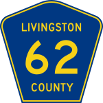
and County Route 36A in Livingston County
, such cases are rare in New York due to the lack of a statewide numbering system. Instead, county routes are assigned on the county level, resulting in numbering systems that vary by county. Some counties, such as Dutchess County
, use a system in which county route numbers are assigned by town in alphabetical order while others like Monroe County
assign numbers in a general west-to-east fashion. Still others, for instance Livingston County
, have no defined pattern.
 The method that each county employs to sign its routes varies from one county to the next. The majority of counties in New York use the MUTCD-standard blue pentagonal shield with yellow lettering. Others tweak this shield slightly, using white lettering instead of yellow (particularly in areas near the Capital District
) or using shapes similar to a pentagon. Additionally, Orange County
employs a wide assortment of signage, ranging from the standard blue pentagonal shield to a blue diamond with white lettering. On the other hand, some counties, such as Orleans County
, do not post signage along their routes.
Like the numbering system and the choice of signage, the complexity of the county highway system varies by county as well. Erie County
, for example, one of the most urbanized counties in Upstate New York
, maintains a system of nearly 400 routes. In contrast, the Southern Tier
county of Tioga
manages only 29 roads.
The highest-numbered posted county route and the only four-digit county route signed as such in the state, County Route 1345, resides in Saratoga County
.
Westchester County routes are typically unmarked, as the county government only loosely enforces the signage of county roads.
U.S. state
A U.S. state is any one of the 50 federated states of the United States of America that share sovereignty with the federal government. Because of this shared sovereignty, an American is a citizen both of the federal entity and of his or her state of domicile. Four states use the official title of...
of New York
New York
New York is a state in the Northeastern region of the United States. It is the nation's third most populous state. New York is bordered by New Jersey and Pennsylvania to the south, and by Connecticut, Massachusetts and Vermont to the east...
, county routes exist in all 62 counties except those in the five boroughs of New York City
New York City
New York is the most populous city in the United States and the center of the New York Metropolitan Area, one of the most populous metropolitan areas in the world. New York exerts a significant impact upon global commerce, finance, media, art, fashion, research, technology, education, and...
. Most are maintained locally by county highway departments. Although county route designations occasionally cross from one county to the next, such as County Route 36 in Ontario County
Ontario County, New York
As of the census of 2000, there were 100,224 people, 38,370 households, and 26,360 families residing in the county. The population density was 156 people per square mile . There were 42,647 housing units at an average density of 66 per square mile...
and County Route 36A in Livingston County
Livingston County, New York
As of the census of 2000, there were 64,328 people, 22,150 households, and 15,349 families residing in the county. The population density was 102 people per square mile . There were 24,023 housing units at an average density of 38 per square mile...
, such cases are rare in New York due to the lack of a statewide numbering system. Instead, county routes are assigned on the county level, resulting in numbering systems that vary by county. Some counties, such as Dutchess County
Dutchess County, New York
Dutchess County is a county located in the U.S. state of New York, in the state's Mid-Hudson Region of the Hudson Valley. The 2010 census lists the population as 297,488...
, use a system in which county route numbers are assigned by town in alphabetical order while others like Monroe County
Monroe County, New York
Monroe County is a county located in the U.S. state of New York. As of the 2010 census, the population was 744,344. It is named after James Monroe, fifth President of the United States of America. Its county seat is the city of Rochester....
assign numbers in a general west-to-east fashion. Still others, for instance Livingston County
Livingston County, New York
As of the census of 2000, there were 64,328 people, 22,150 households, and 15,349 families residing in the county. The population density was 102 people per square mile . There were 24,023 housing units at an average density of 38 per square mile...
, have no defined pattern.
Capital District
New York's Capital District, also known as the Capital Region, is a region in upstate New York that generally refers to the four counties surrounding Albany, the capital of the state: Albany County, Schenectady County, Rensselaer County, and Saratoga County...
) or using shapes similar to a pentagon. Additionally, Orange County
Orange County, New York
Orange County is a county located in the U.S. state of New York. It is part of the Poughkeepsie–Newburgh–Middletown, NY Metropolitan Statistical Area and is located at the northern reaches of the New York metropolitan area. The county sits in the state's scenic Mid-Hudson Region of the Hudson Valley...
employs a wide assortment of signage, ranging from the standard blue pentagonal shield to a blue diamond with white lettering. On the other hand, some counties, such as Orleans County
Orleans County, New York
As of the census of 2000, there were 44,171 people, 15,363 households, and 10,846 families residing in the county. The population density was 113 people per square mile . There were 17,347 housing units at an average density of 44 per square mile...
, do not post signage along their routes.
Like the numbering system and the choice of signage, the complexity of the county highway system varies by county as well. Erie County
Erie County, New York
Erie County is a county located in the U.S. state of New York. As of the 2010 census, the population was 919,040. The county seat is Buffalo. The county's name comes from Lake Erie, which in turn comes from the Erie tribe of American Indians who lived south and east of the lake before 1654.Erie...
, for example, one of the most urbanized counties in Upstate New York
Upstate New York
Upstate New York is the region of the U.S. state of New York that is located north of the core of the New York metropolitan area.-Definition:There is no clear or official boundary between Upstate New York and Downstate New York...
, maintains a system of nearly 400 routes. In contrast, the Southern Tier
Southern Tier
The Southern Tier is a geographical term that refers to the counties of New York State west of the Catskill Mountains along the northern border of Pennsylvania. It is a loosely defined term that generally includes the counties that border Pennsylvania west of Delaware County inclusive...
county of Tioga
Tioga County, New York
As of the census of 2010, there were 51,125 people residing in the county, with 22,203 housing units, of these 20,350 occupied, 1,853 vacant. The population density was 98 people per square mile...
manages only 29 roads.
The highest-numbered posted county route and the only four-digit county route signed as such in the state, County Route 1345, resides in Saratoga County
Saratoga County, New York
Saratoga County is a county located in the U.S. state of New York. As of the 2010 census, the population was 219,607. It is part of the Albany-Schenectady-Troy Metropolitan Statistical Area. The county seat is Ballston Spa...
.
Westchester County routes are typically unmarked, as the county government only loosely enforces the signage of county roads.
List of county routes by county
| Albany to Greene | Hamilton to Rensselaer | Rockland to Yates |
|---|---|---|
|
|
|