
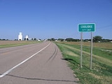
Coolidge, Kansas
Encyclopedia
Coolidge is a city in Hamilton County
, Kansas
, United States
. As of the 2010 census, the city population was 95.
.
, the city has a total area of 0.5 square miles (1.3 km²), all of it land.
of 2000, there were 86 people, 36 households, and 25 families residing in the city. The population density
was 187.4 people per square mile (72.2/km²). There were 41 housing units at an average density of 89.3 per square mile (34.4/km²). The racial makeup of the city was 70.93% White, 26.74% from other races
, and 2.33% from two or more races. Hispanic or Latino of any race were 33.72% of the population.
There were 36 households out of which 33.3% had children under the age of 18 living with them, 66.7% were married couples
living together, 5.6% had a female householder with no husband present, and 27.8% were non-families. 27.8% of all households were made up of individuals and 22.2% had someone living alone who was 65 years of age or older. The average household size was 2.39 and the average family size was 2.88.
In the city the population was spread out with 19.8% under the age of 18, 8.1% from 18 to 24, 24.4% from 25 to 44, 19.8% from 45 to 64, and 27.9% who were 65 years of age or older. The median age was 43 years. For every 100 females there were 83.0 males. For every 100 females age 18 and over, there were 86.5 males.
The median income for a household in the city was $36,250, and the median income for a family was $36,250. Males had a median income of $22,000 versus $26,250 for females. The per capita income
for the city was $17,485. There were no families and 3.0% of the population living below the poverty line, including no under eighteens and 6.3% of those over 64.
starring Chevy Chase
as Clark Griswold, the Griswolds visits Cousin Eddie and his family, who live on a farm outside Coolidge.
Schools
Maps
Hamilton County, Kansas
Hamilton County is a county located in Southwest Kansas, in the Central United States. As of the 2010 census, the county population was 2,690...
, Kansas
Kansas
Kansas is a US state located in the Midwestern United States. It is named after the Kansas River which flows through it, which in turn was named after the Kansa Native American tribe, which inhabited the area. The tribe's name is often said to mean "people of the wind" or "people of the south...
, United States
United States
The United States of America is a federal constitutional republic comprising fifty states and a federal district...
. As of the 2010 census, the city population was 95.
History
The city of Coolidge was named after Thomas Jefferson Coolidge, the former president of the Atchison, Topeka and Santa Fe RailwayAtchison, Topeka and Santa Fe Railway
The Atchison, Topeka and Santa Fe Railway , often abbreviated as Santa Fe, was one of the larger railroads in the United States. The company was first chartered in February 1859...
.
Geography
Coolidge is located at 38°2′32"N 102°0′37"W (38.042318, -102.010210). According to the United States Census BureauUnited States Census Bureau
The United States Census Bureau is the government agency that is responsible for the United States Census. It also gathers other national demographic and economic data...
, the city has a total area of 0.5 square miles (1.3 km²), all of it land.
Demographics
As of the censusCensus
A census is the procedure of systematically acquiring and recording information about the members of a given population. It is a regularly occurring and official count of a particular population. The term is used mostly in connection with national population and housing censuses; other common...
of 2000, there were 86 people, 36 households, and 25 families residing in the city. The population density
Population density
Population density is a measurement of population per unit area or unit volume. It is frequently applied to living organisms, and particularly to humans...
was 187.4 people per square mile (72.2/km²). There were 41 housing units at an average density of 89.3 per square mile (34.4/km²). The racial makeup of the city was 70.93% White, 26.74% from other races
Race (United States Census)
Race and ethnicity in the United States Census, as defined by the Federal Office of Management and Budget and the United States Census Bureau, are self-identification data items in which residents choose the race or races with which they most closely identify, and indicate whether or not they are...
, and 2.33% from two or more races. Hispanic or Latino of any race were 33.72% of the population.
There were 36 households out of which 33.3% had children under the age of 18 living with them, 66.7% were married couples
Marriage
Marriage is a social union or legal contract between people that creates kinship. It is an institution in which interpersonal relationships, usually intimate and sexual, are acknowledged in a variety of ways, depending on the culture or subculture in which it is found...
living together, 5.6% had a female householder with no husband present, and 27.8% were non-families. 27.8% of all households were made up of individuals and 22.2% had someone living alone who was 65 years of age or older. The average household size was 2.39 and the average family size was 2.88.
In the city the population was spread out with 19.8% under the age of 18, 8.1% from 18 to 24, 24.4% from 25 to 44, 19.8% from 45 to 64, and 27.9% who were 65 years of age or older. The median age was 43 years. For every 100 females there were 83.0 males. For every 100 females age 18 and over, there were 86.5 males.
The median income for a household in the city was $36,250, and the median income for a family was $36,250. Males had a median income of $22,000 versus $26,250 for females. The per capita income
Per capita income
Per capita income or income per person is a measure of mean income within an economic aggregate, such as a country or city. It is calculated by taking a measure of all sources of income in the aggregate and dividing it by the total population...
for the city was $17,485. There were no families and 3.0% of the population living below the poverty line, including no under eighteens and 6.3% of those over 64.
Cultural references
In the 1983 movie National Lampoon's VacationNational Lampoon's Vacation
Vacation, sometimes referred as National Lampoon's Vacation, is a 1983 comedy film directed by Harold Ramis and starring Chevy Chase, Beverly D'Angelo, Randy Quaid, Dana Barron and Anthony Michael Hall...
starring Chevy Chase
Chevy Chase
Cornelius Crane "Chevy" Chase is an American comedian, writer, and television and film actor, born into a prominent entertainment industry family. Chase worked a plethora of odd jobs before moving into comedy acting with National Lampoon...
as Clark Griswold, the Griswolds visits Cousin Eddie and his family, who live on a farm outside Coolidge.
Further reading
- Story of the Marking of the Santa Fe Trail by the Daughters of the American Revolution in Kansas and the State of Kansas; Almira Cordry; Crane Co; 164 pages; 1915.
External links
CitySchools
- USD 494, local school district
Maps
- Coolidge City Map, KDOT
- Hamilton County Map, KDOT