

Cooks Station
Encyclopedia
Built in 1863 as part of the Volcano cutoff of the Carson Emigrant Trail, Cooks Station is one of two remaining "stations" on the highway among many that sprang up after the road was completed over the Carson Pass in the 1860s. The other remaining station is Ham's Station, located 3.3 miles (5.3 km) east at 6000 feet (1,828.8 m) elevation.
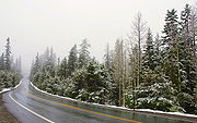
Both stations are routinely used by the California Department of Transportation (CALTRANS) to indicate points where snow chains
Snow chains
Snow chains, or tire chains, are devices fitted to the tires of vehicles to provide maximum traction when driving through snow and ice....
are required for continued travel during snowstorms. Current conditions and requirements are posted at the CALTRANS road information website.
38.5265757°N 120.4332557°W