
Connecticut Route 113
Encyclopedia
Route 113 is a Connecticut
state highway
running from the Bridgeport
-Stratford
town line around the Lordship
section of Stratford to the eastern part of the town.
intrsection. Route 113 then heads north around Stratford Point as Stratford Road and Main Street, along the mouth of the Housatonic River
at Long Island Sound
. The road also provides access to Short Beach Park, a town beach. Main Street continues north towards Stratford center, intersecting with Route 130 and West Broad Street (which provides access to I-95 at Exit 32). Continuing north, it goes under I-95 without an interchange past the Stratford
railroad station, intersecting with U.S. Route 1, then running for another 1.6 miles (2.6 km) in the residential part of town before ending at Route 110 (East Main Street). Main Street continues straight as Route 110.
along the current route of Route 108
. In about 1940, it was extended west along the current route into Bridgeport. In 1944, it was rerouted to the north of Sikorsky Airport (along Access Road), with the sooutherly alignment becoming Route 113A, but was returned to its current route in 1947 (Route 113A was deleted). In 1952, it was extended north to the Shelton town center via the Huntington Turnpike. In 1962, Route 108 was extended south along Nichols Avenue and Route 113 was rerouted east to its current route, over a former section of Route 110. This northernmost portion of current Route 113 was the original southern end of Route 8
prior to the construction of the expressay.
Connecticut
Connecticut is a state in the New England region of the northeastern United States. It is bordered by Rhode Island to the east, Massachusetts to the north, and the state of New York to the west and the south .Connecticut is named for the Connecticut River, the major U.S. river that approximately...
state highway
State highway
State highway, state road or state route can refer to one of three related concepts, two of them related to a state or provincial government in a country that is divided into states or provinces :#A...
running from the Bridgeport
Bridgeport, Connecticut
Bridgeport is the most populous city in the U.S. state of Connecticut. Located in Fairfield County, the city had an estimated population of 144,229 at the 2010 United States Census and is the core of the Greater Bridgeport area...
-Stratford
Stratford, Connecticut
Stratford is a town in Fairfield County, Connecticut, United States, located on Long Island Sound at the mouth of the Housatonic River. It was founded by Puritans in 1639....
town line around the Lordship
Lordship (neighborhood)
Lordship is a small, waterfront neighborhood in Stratford, Connecticut. The neighborhood extends onto a peninsula on Long Island Sound and is bounded from the rest of Stratford by Sikorsky Memorial Airport to the north and Short Beach to the north east...
section of Stratford to the eastern part of the town.
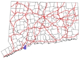
Route description
Route 113 begins at an intersection with I-95 (Exit 30) at the Bridgeport-Stratford town line and heads east into Stratford as Lordship Boulevard. It then heads southeast along the western boundary of Sikorsky Airport, then turns east, still encirclingthe airport, along Oak Bluff Avenue and Prospect Drive. The transition between Oak Bluff Avenue and Prospect Drive is a roundaboutRoundabout
A roundabout is the name for a road junction in which traffic moves in one direction around a central island. The word dates from the early 20th century. Roundabouts are common in many countries around the world...
intrsection. Route 113 then heads north around Stratford Point as Stratford Road and Main Street, along the mouth of the Housatonic River
Housatonic River
The Housatonic River is a river, approximately long, in western Massachusetts and western Connecticut in the United States. It flows south to southeast, and drains about of southwestern New England into Long Island Sound...
at Long Island Sound
Long Island Sound
Long Island Sound is an estuary of the Atlantic Ocean, located in the United States between Connecticut to the north and Long Island, New York to the south. The mouth of the Connecticut River at Old Saybrook, Connecticut, empties into the sound. On its western end the sound is bounded by the Bronx...
. The road also provides access to Short Beach Park, a town beach. Main Street continues north towards Stratford center, intersecting with Route 130 and West Broad Street (which provides access to I-95 at Exit 32). Continuing north, it goes under I-95 without an interchange past the Stratford
Stratford (Metro-North station)
The Stratford Metro-North Railroad station serves the residents of Stratford, Connecticut via the New Haven Line. Although the station is usually served by express trains originating or terminating in New Haven, one peak-hour run of the Waterbury Branch stops each morning and evening, as well as...
railroad station, intersecting with U.S. Route 1, then running for another 1.6 miles (2.6 km) in the residential part of town before ending at Route 110 (East Main Street). Main Street continues straight as Route 110.
History
Route 113 was created in 1932, originally running from Stratford Point to downtown Stratford and then to SheltonShelton, Connecticut
Shelton is a city in Fairfield County, Connecticut, United States. The population was 39,559 at the 2010 census.-Origins:Shelton was settled by the English as part of the town of Stratford, Connecticut, in 1639...
along the current route of Route 108
Connecticut Route 108
Route 108 in the U.S. state of Connecticut, also called Huntington Turnpike and Nichols Avenue, is a two-lane state highway that runs northerly from US 1, Boston Post Road in Stratford, through Trumbull, to Route 110 in downtown Shelton...
. In about 1940, it was extended west along the current route into Bridgeport. In 1944, it was rerouted to the north of Sikorsky Airport (along Access Road), with the sooutherly alignment becoming Route 113A, but was returned to its current route in 1947 (Route 113A was deleted). In 1952, it was extended north to the Shelton town center via the Huntington Turnpike. In 1962, Route 108 was extended south along Nichols Avenue and Route 113 was rerouted east to its current route, over a former section of Route 110. This northernmost portion of current Route 113 was the original southern end of Route 8
Route 8 (Connecticut)
Route 8 is the portion of the multistate New England Route 8 within the state of Connecticut. It is a state highway running north–south from Bridgeport, through Waterbury, all the way to the Massachusetts state line where it continues as Route 8...
prior to the construction of the expressay.
Junction list
| Town | Road names | Junction | Milepost |
|---|---|---|---|
| Bridgeport Bridgeport, Connecticut Bridgeport is the most populous city in the U.S. state of Connecticut. Located in Fairfield County, the city had an estimated population of 144,229 at the 2010 United States Census and is the core of the Greater Bridgeport area... (0.09 miles) |
Hollister Avenue | 0.00 (Junction at Bridgeport-Stratford town line) | |
| Stratford Stratford, Connecticut Stratford is a town in Fairfield County, Connecticut, United States, located on Long Island Sound at the mouth of the Housatonic River. It was founded by Puritans in 1639.... (8.03 miles) |
Lordship Blvd,, Oak Bluff Ave., Prospect Dr., Stratford Rd., Main St. |
5.61 | |
| 6.48 | |||
| 8.12 |