

Climate of Estonia
Encyclopedia
Estonia
lies in the northern part of the temperate climate zone
and in the transition zone between maritime and continental climate
. Because Estonia (and all of Northern Europe
) is continuously warmed by maritime air influenced by the heat content of the northern Atlantic Ocean
, it has a milder climate despite its northern latitude. The Baltic Sea
causes differences between the climate of coastal and inland areas. Estonia has four seasons of near-equal length. Average temperatures range from 16.3 °C (61.3 °F) on the Baltic islands to 18.1 °C (64.6 °F) inland in July, the warmest month, and from -3.5 °C on the Baltic islands to -7.6 °C inland in February, the coldest month.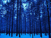 The average annual temperature in Estonia is 5.2 °C (41.4 °F) . The average temperature in February, the coldest month of the year, is -5.7 °C . The average temperature in July, which is considered the warmest month of the year, is 16.4 °C (61.5 °F). The climate is also influenced by the Atlantic Ocean
, the North-Atlantic Stream and the Iceland
ic Minimum, which is an area known for the formation of cyclones and where the average air pressure is lower than in neighbouring areas. Estonia is located in a humid zone in which the amount of precipitation is greater than total evaporation. The average precipitation in 1961–1990 ranged from 535 to 727 mm (21.1 to 28.6 in) per year and was heaviest in late summer. There were between 102 and 127 rainy days a year, and average precipitation was most plentiful on the western slopes of the Sakala and Haanja
Uplands. Snow cover, which is deepest in the south-eastern part of Estonia, usually lasts from mid-December to late March.
Estonia
Estonia , officially the Republic of Estonia , is a state in the Baltic region of Northern Europe. It is bordered to the north by the Gulf of Finland, to the west by the Baltic Sea, to the south by Latvia , and to the east by Lake Peipsi and the Russian Federation . Across the Baltic Sea lies...
lies in the northern part of the temperate climate zone
Temperate
In geography, temperate or tepid latitudes of the globe lie between the tropics and the polar circles. The changes in these regions between summer and winter are generally relatively moderate, rather than extreme hot or cold...
and in the transition zone between maritime and continental climate
Continental climate
Continental climate is a climate characterized by important annual variation in temperature due to the lack of significant bodies of water nearby...
. Because Estonia (and all of Northern Europe
Northern Europe
Northern Europe is the northern part or region of Europe. Northern Europe typically refers to the seven countries in the northern part of the European subcontinent which includes Denmark, Estonia, Latvia, Lithuania, Norway, Finland and Sweden...
) is continuously warmed by maritime air influenced by the heat content of the northern Atlantic Ocean
Atlantic Ocean
The Atlantic Ocean is the second-largest of the world's oceanic divisions. With a total area of about , it covers approximately 20% of the Earth's surface and about 26% of its water surface area...
, it has a milder climate despite its northern latitude. The Baltic Sea
Baltic Sea
The Baltic Sea is a brackish mediterranean sea located in Northern Europe, from 53°N to 66°N latitude and from 20°E to 26°E longitude. It is bounded by the Scandinavian Peninsula, the mainland of Europe, and the Danish islands. It drains into the Kattegat by way of the Øresund, the Great Belt and...
causes differences between the climate of coastal and inland areas. Estonia has four seasons of near-equal length. Average temperatures range from 16.3 °C (61.3 °F) on the Baltic islands to 18.1 °C (64.6 °F) inland in July, the warmest month, and from -3.5 °C on the Baltic islands to -7.6 °C inland in February, the coldest month.
Atlantic Ocean
The Atlantic Ocean is the second-largest of the world's oceanic divisions. With a total area of about , it covers approximately 20% of the Earth's surface and about 26% of its water surface area...
, the North-Atlantic Stream and the Iceland
Iceland
Iceland , described as the Republic of Iceland, is a Nordic and European island country in the North Atlantic Ocean, on the Mid-Atlantic Ridge. Iceland also refers to the main island of the country, which contains almost all the population and almost all the land area. The country has a population...
ic Minimum, which is an area known for the formation of cyclones and where the average air pressure is lower than in neighbouring areas. Estonia is located in a humid zone in which the amount of precipitation is greater than total evaporation. The average precipitation in 1961–1990 ranged from 535 to 727 mm (21.1 to 28.6 in) per year and was heaviest in late summer. There were between 102 and 127 rainy days a year, and average precipitation was most plentiful on the western slopes of the Sakala and Haanja
Haanja
Haanja is a village in Võru County, in southeastern Estonia. It's located 16 km south from the town of Võru. Haanja is the administrative centre of Haanja Parish. The village had a population of 191 ....
Uplands. Snow cover, which is deepest in the south-eastern part of Estonia, usually lasts from mid-December to late March.