

Climate of Azerbaijan
Encyclopedia
The climate of Azerbaijan is unique. Nine of the Earth's eleven climatic zones can be discovered in Azerbaijan.
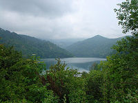 As a predominantly mountainous country, Azerbaijan is surrounded by the Major Caucasus, Minor Caucasus, Talysh and North Iranian Mountains. The Kur lowland, between the Major and Minor Caucasus, stretches to the Caspian Sea
in the eastern part of the country. The Major Caucasus, situated in the north of the country and stretching from the northwest to the southeast, protects the country from direct influences of northern cold air masses. That leads to the formation of a subtropical climate on most of the foothills and plains of the country. Other mountain chains surrounding the country also impact air circulation. The complexity of the landscape causes nonuniform formation of climatic zones and creates vertical climate zones.
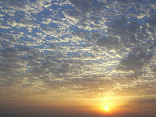 The Azerbaijani plains and foothills have high insolation
rates. The sun shines for 2,200 to 2,400 hours annually on the Kur-Araz lowland, Apsheron peninsula and other plains and foothills, and 2,600 to 2,800 hours on the plains around Araz in the Nakhchivan region. Due to increased cloudiness in the mountainous regions, those areas receive only 1,900 to 2,200 hours of direct sunlight..
Bright sun shines 2,200 to 2,500 hours a year at altitudes over 3000 metres (9,842.5 ft). The total annual radiation equals 128–132 kcal/cm2 (118–122 kWh/ft2). Toward the mountains, it declines to 120–124 kcal/cm2 (109–113 kWh/ft2), at an altitude of 500 to 600 m (1,640.4 to 1,968.5 ft) above sea level, then gradually increases and reaches 140–150 kcal/cm2 (129–139 kWh/ft2) at altitudes above 3000 metres (9,842.5 ft) in the Major and Minor Caucasuses.
The total amount of solar radiation affecting the Araz plains in Nakhchivan totals 148–150 kcal/cm2 (137–139 kWh/ft2). It increases in the mountains, reaching 152–160 kcal/cm2 (140–148 kWh/ft2). The solar radiation on the country's plains and foothills amounts to 40–50 kcal/cm2 (37–46 kWh/ft2); in Lenkoran, 50–60 kcal/cm2 (46–55 kWh/ft2); in the mountains, 15–25 kcal/cm2 (14–23 kWh/ft2).
es. Cold air masses, such as the Kara and Scandinavia
n arctic anticyclones, the temperate Siberian anticyclones, and the maritime Azores maximum influence the climate. Likewise, tropical hot air masses (subtropical anticyclone and southern cyclones), as well as Central Asian anticyclones and local weather conditions, have influence. These air masses enter the country in different ways thanks to its varied geography. Thus, although they do not prevent the hot masses entering Azerbaijan from the south, cold continental and maritime air masses cause changes in properties of those hot air masses, and influence the dynamics of atmosphere conditions.
can be found in Azerbaijan . Many of these patterns are divided into subtypes.
Geography
Azerbaijan is situated on the northern extremity of the subtropical zone, in the southeastern part of the Caucasus and the northwestern part of the Iran plateau. The complicated geographical location and landscape, the proximity of the Caspian Sea, the effect of sun's radiation, air masses of different origin, etc., contribute to its climatological diversity.Landscape
Caspian Sea
The Caspian Sea is the largest enclosed body of water on Earth by area, variously classed as the world's largest lake or a full-fledged sea. The sea has a surface area of and a volume of...
in the eastern part of the country. The Major Caucasus, situated in the north of the country and stretching from the northwest to the southeast, protects the country from direct influences of northern cold air masses. That leads to the formation of a subtropical climate on most of the foothills and plains of the country. Other mountain chains surrounding the country also impact air circulation. The complexity of the landscape causes nonuniform formation of climatic zones and creates vertical climate zones.
Solar Radiation
Insolation
Insolation is a measure of solar radiation energy received on a given surface area in a given time. It is commonly expressed as average irradiance in watts per square meter or kilowatt-hours per square meter per day...
rates. The sun shines for 2,200 to 2,400 hours annually on the Kur-Araz lowland, Apsheron peninsula and other plains and foothills, and 2,600 to 2,800 hours on the plains around Araz in the Nakhchivan region. Due to increased cloudiness in the mountainous regions, those areas receive only 1,900 to 2,200 hours of direct sunlight..
Bright sun shines 2,200 to 2,500 hours a year at altitudes over 3000 metres (9,842.5 ft). The total annual radiation equals 128–132 kcal/cm2 (118–122 kWh/ft2). Toward the mountains, it declines to 120–124 kcal/cm2 (109–113 kWh/ft2), at an altitude of 500 to 600 m (1,640.4 to 1,968.5 ft) above sea level, then gradually increases and reaches 140–150 kcal/cm2 (129–139 kWh/ft2) at altitudes above 3000 metres (9,842.5 ft) in the Major and Minor Caucasuses.
The total amount of solar radiation affecting the Araz plains in Nakhchivan totals 148–150 kcal/cm2 (137–139 kWh/ft2). It increases in the mountains, reaching 152–160 kcal/cm2 (140–148 kWh/ft2). The solar radiation on the country's plains and foothills amounts to 40–50 kcal/cm2 (37–46 kWh/ft2); in Lenkoran, 50–60 kcal/cm2 (46–55 kWh/ft2); in the mountains, 15–25 kcal/cm2 (14–23 kWh/ft2).
Circulation of air masses
Climate formation in Azerbaijan is influenced by various air massAir mass
In meteorology, an air mass is a volume of air defined by its temperature and water vapor content. Air masses cover many hundreds or thousands of square miles, and adopt the characteristics of the surface below them. They are classified according to latitude and their continental or maritime...
es. Cold air masses, such as the Kara and Scandinavia
Scandinavia
Scandinavia is a cultural, historical and ethno-linguistic region in northern Europe that includes the three kingdoms of Denmark, Norway and Sweden, characterized by their common ethno-cultural heritage and language. Modern Norway and Sweden proper are situated on the Scandinavian Peninsula,...
n arctic anticyclones, the temperate Siberian anticyclones, and the maritime Azores maximum influence the climate. Likewise, tropical hot air masses (subtropical anticyclone and southern cyclones), as well as Central Asian anticyclones and local weather conditions, have influence. These air masses enter the country in different ways thanks to its varied geography. Thus, although they do not prevent the hot masses entering Azerbaijan from the south, cold continental and maritime air masses cause changes in properties of those hot air masses, and influence the dynamics of atmosphere conditions.
Major aspects
Some of the major influences on Azerbaijan's climate are temperature, precipitation, humidity, rate of evaporation, and cloud cover.Temperature
The temperature regime and its distribution throughout Azerbaijan is regular, and depends on the features of air masses entering the country, the regional landscape, and proximity to the Caspian Sea. The sea causes temperatures in the maritime areas (20 kilometres or 12.4 mi away from the sea) to decline in the summer and rise in the winter. At the same time, the sea moderates the influence of hot and dry air masses coming from Central Asia. The average annual temperature is 14–15 °C (57.2–59 °F) in the Kur-Araz Lowland, the coastal regions south to the Apsheron Peninsula, and in the Lenkoran Lowland. The temperature declines with proximity to the mountains, averaging 4–5 °C (39.2–41 °F) at an altitude of 2000 metres (6,561.7 ft), and 1–2 °C (33.8–35.6 °F) at 3000 metres (9,842.5 ft).Climate types
Taking into consideration the distribution and features of the weather, temperature, humidity, and precipitation, nine out of the 11 climate patterns in the Köppen climate classificationKöppen climate classification
The Köppen climate classification is one of the most widely used climate classification systems. It was first published by Crimea German climatologist Wladimir Köppen in 1884, with several later modifications by Köppen himself, notably in 1918 and 1936...
can be found in Azerbaijan . Many of these patterns are divided into subtypes.
- Semi-desert and dry steppe climates cover the central lowlands in Kur to 400 metres (1,312.3 ft), the Caspian zone from the end of Samur River to the Gizilagaj gulf, the plains of Nakhchivan along the Araz river, and the valleys of the Talish Mountains below 1000 metres (3,280.8 ft). Annual precipitation accounts for 15 to 50 percent of the possible evaporation. Winters are usually warm (though cold on the Araz River plains along, and in the valleys of, the Talish Mountains). Summers are extremely hot, sometimes over 40 °C (104 °F).
- Semi-desert and dry steppe climate with cold winter and dry hot climate.
- A moderate climate with mild, dry winters covers the south hills (below 1000 metres or 3,280.8 ft) of the Great Caucasus, the Ganikh-Eyrichay valley between 200 and 500 m (656.2 and 1,640.4 ft), and the north and east hills of the Small Caucasus between 400 and 1500 m (1,312.3 and 4,921.3 ft). Annual precipitation accounts for 50 to 100 percent of the possible evaporation in this climate zone.
- A moderately hot climate with dry summers covers the Lankaran-Astara region. Annual precipitation accounts for 100 to 150 percent or more of the possible evaporation. Winters are mild, summers are hot and dry, and autumns are rainy. The period of May through August is usually dry, requiring artificial irrigation.
- Cold, dry winters cover the southeast hills of the Great Caucasus between 1000 and 2700 m (3,280.8 and 8,858.3 ft), and mountainous regions of the Small Caucasus between 1400 and 2700 m (4,593.2 and 8,858.3 ft). Annual precipitation accounts for 75 to 100 percent of the possible evaporation. Summers are cool and winter is mild.
- A cold climate with cool, dry summers covers the middle and high mountains of Nakhchivan AR between 1000 and 3000 m (3,280.8 and 9,842.5 ft). Annual precipitation accounts for 50 to 100 percent of possible evaporation. Summers are cool, and winter is cold enough for snow.
- A mildly-hot climate with equal distribution of rainfall covers the mountainous forests in the south between 600 and 1500 m (1,968.5 and 4,921.3 ft), and the northeast hills of the Great Caucasus between 200 and 500 m (656.2 and 1,640.4 ft).. Annual rainfall accounts for 75 to 100 percent of the possible evaporation in the south hills, and 50 to 100 percent in the northeast hills. Winters are mild, summers warm.
- A cold climate with heavy precipitation year-round occurs in the south hills of the Great Caucasus between 1500 and 2700 m (4,921.3 and 8,858.3 ft), which include forest, subalpine, and alpine zones. Annual precipitation accounts for more than 150 to 200 percent of the possible evaporation. Winters are quite cold, summers cool.
- Mountainous tundra covers the areas of Great and Small Caucasus above 2700 metres (8,858.3 ft), and Nakhchivan above 3200 metres (10,498.7 ft). Annual precipitation accounts for more than 100 to 200 percent of the possible evaporation. Winters and summers are both cold. In some places, the snow does not melt until the following winter.