

Chester Township, Ottawa County, Michigan
Encyclopedia
Chester Township is a civil township
of Ottawa County
in the U.S. state
of Michigan
. As of the 2000 census, the township population was 2,315.
On the eastern boundary with Sparta Township
, Gooding was a station on the Toledo, Saginaw and Muskegon Railway in Kent County. A post office was established in November 1888 and named after storekeeper/postmaster Richard J. Gooding. In June 1918, the post office was transferred to a site on the Ottawa County side and remained in operation until January 1923. The most noticeable remnant of Gooding is in the name give to Gooding Street, which runs east-west across the township, passing just south of Crockery Lake. The street continues as 13 Mile Road in Kent County and as Ellis Road in Muskegon County.
About one mile (1.6 km) south of Gooding, is the site of the former village of Lisbon. This was first settled by John Pintler from New York in 1846. A post office was established in Ottawa County in 1848 with the name "Pintler's Corners". The name was changed in 1859 to Lisbon. In March 1869, a village was incorporated, extending one half mile in each direction from the northwest corner of section 30 of Sparta Township (thus including a quarter section of section 19 to the north in Sparta Township as well as quarter sections of sections 24 and 25 in Chester Township. However, railroad lines bypassed the village and it did not prosper, eventually disincorporating.
The township protrudes to the north of the rest of Ottawa County, and is bounded on the west and north by Muskegon County
and on the east by Kent County
. Polkton Township
lies to the southwest and Wright Township
to the south.
No major roads pass through the township, although Interstate 96
passes just to the south. The city of Coopersville
is just a few miles to the southwest. Grand Haven
is about 20 miles (32.2 km) to the west, while Grand Rapids
is about 15 miles (24.1 km) to the southeast.
that flows mostly westward in the township. The southern portion is drained by branches of Rio Grande Creek, which flow mostly westward before joining Crockery Creek just south of Ravenna
. A small area in the southwest corner is drained by Beaver Creek, which flows mostly south into Deer Creek just about a mile before Deer Creek enters the Grand River in Polkton Township. A very small area in the southeast of the township is drained by Nash Creek, which flows east to the Rogue River
. Crockery Lake, on the Crockery Creek near the center of the township, is the only sizeable body of water in the township. The highest point in Conklin is appx. 1 miles (1.6 km) from Crockery Lake by Gooding St. and 24th Avenue.
According to the United States Census Bureau
, the township has a total area of 35.9 square miles (93 km²), of which, 35.7 square miles (92.5 km²) of it is land and 0.2 square mile (0.517997622 km²) of it (0.47%) is water.
Grose Park is a 40 acres (161,874.4 m²) county park overlooking the north side of Crockery Lake and provides a variety of recreational opportunities including swimming, fishing, sand volleyball and picnicking. There is about one mile (1.6 km) of hiking trails along Lange Creek. Major improvements were made in 2000 to Grose Park as part of a $660,000 renovation with about 60% of the funding coming from the Michigan Natural Resources Trust Fund.
Zip Codes
School Districts
of 2000, there were 2,315 people, 714 households, and 579 families residing in the township. The population density
was 64.9 per square mile (25.0/km²). There were 793 housing units at an average density of 22.2 per square mile (8.6/km²). The racial makeup of the township was 94.43% White, 0.78% African American, 0.13% Native American, 0.22% Asian, 3.63% from other races
, and 0.82% from two or more races. Hispanic or Latino of any race were 6.22% of the population.
There were 714 households out of which 41.3% had children under the age of 18 living with them, 70.3% were married couples
living together, 6.7% had a female householder with no husband present, and 18.9% were non-families. 14.7% of all households were made up of individuals and 4.8% had someone living alone who was 65 years of age or older. The average household size was 2.99 and the average family size was 3.32.
In the township the population was spread out with 30.9% under the age of 18, 7.9% from 18 to 24, 31.1% from 25 to 44, 18.5% from 45 to 64, and 11.6% who were 65 years of age or older. The median age was 35 years. For every 100 females there were 104.9 males. For every 100 females age 18 and over, there were 103.0 males.
The median income for a household in the township was $46,328, and the median income for a family was $51,900. Males had a median income of $39,286 versus $27,159 for females. The per capita income
for the township was $18,197. About 6.0% of families and 10.4% of the population were below the poverty line, including 9.0% of those under age 18 and 4.1% of those age 65 or over.
Civil township
A civil township is a widely used unit of local government in the United States, subordinate to, and geographic divisions of, a county. Specific responsibilities and the degree of autonomy vary based on each state. Civil townships are distinct from survey townships, but in states that have both,...
of Ottawa County
Ottawa County, Michigan
-Demographics:As of the census of 2000, there were 238,314 people, 81,662 households, and 61,328 families residing in the county. The population density was 421 people per square mile . There were 86,856 housing units at an average density of 154 per square mile...
in the U.S. state
U.S. state
A U.S. state is any one of the 50 federated states of the United States of America that share sovereignty with the federal government. Because of this shared sovereignty, an American is a citizen both of the federal entity and of his or her state of domicile. Four states use the official title of...
of Michigan
Michigan
Michigan is a U.S. state located in the Great Lakes Region of the United States of America. The name Michigan is the French form of the Ojibwa word mishigamaa, meaning "large water" or "large lake"....
. As of the 2000 census, the township population was 2,315.
Communities
There are no incorporated municipalities within the township. There are a few unincorporated communitities and homeowners associations:- Conklin, in the southwest part of the township at 43°07′44"N 85°52′53"W. It was a station on the Grand Rapids and Indiana RailroadGrand Rapids and Indiana RailroadThe Grand Rapids and Indiana Railroad at its height provided passenger and freight railroad services between Cincinnati, Ohio and the Straits of Mackinac in Michigan, USA...
, with its post office first opening in June 1887 and continues to service most of the township with ZIP codeZIP CodeZIP codes are a system of postal codes used by the United States Postal Service since 1963. The term ZIP, an acronym for Zone Improvement Plan, is properly written in capital letters and was chosen to suggest that the mail travels more efficiently, and therefore more quickly, when senders use the...
49403.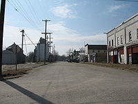
- Crockery Lake, a homeowners association on Crockery Lake near the center of the township.
- Harrisburg, on the north branch of Crockery Creek in the northwest of the township at 43°11′31"N 85°52′26"W. It was a station on the Toledo, Saginaw and Muskegon RailwayToledo, Saginaw and Muskegon RailwayThe Toledo, Saginaw and Muskegon Railway is a defunct railroad incorporated in January, 1886. The railroad offered service between Ashley, Michigan and Muskegon, Michigan starting on August 1, 1888...
, with a post office operating from December 1888 until February 1907.
On the eastern boundary with Sparta Township
Sparta Township, Michigan
Sparta Township is a civil township of Kent County in the U.S. state of Michigan. The population was 8,938 at the 2000 census.-Geography:According to the United States Census Bureau, the township has a total area of , of which, of it is land and of it is water.Most of the township is served by...
, Gooding was a station on the Toledo, Saginaw and Muskegon Railway in Kent County. A post office was established in November 1888 and named after storekeeper/postmaster Richard J. Gooding. In June 1918, the post office was transferred to a site on the Ottawa County side and remained in operation until January 1923. The most noticeable remnant of Gooding is in the name give to Gooding Street, which runs east-west across the township, passing just south of Crockery Lake. The street continues as 13 Mile Road in Kent County and as Ellis Road in Muskegon County.
About one mile (1.6 km) south of Gooding, is the site of the former village of Lisbon. This was first settled by John Pintler from New York in 1846. A post office was established in Ottawa County in 1848 with the name "Pintler's Corners". The name was changed in 1859 to Lisbon. In March 1869, a village was incorporated, extending one half mile in each direction from the northwest corner of section 30 of Sparta Township (thus including a quarter section of section 19 to the north in Sparta Township as well as quarter sections of sections 24 and 25 in Chester Township. However, railroad lines bypassed the village and it did not prosper, eventually disincorporating.
The township protrudes to the north of the rest of Ottawa County, and is bounded on the west and north by Muskegon County
Muskegon County, Michigan
-Demographics:As of the census of 2000, there were 170,200 people, 63,330 households, and 44,267 families residing in the county. The population density was 334 people per square mile . There were 68,556 housing units at an average density of 135 per square mile...
and on the east by Kent County
Kent County, Michigan
-Air Service:*Commercial air service to Grand Rapids is provided by Gerald R. Ford International Airport . Previously named Kent County International Airport, it holds Grand Rapids' mark in modern history with the United States' first regularly scheduled airline service, beginning July 31, 1926,...
. Polkton Township
Polkton Township, Michigan
Polkton Charter Township is a charter township of Ottawa County in the U.S. state of Michigan. The population was 2,335 at the 2000 census.-Geography:...
lies to the southwest and Wright Township
Wright Township, Ottawa County, Michigan
Wright Township is a civil township of Ottawa County in the U.S. state of Michigan. The population was 3,147 at the 2010 census.-Communities:*Big Spring was a small settlement at on the northern boundary of the township between sections 3 and 4...
to the south.
No major roads pass through the township, although Interstate 96
Interstate 96
Interstate 96 is an intrastate Interstate Highway that is entirely within the US state of Michigan. Its western terminus is at an interchange with US Highway 31 and Business US Highway 31 , on the western boundary of Norton Shores southeast of Muskegon. Its eastern terminus is at I-75 near the...
passes just to the south. The city of Coopersville
Coopersville, Michigan
Coopersville is a city located in north central Ottawa County in the U.S. state of Michigan. The population was 4,275 at the 2010 census. It is primarily a farming community....
is just a few miles to the southwest. Grand Haven
Grand Haven, Michigan
Grand Haven is a city in the U.S. state of Michigan and is the county seat of Ottawa County. Grand Haven is located on the eastern shore of Lake Michigan at the mouth of the Grand River, for which it is named. As of the 2010 census, Grand Haven had a population of 10,412. It is part of the...
is about 20 miles (32.2 km) to the west, while Grand Rapids
Grand Rapids, Michigan
Grand Rapids is a city in the U.S. state of Michigan. The city is located on the Grand River about 40 miles east of Lake Michigan. As of the 2010 census, the city population was 188,040. In 2010, the Grand Rapids metropolitan area had a population of 774,160 and a combined statistical area, Grand...
is about 15 miles (24.1 km) to the southeast.
Geography
The northern part of the township is drained by the north branch of Crockery Creek, a tributary of the Grand RiverGrand River (Michigan)
The Grand River is the longest river in the U.S. state of Michigan. It runs through the cities of Jackson, Eaton Rapids, Lansing, Grand Rapids, and Grand Haven.-Description:...
that flows mostly westward in the township. The southern portion is drained by branches of Rio Grande Creek, which flow mostly westward before joining Crockery Creek just south of Ravenna
Ravenna, Michigan
Ravenna is a village in Muskegon County in the U.S. state of Michigan. The population was 1,206 at the 2000 census. The village is located with Ravenna Township.-Geography:...
. A small area in the southwest corner is drained by Beaver Creek, which flows mostly south into Deer Creek just about a mile before Deer Creek enters the Grand River in Polkton Township. A very small area in the southeast of the township is drained by Nash Creek, which flows east to the Rogue River
Rogue River (Michigan)
The Rogue River is a river in the U.S. state of Michigan. It runs through Kent and Newaygo counties and through the Rogue River State Game Area. It is long and has a drainage basin of ....
. Crockery Lake, on the Crockery Creek near the center of the township, is the only sizeable body of water in the township. The highest point in Conklin is appx. 1 miles (1.6 km) from Crockery Lake by Gooding St. and 24th Avenue.
According to the United States Census Bureau
United States Census Bureau
The United States Census Bureau is the government agency that is responsible for the United States Census. It also gathers other national demographic and economic data...
, the township has a total area of 35.9 square miles (93 km²), of which, 35.7 square miles (92.5 km²) of it is land and 0.2 square mile (0.517997622 km²) of it (0.47%) is water.
Grose Park is a 40 acres (161,874.4 m²) county park overlooking the north side of Crockery Lake and provides a variety of recreational opportunities including swimming, fishing, sand volleyball and picnicking. There is about one mile (1.6 km) of hiking trails along Lange Creek. Major improvements were made in 2000 to Grose Park as part of a $660,000 renovation with about 60% of the funding coming from the Michigan Natural Resources Trust Fund.
Zip Codes
- Conklin-49403
School Districts
- Sparta Area Schools
- Kent City Community Schools
- Ravenna Public Schools
- Coopersville Public Schools
Demographics
As of the censusCensus
A census is the procedure of systematically acquiring and recording information about the members of a given population. It is a regularly occurring and official count of a particular population. The term is used mostly in connection with national population and housing censuses; other common...
of 2000, there were 2,315 people, 714 households, and 579 families residing in the township. The population density
Population density
Population density is a measurement of population per unit area or unit volume. It is frequently applied to living organisms, and particularly to humans...
was 64.9 per square mile (25.0/km²). There were 793 housing units at an average density of 22.2 per square mile (8.6/km²). The racial makeup of the township was 94.43% White, 0.78% African American, 0.13% Native American, 0.22% Asian, 3.63% from other races
Race (United States Census)
Race and ethnicity in the United States Census, as defined by the Federal Office of Management and Budget and the United States Census Bureau, are self-identification data items in which residents choose the race or races with which they most closely identify, and indicate whether or not they are...
, and 0.82% from two or more races. Hispanic or Latino of any race were 6.22% of the population.
There were 714 households out of which 41.3% had children under the age of 18 living with them, 70.3% were married couples
Marriage
Marriage is a social union or legal contract between people that creates kinship. It is an institution in which interpersonal relationships, usually intimate and sexual, are acknowledged in a variety of ways, depending on the culture or subculture in which it is found...
living together, 6.7% had a female householder with no husband present, and 18.9% were non-families. 14.7% of all households were made up of individuals and 4.8% had someone living alone who was 65 years of age or older. The average household size was 2.99 and the average family size was 3.32.
In the township the population was spread out with 30.9% under the age of 18, 7.9% from 18 to 24, 31.1% from 25 to 44, 18.5% from 45 to 64, and 11.6% who were 65 years of age or older. The median age was 35 years. For every 100 females there were 104.9 males. For every 100 females age 18 and over, there were 103.0 males.
The median income for a household in the township was $46,328, and the median income for a family was $51,900. Males had a median income of $39,286 versus $27,159 for females. The per capita income
Per capita income
Per capita income or income per person is a measure of mean income within an economic aggregate, such as a country or city. It is calculated by taking a measure of all sources of income in the aggregate and dividing it by the total population...
for the township was $18,197. About 6.0% of families and 10.4% of the population were below the poverty line, including 9.0% of those under age 18 and 4.1% of those age 65 or over.