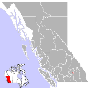
Cherryville, British Columbia
Encyclopedia
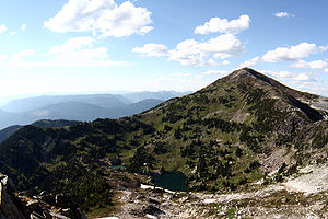
Monashee Mountains
The Monashee Mountains are a mountain range mostly in British Columbia, Canada, extending into the U.S. state of Washington. They stretch from north to south and from east to west. They are a subrange of the Columbia Mountains...
in British Columbia
British Columbia
British Columbia is the westernmost of Canada's provinces and is known for its natural beauty, as reflected in its Latin motto, Splendor sine occasu . Its name was chosen by Queen Victoria in 1858...
with a population of approximately 614. It is located 14 miles (22 km) east of Lumby
Lumby, British Columbia
Lumby is a small community of 1,804, located at the northeast corner of the Okanagan Valley, in the Canadian province of British Columbia. It is mainly a logging, manufacturing and agriculture community, but tourism is a growing trend within the area....
, along Highway 6.
The small community of Cherryville was an old gold mining
Gold mining
Gold mining is the removal of gold from the ground. There are several techniques and processes by which gold may be extracted from the earth.-History:...
camp founded in the 1860s by prospectors from the California Gold Rush
California Gold Rush
The California Gold Rush began on January 24, 1848, when gold was found by James W. Marshall at Sutter's Mill in Coloma, California. The first to hear confirmed information of the gold rush were the people in Oregon, the Sandwich Islands , and Latin America, who were the first to start flocking to...
who had come north to the British Columbia gold rushes
British Columbia Gold Rushes
The presence of gold in the region that is now British Columbia is mentioned in old legends that, in part, led to its discovery. The Strait of Anian, claimed to have been sailed by Juan de Fuca for whom today's Strait of Juan de Fuca is named, was described as passing through a land "rich in gold,...
. Between 1863 and 1895, the original town that is now known as Cherryville was a small mining camp located within the canyon walls of Cherry Creek. Its population was 100 people, half of which were Chinese miners.
With more and more miners heading into Cherry Creek area, a road was built from Lumby in 1877, through Blue Springs Valley, attracting new families to the area. The community was known by the post office name of Cherry Creek, then Hilton, which remained the name of the Cherryville for many years. Cherry Creek and Cherryville were named after the wild Choke Cherries (Prunus virginiana) that grew along the banks of the creek.
Services in Cherryville include accommodation, two general stores, restaurants, a library, a campground, shops and other amenities. Originally an area of orchards, ranching and logging are major industries in the community.