

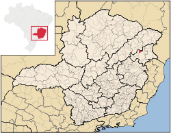
Catuji
Encyclopedia
Minas Gerais
Minas Gerais is one of the 26 states of Brazil, of which it is the second most populous, the third richest, and the fourth largest in area. Minas Gerais is the Brazilian state with the largest number of Presidents of Brazil, the current one, Dilma Rousseff, being one of them. The capital is the...
. Its population as of 2007 was estimated to be 6,597 people living in a total area of 421 km². The city belongs to the mesoregion of Vale do Mucuri and to the microregion of Teófilo Otoni. It became a municipality in 1993.
The region is famous for its unique rock formations of which Pedra do Chifre and Pedra de Santa Rosa are the most interesting.
Catuji is located on highway BR-116 at an elevation of 625 meters, 72 km. north of Teófilo Otoni
Teófilo Otoni
Téofilo Otoni is a city in northeast Minas Gerais state, Brazil. The population of the municipality was 126,895 in 2007 and the area is 3,253.4 km².-Origin of the name:...
. The distance to the state capital, Belo Horizonte
Belo Horizonte
Belo Horizonte is the capital of and largest city in the state of Minas Gerais, located in the southeastern region of Brazil. It is the third largest metropolitan area in the country...
, is 513 km. Neighboring municipalities are: Teófilo Otoni
Teófilo Otoni
Téofilo Otoni is a city in northeast Minas Gerais state, Brazil. The population of the municipality was 126,895 in 2007 and the area is 3,253.4 km².-Origin of the name:...
, Itaipé
Itaipé
Itaipé is a Brazilian municipality located in the northeast of the state of Minas Gerais. Its population as of 2007 was estimated to be 11,497 people living in a total area of 483 km². The city belongs to the mesoregion of Vale do Mucuri and to the microregion of Teófilo Otoni. It became a...
, Novo Oriente de Minas
Novo Oriente de Minas
Novo Oriente de Minas is a municipality in the northeast of the Brazilian state of Minas Gerais. As of 2007 the population was 10,327 in a total area of 754 km². The elevation is 400 meters. It became a municipality in 1997. The postal code is 39817-000.Novo Oriente de Minas is part of the...
and Padre Paraíso
Padre Paraíso
Padre Paraíso is a Brazilian municipality located in the northeast of the state of Minas Gerais. Its population as of 2007 was estimated to be 18,120 people living in a total area of 543 km². The city belongs to the mesoregion of Jequitinhonha and to the microregion of Araçuaí...
.
The main economic activities are services, small industries, and agriculture. The GDP in 2005 was R$18 million, with 12 million from services, 2 million from industry, and 3 million from agriculture. There were 600 rural producers on 13,000 hectares of land. Only 7 farms had tractors (2006). Approximately 1,700 persons were dependent on agriculture. The main crops were bananas, coffee, sugarcane, beans and corn. There were 7,000 head of cattle (2006). There were no banks (2007) and 166 automobiles (145 motorcycles), giving a ratio of 40 inhabitants per automobile.
There were 4 health clinics. Patients with more serious health conditions are transported to Teófilo Otoni. Educational needs were met by 17 primary schools, 1 middle school, and 1 pre-primary school.
- Municipal Human Development IndexHuman Development IndexThe Human Development Index is a composite statistic used to rank countries by level of "human development" and separate "very high human development", "high human development", "medium human development", and "low human development" countries...
: 0.621 (2000) - State ranking: 803 out of 853 municipalities as of 2000
- National ranking: 4,280 out of 5,138 municipalities as of 2000
- Literacy rate: 64%
- Life expectancy: 65 (average of males and females)
In 2000 the per capita income of R$82.00 was well below the state and national average of R$276.00 and R$297.00 respectively.
The highest ranking municipality in Minas Gerais in 2000 was Poços de Caldas
Poços de Caldas
Poços de Caldas is a city and municipality in south-western Minas Gerais state, Brazil, in the microregion of the same name. Its estimated population in 2009 was 151,449 inhabitants...
with 0.841, while the lowest was Setubinha
Setubinha
Setubinha is a municipality in the northeast of the Brazilian state of Minas Gerais. As of 2007 the population was 10,834 in a total area of 536 km². The elevation is 729 metres. It is part of the IBGE statistical microregion of Teófilo Otoni...
with 0.568. Nationally the highest was São Caetano do Sul
São Caetano do Sul
São Caetano do Sul is a city in São Paulo state in Brazil, located in the Greater São Paulo Metropolitan Area. It is the city with the highest per capita income in Brazil and it also has the highest Human Development Index .-Geography:São Caetano do Sul is located on a plateau that is part of the...
in São Paulo with 0.919, while the lowest was Setubinha. In more recent statistics (considering 5,507 municipalities) Manari in the state of Pernambuco
Pernambuco
Pernambuco is a state of Brazil, located in the Northeast region of the country. To the north are the states of Paraíba and Ceará, to the west is Piauí, to the south are Alagoas and Bahia, and to the east is the Atlantic Ocean. There are about of beaches, some of the most beautiful in the...
has the lowest rating in the country—0,467—putting it in last
place.
- Percentage of population aged less than 5 years old: 11.18 (2000)
- Percentage of population aged 10 to 19: 27.01
- Percentage of population aged 60 or more: 8.83
- Percentage of urbanization: 21.47
- Percentage of urban residences connected to sewage system: 83.40
- Infant mortality rate: 20.69 (in 1,000 live births)
See also
- List of municipalities in Minas Gerais