
Castleton Corners, Staten Island
Encyclopedia
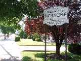
Castleton Corners is an upscale neighborhood of Staten Island
, one of the five boroughs of New York City
. It is in a region of the island often referred as the North Shore, Staten Island
.
 The word "corners" in the neighborhood's name refers to the intersection of Victory Boulevard and Manor Road, which forms its core. It was once called Centerville, but became more popularly known as Castleton Corners when a post office by that name was opened there in 1872. "Castleton" refers to Cassiltowne, County Kildare
, Ireland
, the birthplace of Thomas Dongan, the colonial governor of the Province of New York
after it was obtained from the Dutch—who had called it New Amsterdam
—in 1682. The post office later closed, but reopened in 1949, and today it is the general, or main, post office for Staten Island as a whole, its ZIP Code
being 10314.
Castleton Corners is separated from its eastern neighbor Sunnyside
by Castleton Hill, noted for the two churches that stand across from one another on its western ridge—a Moravian church (Castleton Hill Moravian Church) on one side of Victory Boulevard and a Roman Catholic church (St. Teresa's) on the other. To the north lies West Brighton
, with a National Guard
armory at the boundary between the two, with Westerleigh
and Meiers Corners
to the northwest and southwest, respectively, and Todt Hill
rising to the south. The Todt Hill public housing
project is actually in Castleton Corners in spite of its name.
The corner of Victory Boulevard and Manor Road has long been the center of an important commercial district, although its prominence has declined somewhat in recent decades due to the opening of the Staten Island Mall
in 1973. The area had largely been built up by the time the Verrazano-Narrows Bridge
opened in November 1964, meaning that Castleton Corners has been relatively unaffected by the dramatic upsurge in population the bridge's opening largely helped bring about, at least compared with most other neighborhoods on the island.
Staten Island
Staten Island is a borough of New York City, New York, United States, located in the southwest part of the city. Staten Island is separated from New Jersey by the Arthur Kill and the Kill Van Kull, and from the rest of New York by New York Bay...
, one of the five boroughs of New York City
New York City
New York is the most populous city in the United States and the center of the New York Metropolitan Area, one of the most populous metropolitan areas in the world. New York exerts a significant impact upon global commerce, finance, media, art, fashion, research, technology, education, and...
. It is in a region of the island often referred as the North Shore, Staten Island
North Shore, Staten Island
The term North Shore is frequently applied to a series of neighborhoods within New York City's borough of Staten Island, USA.- Boundaries :...
.
County Kildare
County Kildare is a county in Ireland. It is part of the Mid-East Region and is also located in the province of Leinster. It is named after the town of Kildare. Kildare County Council is the local authority for the county...
, Ireland
Ireland
Ireland is an island to the northwest of continental Europe. It is the third-largest island in Europe and the twentieth-largest island on Earth...
, the birthplace of Thomas Dongan, the colonial governor of the Province of New York
Province of New York
The Province of New York was an English and later British crown territory that originally included all of the present U.S. states of New York, New Jersey, Delaware and Vermont, along with inland portions of Connecticut, Massachusetts, and Maine, as well as eastern Pennsylvania...
after it was obtained from the Dutch—who had called it New Amsterdam
New Amsterdam
New Amsterdam was a 17th-century Dutch colonial settlement that served as the capital of New Netherland. It later became New York City....
—in 1682. The post office later closed, but reopened in 1949, and today it is the general, or main, post office for Staten Island as a whole, its ZIP Code
ZIP Code
ZIP codes are a system of postal codes used by the United States Postal Service since 1963. The term ZIP, an acronym for Zone Improvement Plan, is properly written in capital letters and was chosen to suggest that the mail travels more efficiently, and therefore more quickly, when senders use the...
being 10314.
Castleton Corners is separated from its eastern neighbor Sunnyside
Sunnyside, Staten Island
Sunnyside is the name of a neighborhood in the Mid-Island region of the New York City borough of Staten Island.Two large city parks—Silver Lake Park and Clove Lakes Park—form the eastern and western boundaries, respectively, of Sunnyside, which is named for a boarding house that was...
by Castleton Hill, noted for the two churches that stand across from one another on its western ridge—a Moravian church (Castleton Hill Moravian Church) on one side of Victory Boulevard and a Roman Catholic church (St. Teresa's) on the other. To the north lies West Brighton
West New Brighton, Staten Island
West New Brighton is a neighborhood of New York City, Richmond County, USA, situated along the central North Shore of Staten Island...
, with a National Guard
United States National Guard
The National Guard of the United States is a reserve military force composed of state National Guard militia members or units under federally recognized active or inactive armed force service for the United States. Militia members are citizen soldiers, meaning they work part time for the National...
armory at the boundary between the two, with Westerleigh
Westerleigh, Staten Island
-Geography:Westerleigh is located in the northwest quadrant of the borough and is bounded in the east by Manor Road, the west by Crystal Avenue, the south by Victory Boulevard and to the north by College Avenue....
and Meiers Corners
Meiers Corners, Staten Island
Meiers Corners is a neighborhood on Staten Island, one of the five boroughs of New York City, USA.-Location:Meiers Corners is sometimes confused with the adjacent neighborhood of Westerleigh; however, Westerleigh is generally understood to mean the area immediately west of Castleton Corners that is...
to the northwest and southwest, respectively, and Todt Hill
Todt Hill
Todt Hill [elevation 410 ft ] is a hill formed of serpentine rock on Staten Island, New York. It is the highest natural point in the five boroughs of New York City and the highest elevation on the entire Atlantic Coastal Plain from Florida to Cape Cod., The summit of the ridge is largely covered...
rising to the south. The Todt Hill public housing
Public housing
Public housing is a form of housing tenure in which the property is owned by a government authority, which may be central or local. Social housing is an umbrella term referring to rental housing which may be owned and managed by the state, by non-profit organizations, or by a combination of the...
project is actually in Castleton Corners in spite of its name.
The corner of Victory Boulevard and Manor Road has long been the center of an important commercial district, although its prominence has declined somewhat in recent decades due to the opening of the Staten Island Mall
Staten Island Mall
Staten Island Mall is a shopping mall in the Staten Island borough of New York City, United States. It is the only indoor shopping mall in the borough. It is the largest retail center on the island and is the site of the island's second largest public transit hub after the St...
in 1973. The area had largely been built up by the time the Verrazano-Narrows Bridge
Verrazano-Narrows Bridge
The Verrazano-Narrows Bridge is a double-decked suspension bridge that connects the boroughs of Staten Island and Brooklyn in New York City at the Narrows, the reach connecting the relatively protected upper bay with the larger lower bay....
opened in November 1964, meaning that Castleton Corners has been relatively unaffected by the dramatic upsurge in population the bridge's opening largely helped bring about, at least compared with most other neighborhoods on the island.