

Blue Town
Encyclopedia
Sheerness
Sheerness is a town located beside the mouth of the River Medway on the northwest corner of the Isle of Sheppey in north Kent, England. With a population of 12,000 it is the largest town on the island....
on the Isle of Sheppey
Isle of Sheppey
The Isle of Sheppey is an island off the northern coast of Kent, England in the Thames Estuary, some to the east of London. It has an area of . The island forms part of the local government district of Swale...
in Kent
Kent
Kent is a county in southeast England, and is one of the home counties. It borders East Sussex, Surrey and Greater London and has a defined boundary with Essex in the middle of the Thames Estuary. The ceremonial county boundaries of Kent include the shire county of Kent and the unitary borough of...
. It sits on the A249 Brielle Way which runs from Queenborough
Queenborough
Queenborough is a small town on the Isle of Sheppey in the Swale borough of Kent in South East England.Queenborough is two miles south of Sheerness. It grew as a port near the Thames Estuary at the westward entrance to The Swale where it joins the River Medway...
to Sheerness.
It sits just outside the dockyard wall which marks the boundary of Sheerness proper and today is largely industrial in nature.
History
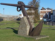
Blue Town grew up alongside the Naval Dock Yard during the Napoleonic WarsNapoleonic Wars
The Napoleonic Wars were a series of wars declared against Napoleon's French Empire by opposing coalitions that ran from 1803 to 1815. As a continuation of the wars sparked by the French Revolution of 1789, they revolutionised European armies and played out on an unprecedented scale, mainly due to...
and gained its distinctive name from the practice of the earliest inhabitants to preserve their wooden houses using blue paint “liberated” from their employers in the dock yard. It began as a small self-contained community built on a very damp and wet place reclaimed out of the marshes. It was a very confined area, a dense triangle of houses and alleyways compressed between the dockyard wall and Well Marsh, and was prone to both flood and fire.
At one point separated from Sheerness fort by a moat and drawbridge, the area was enclosed by an earthwork bastioned trace at the end of the 18th century amid growing fears of a French invasion.