
Bert T. Combs Mountain Parkway
Encyclopedia
The Bert T. Combs
Mountain Parkway, commonly known as the Mountain Parkway, is a freeway in eastern Kentucky
. The route runs fromInterstate 64
just east of Winchester
southeast for 75.627 miles (121.710 km) to a junction with U.S. Route 460
near Salyersville
. The first 43 miles (69.2 km), beginning at the western terminus in Winchester is a four-lane limited access highway with only minor design standard differences from an Interstate Highway, while the remainder is a limited access Super 2 highway.
.
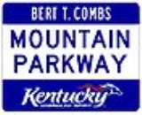
The route was originally signed only as the 'Mountain Parkway'. In the late 1970s, the "Bert T. Combs" name was added to honor the governor from the mountains who spearheaded construction of the highway. Auxiliary plates were added above the circular Mountain Parkway signs to mark the designation.
As with all of Kentucky's toll roads, the tolls were removed as the construction bonds were paid off. Tolls were removed from the four-lane section in 1985, and the road became a freeway in 1986 when the remaining tolls were removed from the two-lane section.
The route was designated Kentucky Route 114 in April 1985. In August, the road was redesignated Kentucky Route 402. Later, in February 1990, the parkway was designated Kentucky Route 9000 from its western terminus to Kentucky Route 15 Spur near Campton
and Kentucky Route 9009 from KY 15 Spur to the parkway's eastern terminus. Both designations are unsigned.
Bert T. Combs
Bertram Thomas Combs was a jurist and politician from the US state of Kentucky. After serving on the Kentucky Court of Appeals, he was elected the 50th Governor of Kentucky in 1959 on his second run for the office. Following his gubernatorial term, he was appointed to the Sixth Circuit Court of...
Mountain Parkway, commonly known as the Mountain Parkway, is a freeway in eastern Kentucky
Kentucky
The Commonwealth of Kentucky is a state located in the East Central United States of America. As classified by the United States Census Bureau, Kentucky is a Southern state, more specifically in the East South Central region. Kentucky is one of four U.S. states constituted as a commonwealth...
. The route runs fromInterstate 64
Interstate 64
Interstate 64 is an Interstate Highway in the Midwestern and Southeastern United States. Its western terminus is at I-70, U.S. 40, and U.S. 61 in Wentzville, Missouri. Its eastern terminus is at an interchange with I-264 and I-664 at Bowers Hill in Chesapeake, Virginia. As I-64 is concurrent with...
just east of Winchester
Winchester, Kentucky
Winchester is a city in and the county seat of Clark County, Kentucky, United States. The population was 16,724 at the 2000 census. It is part of the Lexington-Fayette, KY Metropolitan Statistical Area.-Geography:...
southeast for 75.627 miles (121.710 km) to a junction with U.S. Route 460
U.S. Route 460
U.S. Route 460 is a spur of U.S. Route 60. It currently runs for 655 miles from Norfolk, Virginia at U.S. Route 60 at Ocean View to Frankfort, Kentucky at U.S. Route 60. It passes through the states of Virginia, West Virginia, and Kentucky...
near Salyersville
Salyersville, Kentucky
Salyersville is a city in and the county seat of Magoffin County, Kentucky, United States. It is located on the Licking River. The population was 1,604 at the 2000 census.-History:...
. The first 43 miles (69.2 km), beginning at the western terminus in Winchester is a four-lane limited access highway with only minor design standard differences from an Interstate Highway, while the remainder is a limited access Super 2 highway.
History
The Bert T. Combs Mountain Parkway was built in the early 1960s and opened in January 1963 as Kentucky's second toll roadToll road
A toll road is a privately or publicly built road for which a driver pays a toll for use. Structures for which tolls are charged include toll bridges and toll tunnels. Non-toll roads are financed using other sources of revenue, most typically fuel tax or general tax funds...
.
The route was originally signed only as the 'Mountain Parkway'. In the late 1970s, the "Bert T. Combs" name was added to honor the governor from the mountains who spearheaded construction of the highway. Auxiliary plates were added above the circular Mountain Parkway signs to mark the designation.
As with all of Kentucky's toll roads, the tolls were removed as the construction bonds were paid off. Tolls were removed from the four-lane section in 1985, and the road became a freeway in 1986 when the remaining tolls were removed from the two-lane section.
The route was designated Kentucky Route 114 in April 1985. In August, the road was redesignated Kentucky Route 402. Later, in February 1990, the parkway was designated Kentucky Route 9000 from its western terminus to Kentucky Route 15 Spur near Campton
Campton, Kentucky
As of the census of 200, there were 44 people, 16 households, and 17 families residing in the city. The population density was 33.4 people per square mile . There were 29 housing units at an average density of 212.5 per square mile . The racial makeup of the city was 99.76% White, and 0.24% from...
and Kentucky Route 9009 from KY 15 Spur to the parkway's eastern terminus. Both designations are unsigned.